Property Record
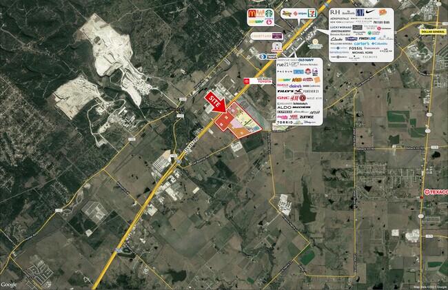
6215 S Interstate 35, San Marcos, TX 78666


Property Detail
6215 S Interstate 35
Austin-Round Rock-San Marcos, TX
A0089 A0089 - SAMUEL CRAFT SR SURVEY, ACRES 57.778
R13332
Hays
Farms
Texas
B and X Area of moderate flood hazard, usually the area between the limits of the 100-year and 500-year floods.
57.78 AC
2024
Hays County
2025
Austin
010402
NEARBY LISTINGS FOR SALE OR LEASE
DEMOGRAPHICS near 6215 S Interstate 35
1 mile
3 mile
5 mile
2025 Total Population
437
4,184
27,428
2030 Population
524
5,003
32,271
Pop Growth 2025-2030
+ 19.91%
+ 19.57%
+ 17.66%
Average Age
32
37
39
2025 Total Households
185
1,755
10,669
HH Growth 2025-2030
+ 21.08%
+ 20.51%
+ 18.50%
Median Household Inc
$55,000
$60,935
$73,913
Avg Household Size
2.30
2.30
2.50
2025 Avg HH Vehicles
2.00
2.00
2.00
Median Home Value
$366,666
$373,509
$403,954
Median Year Built
2010
2010
2010
Nearby Places
Map Layers
Map Styles
 Street
 Aerial
Transit
 Traffic
 Biking
Places
Listings with unknown addresses are not visible on the map
- Restaurants
- Banks
- Shops
- Fitness
- Groceries
PUBLIC TRANSPORTATION
COMMUTER RAIL
Drive
Walk
Distance
12 min
7.6 mi
AIRPORT
San Antonio International
Drive
Walk
Distance
San Antonio International
48 min
39.3 mi
Austin-Bergstrom International
Drive
Walk
Distance
Austin-Bergstrom International
54 min
42.5 mi
SALE & LEASE HISTORY
LISTING DATE
SALE/LEASE

Jul 13, 2021
For Sale
Nearby Properties
Address
Land Use
TOTAL SIZE
Lot Size
Zoning
Address
Land Use
TOTAL SIZE
Lot Size
Zoning
960 SF
100.89 AC
Address
Land Use
TOTAL SIZE
Lot Size
Zoning
70,432 SF
45.07 AC
Address
Land Use
TOTAL SIZE
Lot Size
Zoning
454,563 SF
16.44 AC
Address
Land Use
TOTAL SIZE
Lot Size
Zoning
250,811 SF
23.88 AC
Address
Land Use
TOTAL SIZE
Lot Size
Zoning
326,836 SF
16.38 AC
Address
Land Use
TOTAL SIZE
Lot Size
Zoning
239,345 SF
23.41 AC
Address
Land Use
TOTAL SIZE
Lot Size
Zoning
190,554 SF
5.59 AC
Address
Land Use
TOTAL SIZE
Lot Size
Zoning
240,123 SF
8.75 AC
Address
Land Use
TOTAL SIZE
Lot Size
Zoning
146,295 SF
5.08 AC
Address
Land Use
TOTAL SIZE
Lot Size
Zoning
167,289 SF
6.04 AC
Address
Land Use
TOTAL SIZE
Lot Size
Zoning
23,897 SF
19.22 AC
Address
Land Use
TOTAL SIZE
Lot Size
Zoning
32,360 SF
90 AC
Address
Land Use
TOTAL SIZE
Lot Size
Zoning
104,695 SF
26.43 AC
Address
Land Use
TOTAL SIZE
Lot Size
Zoning
800 SF
51.92 AC
Address
Land Use
TOTAL SIZE
Lot Size
Zoning
54,862 SF
4.06 AC
Address
Land Use
TOTAL SIZE
Lot Size
Zoning
48,520 SF
4 AC
Address
Land Use
TOTAL SIZE
Lot Size
Zoning
101,931 SF
4.06 AC
Address
Land Use
TOTAL SIZE
Lot Size
Zoning
5,250 SF
18.06 AC
Address
Land Use
TOTAL SIZE
Lot Size
Zoning
50,580 SF
2.25 AC
Address
Land Use
TOTAL SIZE
Lot Size
Zoning
161,365 SF
45.60 AC
Address
Land Use
TOTAL SIZE
Lot Size
Zoning
18,878 SF
1.29 AC
Address
Land Use
TOTAL SIZE
Lot Size
Zoning
5,640 SF
15.13 AC
Address
Land Use
TOTAL SIZE
Lot Size
Zoning
26,062 SF
17.37 AC
Address
Land Use
TOTAL SIZE
Lot Size
Zoning
28,000 SF
9.19 AC
Address
Land Use
TOTAL SIZE
Lot Size
Zoning
49.23 AC
Address
Land Use
TOTAL SIZE
Lot Size
Zoning
30,000 SF
3.56 AC
Address
Land Use
TOTAL SIZE
Lot Size
Zoning
5,190 SF
83.73 AC
Address
Land Use
TOTAL SIZE
Lot Size
Zoning
2,160 SF
44.83 AC
Address
Land Use
TOTAL SIZE
Lot Size
Zoning
62,724 SF
5.63 AC
Address
Land Use
TOTAL SIZE
Lot Size
Zoning
9,340 SF
12.37 AC
The World's #1 Commercial Real Estate Marketplace
Connect with us
© 2026 CoStar Group
The information above has been obtained from sources believed reliable. While we do not doubt its accuracy we have not verified it and make no guarantee, warranty or representation about it. It is your responsibility to independently confirm its accuracy and completeness. Any projections, opinions, assumptions, or estimates used are for example only and do not represent the current or future performance of the property. The value of this transaction to you depends on tax and other factors which should be evaluated by your tax, financial, and legal advisors. You and your advisors should conduct a careful, independent investigation of the property to determine to your satisfaction the suitability of the property for your needs.