Property Record
11255 Slate Stone Dr, Fishers, IN 46037
NEARBY LISTINGS FOR SALE OR LEASE
Property Detail
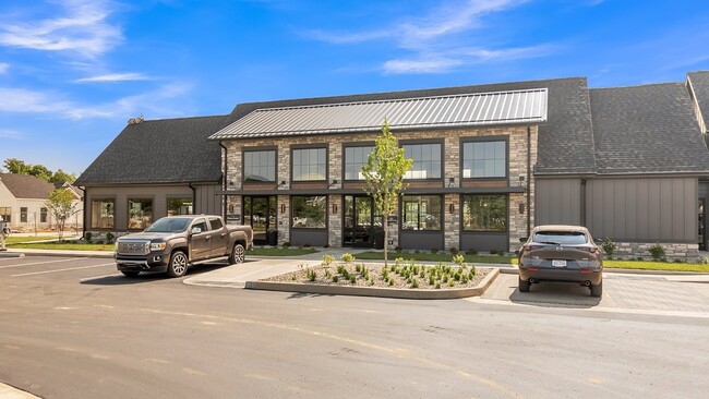
11255 Slate Stone Dr
Indianapolis
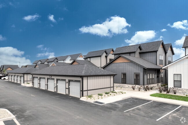
The Slate At Fishers District
Indianapolis-Carmel-Anderson, IN
ACREAGE 14.00, SECTION 6, TOWNSHIP 17, RANGE 5, THE SLATE AT FISHERS DISTRICT, BLOCK D, IRREGULAR SHAPE
29-15-06-000-002.012-006
Hamilton
Commercialacreage
Indiana
2023
10.50 AC
2024
Fishers/Hawthorn Hills
110822
DEMOGRAPHICS near 11255 Slate Stone Dr
1 Mile
3 Mile
5 Mile
2024 Total Population
9,091
64,288
171,700
2029 Population
10,325
70,930
186,179
Pop Growth 2024-2029
+ 13.57%
+ 10.33%
+ 8.43%
Average Age
38
39
38
2024 Total Households
3,544
24,763
66,163
HH Growth 2024-2029
+ 13.43%
+ 10.24%
+ 7.89%
Median Household Inc
$110,791
$107,352
$98,811
Avg Household Size
2.50
2.50
2.50
2024 Avg HH Vehicles
2.00
2.00
2.00
Median Home Value
$308,859
$288,517
$299,660
Median Year Built
1998
1995
1996
Nearby Places
- Restaurants
- Banks
- Shops
- Fitness
- Groceries
PUBLIC TRANSPORTATION
AIRPORT
Indianapolis International
DRIVE
WALK
Distance
Indianapolis International
50 min
30.9 mi
Freight Ports
Port of Toledo
DRIVE
WALK
Distance
Port of Toledo
247 min
209.6 mi
Nearby Properties
Address
Land Use
TOTAL SIZE
Lot Size
Zoning
Address
Land Use
TOTAL SIZE
Lot Size
Zoning
584,003 SF
56.14 AC
Address
Land Use
TOTAL SIZE
Lot Size
Zoning
22,081 SF
27.39 AC
ZO01
Address
Land Use
TOTAL SIZE
Lot Size
Zoning
683,795 SF
25.53 AC
Address
Land Use
TOTAL SIZE
Lot Size
Zoning
555,234 SF
36.07 AC
Address
Land Use
TOTAL SIZE
Lot Size
Zoning
528,117 SF
57.02 AC
Address
Land Use
TOTAL SIZE
Lot Size
Zoning
450,918 SF
35.32 AC
Address
Land Use
TOTAL SIZE
Lot Size
Zoning
426,525 SF
16.44 AC
Address
Land Use
TOTAL SIZE
Lot Size
Zoning
372,138 SF
20.71 AC
Address
Land Use
TOTAL SIZE
Lot Size
Zoning
363,408 SF
30.78 AC
Address
Land Use
TOTAL SIZE
Lot Size
Zoning
125.31 AC
Address
Land Use
TOTAL SIZE
Lot Size
Zoning
434,376 SF
35.75 AC
Address
Land Use
TOTAL SIZE
Lot Size
Zoning
286,120 SF
8.03 AC
Address
Land Use
TOTAL SIZE
Lot Size
Zoning
321,878 SF
14.81 AC
Address
Land Use
TOTAL SIZE
Lot Size
Zoning
176,103 SF
0.90 AC
Address
Land Use
TOTAL SIZE
Lot Size
Zoning
289,664 SF
35.22 AC
Address
Land Use
TOTAL SIZE
Lot Size
Zoning
391,181 SF
23.82 AC
Address
Land Use
TOTAL SIZE
Lot Size
Zoning
217,633 SF
78.75 AC
Address
Land Use
TOTAL SIZE
Lot Size
Zoning
224,368 SF
0.73 AC
Address
Land Use
TOTAL SIZE
Lot Size
Zoning
185,155 SF
18.54 AC
Address
Land Use
TOTAL SIZE
Lot Size
Zoning
24,192 SF
5.93 AC
Address
Land Use
TOTAL SIZE
Lot Size
Zoning
140,987 SF
13.99 AC
Address
Land Use
TOTAL SIZE
Lot Size
Zoning
288,939 SF
34.29 AC
Address
Land Use
TOTAL SIZE
Lot Size
Zoning
167,734 SF
3.69 AC
Address
Land Use
TOTAL SIZE
Lot Size
Zoning
224,860 SF
18.52 AC
Address
Land Use
TOTAL SIZE
Lot Size
Zoning
188,840 SF
10.49 AC
Address
Land Use
TOTAL SIZE
Lot Size
Zoning
293,429 SF
25.88 AC
ZO01
Address
Land Use
TOTAL SIZE
Lot Size
Zoning
76,666 SF
9.41 AC
Address
Land Use
TOTAL SIZE
Lot Size
Zoning
190,460 SF
13.32 AC
Address
Land Use
TOTAL SIZE
Lot Size
Zoning
54,344 SF
9.57 AC
Address
Land Use
TOTAL SIZE
Lot Size
Zoning
241,325 SF
26 AC
The World's #1 Commercial Real Estate Marketplace
Connect with us
© 2025 CoStar Group
The information above has been obtained from sources believed reliable. While we do not doubt its accuracy we have not verified it and make no guarantee, warranty or representation about it. It is your responsibility to independently confirm its accuracy and completeness. Any projections, opinions, assumptions, or estimates used are for example only and do not represent the current or future performance of the property. The value of this transaction to you depends on tax and other factors which should be evaluated by your tax, financial, and legal advisors. You and your advisors should conduct a careful, independent investigation of the property to determine to your satisfaction the suitability of the property for your needs.