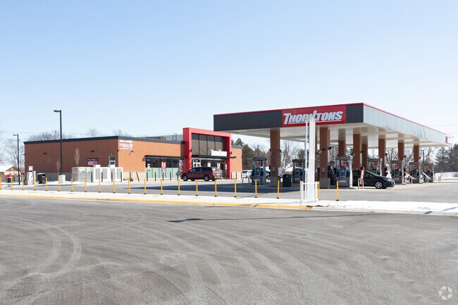
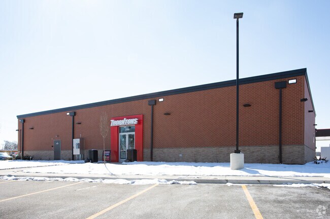
Property Record
Il Route 120, Mchenry, IL
Property Detail
Il Route 120
Chicago-Naperville-Elgin, IL-IN
DOC 2018R0000272 (PLAT) S PT LT 1 HEIDNER PROPERTIES SUB
09-36-226-001
MCHENRY
Commercialnec
Illinois
B and X Area of moderate flood hazard, usually the area between the limits of the 100-year and 500-year floods.
1
2024
4.19 AC
2024
Far Northwest
870702
Chicago
NEARBY LISTINGS FOR SALE OR LEASE
DEMOGRAPHICS near Il Route 120
1 mile
3 mile
5 mile
2025 Total Population
3,038
33,774
78,424
2030 Population
3,137
34,510
80,191
Pop Growth 2025-2030
+ 3.26%
+ 2.18%
+ 2.25%
Average Age
42
42
42
2025 Total Households
1,165
13,427
30,718
HH Growth 2025-2030
+ 3.26%
+ 2.20%
+ 2.26%
Median Household Inc
$125,763
$91,479
$96,690
Avg Household Size
2.60
2.50
2.50
2025 Avg HH Vehicles
2.00
2.00
2.00
Median Home Value
$344,335
$284,373
$283,230
Median Year Built
1990
1984
1988
Nearby Places
Map Layers
Map Styles
 Street
 Aerial
Transit
 Traffic
 Biking
Places
Listings with unknown addresses are not visible on the map
- Restaurants
- Banks
- Shops
- Fitness
- Groceries
PUBLIC TRANSPORTATION
COMMUTER RAIL
Mchenry Station (Union Pacific Northwest Line - Northeast Illinois Regional Commuter Railroad (Metra))
Drive
Walk
Distance
Mchenry Station (Union Pacific Northwest Line - Northeast Illinois Regional Commuter Railroad (Metra))
5 min
2.0 mi
Fox Lake Station (Milwaukee District North Line - Northeast Illinois Regional Commuter Railroad (Metra))
Drive
Walk
Distance
Fox Lake Station (Milwaukee District North Line - Northeast Illinois Regional Commuter Railroad (Metra))
16 min
9.9 mi
Freight Ports
Port Milwaukee
Drive
Walk
Distance
Port Milwaukee
82 min
64.5 mi
Nearby Properties
Address
Land Use
TOTAL SIZE
Lot Size
Zoning
Address
Land Use
TOTAL SIZE
Lot Size
Zoning
20.51 AC
Address
Land Use
TOTAL SIZE
Lot Size
Zoning
5,000 SF
30.62 AC
Address
Land Use
TOTAL SIZE
Lot Size
Zoning
12.28 AC
Address
Land Use
TOTAL SIZE
Lot Size
Zoning
10.75 AC
Address
Land Use
TOTAL SIZE
Lot Size
Zoning
54,986 SF
5.83 AC
Address
Land Use
TOTAL SIZE
Lot Size
Zoning
47,440 SF
3.59 AC
Address
Land Use
TOTAL SIZE
Lot Size
Zoning
191,960 SF
19 AC
Address
Land Use
TOTAL SIZE
Lot Size
Zoning
Address
Land Use
TOTAL SIZE
Lot Size
Zoning
185,809 SF
21 AC
Address
Land Use
TOTAL SIZE
Lot Size
Zoning
10,082 SF
0.80 AC
Address
Land Use
TOTAL SIZE
Lot Size
Zoning
124,114 SF
6.05 AC
Address
Land Use
TOTAL SIZE
Lot Size
Zoning
0.50 AC
Address
Land Use
TOTAL SIZE
Lot Size
Zoning
21,686 SF
0.90 AC
Address
Land Use
TOTAL SIZE
Lot Size
Zoning
267,134 SF
5.59 AC
Address
Land Use
TOTAL SIZE
Lot Size
Zoning
81,264 SF
0.50 AC
Address
Land Use
TOTAL SIZE
Lot Size
Zoning
3.11 AC
Address
Land Use
TOTAL SIZE
Lot Size
Zoning
20.47 AC
Address
Land Use
TOTAL SIZE
Lot Size
Zoning
115,923 SF
12 AC
Address
Land Use
TOTAL SIZE
Lot Size
Zoning
83,570 SF
3 AC
Address
Land Use
TOTAL SIZE
Lot Size
Zoning
46,824 SF
6.68 AC
Address
Land Use
TOTAL SIZE
Lot Size
Zoning
66,380 SF
5.36 AC
Address
Land Use
TOTAL SIZE
Lot Size
Zoning
64,614 SF
5 AC
Address
Land Use
TOTAL SIZE
Lot Size
Zoning
57,000 SF
0.86 AC
Address
Land Use
TOTAL SIZE
Lot Size
Zoning
1,704 SF
0.25 AC
Address
Land Use
TOTAL SIZE
Lot Size
Zoning
10,432 SF
3 AC
Address
Land Use
TOTAL SIZE
Lot Size
Zoning
2,250 SF
6.59 AC
Address
Land Use
TOTAL SIZE
Lot Size
Zoning
103,822 SF
7.64 AC
Address
Land Use
TOTAL SIZE
Lot Size
Zoning
38,783 SF
10.92 AC
Address
Land Use
TOTAL SIZE
Lot Size
Zoning
75,402 SF
7.34 AC
Address
Land Use
TOTAL SIZE
Lot Size
Zoning
118,020 SF
11 AC
The World's #1 Commercial Real Estate Marketplace
Connect with us
© 2026 CoStar Group
The information above has been obtained from sources believed reliable. While we do not doubt its accuracy we have not verified it and make no guarantee, warranty or representation about it. It is your responsibility to independently confirm its accuracy and completeness. Any projections, opinions, assumptions, or estimates used are for example only and do not represent the current or future performance of the property. The value of this transaction to you depends on tax and other factors which should be evaluated by your tax, financial, and legal advisors. You and your advisors should conduct a careful, independent investigation of the property to determine to your satisfaction the suitability of the property for your needs.