Property Record
Imlay City Rd, Lapeer, MI 48446

NEARBY LISTINGS FOR SALE OR LEASE
-
-
View all Lapeer listings for sale on LoopNet.com
Property Detail
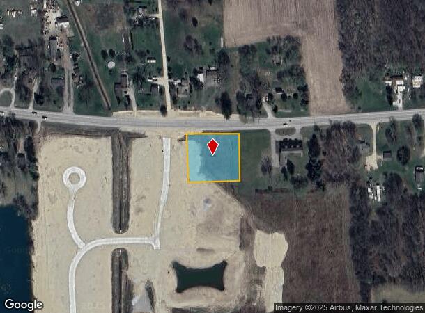
Imlay City Rd
012-012-010-10
SEC 12 T7N R10E COM AT THE N 1/4 COR TH E 627.68' TO POB; TH S 258.15 FT, TH E 200 FT, TH N 261.52 FT, TH W 200 FT TO POB.
Commercialacreage
Lapeer
X
Michigan
26087C0300E
1.19 AC
2024
St Clair & Lapeer Counties
2025
Detroit
337000
Detroit-Warren-Dearborn, MI
DEMOGRAPHICS near Imlay City Rd
1 Mile
3 Mile
5 Mile
2024 Total Population
986
5,144
20,126
2029 Population
988
5,151
20,198
Pop Growth 2024-2029
+ 0.20%
+ 0.14%
+ 0.36%
Average Age
44
44
43
2024 Total Households
391
2,031
8,313
HH Growth 2024-2029
+ 0.26%
+ 0.05%
+ 0.34%
Median Household Inc
$69,264
$71,987
$63,517
Avg Household Size
2.40
2.50
2.30
2024 Avg HH Vehicles
2.00
2.00
2.00
Median Home Value
$212,281
$215,275
$178,276
Median Year Built
1979
1979
1977
Nearby Places
Map Layers
Map Styles
 Street
 Aerial
- Restaurants
- Banks
- Shops
- Fitness
- Groceries
PUBLIC TRANSPORTATION
COMMUTER RAIL
Lapeer Amtrak Station (Blue Water - Amtrak)
DRIVE
WALK
Distance
Lapeer Amtrak Station (Blue Water - Amtrak)
7 min
4.0 mi
AIRPORT
Bishop International
DRIVE
WALK
Distance
Bishop International
49 min
33.3 mi
Freight Ports
Port of Toledo
DRIVE
WALK
Distance
Port of Toledo
157 min
121.7 mi
SALE & LEASE HISTORY
LISTING DATE
SALE/LEASE

Nov 16, 2017
For Sale
Nov 03, 2017
For Sale
Nearby Properties
Address
Land Use
TOTAL SIZE
Lot Size
Zoning
Address
Land Use
TOTAL SIZE
Lot Size
Zoning
240,748 SF
22.20 AC
I1 INDU
Address
Land Use
TOTAL SIZE
Lot Size
Zoning
142,610 SF
35.53 AC
M-2
Address
Land Use
TOTAL SIZE
Lot Size
Zoning
9,655 SF
137.65 AC
RMH
Address
Land Use
TOTAL SIZE
Lot Size
Zoning
28,531 SF
17 AC
R-1A
Address
Land Use
TOTAL SIZE
Lot Size
Zoning
4,333 SF
200 AC
AE
Address
Land Use
TOTAL SIZE
Lot Size
Zoning
2.40 AC
I1 INDU
Address
Land Use
TOTAL SIZE
Lot Size
Zoning
34,392 SF
5.47 AC
M-1
Address
Land Use
TOTAL SIZE
Lot Size
Zoning
2,652 SF
151.65 AC
AR
Address
Land Use
TOTAL SIZE
Lot Size
Zoning
1,280 SF
152.50 AC
AE
Address
Land Use
TOTAL SIZE
Lot Size
Zoning
4,987 SF
1.28 AC
C-3
Address
Land Use
TOTAL SIZE
Lot Size
Zoning
69 AC
AE
Address
Land Use
TOTAL SIZE
Lot Size
Zoning
10,000 SF
2.49 AC
M-1
Address
Land Use
TOTAL SIZE
Lot Size
Zoning
3,442 SF
40 AC
AE
Address
Land Use
TOTAL SIZE
Lot Size
Zoning
145.05 AC
AE
Address
Land Use
TOTAL SIZE
Lot Size
Zoning
2,740 SF
120 AC
AE
Address
Land Use
TOTAL SIZE
Lot Size
Zoning
1,512 SF
120 AC
R-1
Address
Land Use
TOTAL SIZE
Lot Size
Zoning
1,672 SF
60.44 AC
R-2
Address
Land Use
TOTAL SIZE
Lot Size
Zoning
12,784 SF
2 AC
R-1A
Address
Land Use
TOTAL SIZE
Lot Size
Zoning
9,600 SF
4.60 AC
C-3
Address
Land Use
TOTAL SIZE
Lot Size
Zoning
2,405 SF
40 AC
AE
Address
Land Use
TOTAL SIZE
Lot Size
Zoning
21,000 SF
4.82 AC
I1 INDU
Address
Land Use
TOTAL SIZE
Lot Size
Zoning
2,798 SF
66.91 AC
AR
Address
Land Use
TOTAL SIZE
Lot Size
Zoning
155 AC
AE
Address
Land Use
TOTAL SIZE
Lot Size
Zoning
4.06 AC
R-1B
Address
Land Use
TOTAL SIZE
Lot Size
Zoning
2,667 SF
55.58 AC
AE
Address
Land Use
TOTAL SIZE
Lot Size
Zoning
1,526 SF
93 AC
R-1
Address
Land Use
TOTAL SIZE
Lot Size
Zoning
120.38 AC
AE
Address
Land Use
TOTAL SIZE
Lot Size
Zoning
117.14 AC
R-2
Address
Land Use
TOTAL SIZE
Lot Size
Zoning
107.78 AC
R-1
Address
Land Use
TOTAL SIZE
Lot Size
Zoning
110.82 AC
R-1A
The World's #1 Commercial Real Estate Marketplace
Connect with us
© 2026 CoStar Group
The information above has been obtained from sources believed reliable. While we do not doubt its accuracy we have not verified it and make no guarantee, warranty or representation about it. It is your responsibility to independently confirm its accuracy and completeness. Any projections, opinions, assumptions, or estimates used are for example only and do not represent the current or future performance of the property. The value of this transaction to you depends on tax and other factors which should be evaluated by your tax, financial, and legal advisors. You and your advisors should conduct a careful, independent investigation of the property to determine to your satisfaction the suitability of the property for your needs.