Property Record
2260 Richards St, Naples, FL 34120


NEARBY LISTINGS FOR SALE OR LEASE
-
-
View all Naples listings for sale on LoopNet.com
Property Detail
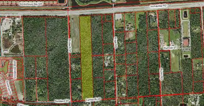
2260 Richards St
Naples-Immokalee-Marco Island, FL
Acreage Header
00216640005
Collier
Mobilemanufacturedhomeregardlessoflandownership
Florida
AH
5 AC
12021C0218H
Outlying Collier County
924 SF
Southwest Florida
DEMOGRAPHICS near 2260 Richards St
1 Mile
3 Mile
5 Mile
2024 Total Population
1,430
24,053
62,384
2029 Population
1,682
27,393
70,878
Pop Growth 2024-2029
+ 17.62%
+ 13.89%
+ 13.62%
Average Age
49
45
46
2024 Total Households
577
9,072
24,244
HH Growth 2024-2029
+ 16.98%
+ 13.60%
+ 13.71%
Median Household Inc
$94,675
$83,596
$91,778
Avg Household Size
2.30
2.50
2.50
2024 Avg HH Vehicles
2.00
2.00
2.00
Median Home Value
$558,429
$481,280
$458,477
Median Year Built
2010
2009
2007
Nearby Places
Map Layers
Map Styles
 Street
 Aerial
- Restaurants
- Banks
- Shops
- Fitness
- Groceries
PUBLIC TRANSPORTATION
AIRPORT
Southwest Florida International
DRIVE
WALK
Distance
Southwest Florida International
38 min
28.3 mi
Freight Ports
Port Everglades
DRIVE
WALK
Distance
Port Everglades
127 min
109.6 mi
SALE & LEASE HISTORY
LISTING DATE
SALE/LEASE

Sep 24, 2016
For Sale
Jul 28, 2017
For Sale
Jan 09, 2019
For Sale
Nearby Properties
Address
Land Use
TOTAL SIZE
Lot Size
Zoning
Address
Land Use
TOTAL SIZE
Lot Size
Zoning
465,208 SF
17.72 AC
Address
Land Use
TOTAL SIZE
Lot Size
Zoning
312,140 SF
15 AC
Address
Land Use
TOTAL SIZE
Lot Size
Zoning
275,219 SF
16.20 AC
Address
Land Use
TOTAL SIZE
Lot Size
Zoning
52,982 SF
10.58 AC
Address
Land Use
TOTAL SIZE
Lot Size
Zoning
142,737 SF
37.48 AC
A
Address
Land Use
TOTAL SIZE
Lot Size
Zoning
50,994 SF
37.60 AC
A-MHO
Address
Land Use
TOTAL SIZE
Lot Size
Zoning
41,465 SF
3.36 AC
PUD
Address
Land Use
TOTAL SIZE
Lot Size
Zoning
115,552 SF
13.20 AC
PUD
Address
Land Use
TOTAL SIZE
Lot Size
Zoning
104,470 SF
13.06 AC
PUD
Address
Land Use
TOTAL SIZE
Lot Size
Zoning
22,099 SF
7.73 AC
PUD
Address
Land Use
TOTAL SIZE
Lot Size
Zoning
113,867 SF
6.90 AC
PUD
Address
Land Use
TOTAL SIZE
Lot Size
Zoning
54,140 SF
50.66 AC
PUD
Address
Land Use
TOTAL SIZE
Lot Size
Zoning
46,820 SF
7.02 AC
PUD
Address
Land Use
TOTAL SIZE
Lot Size
Zoning
62,557 SF
254.05 AC
A-MHO
Address
Land Use
TOTAL SIZE
Lot Size
Zoning
39,728 SF
5.74 AC
Address
Land Use
TOTAL SIZE
Lot Size
Zoning
61,688 SF
2.65 AC
Address
Land Use
TOTAL SIZE
Lot Size
Zoning
40,045 SF
35.33 AC
A-MHO
Address
Land Use
TOTAL SIZE
Lot Size
Zoning
67,872 SF
13.39 AC
Address
Land Use
TOTAL SIZE
Lot Size
Zoning
59,616 SF
2.51 AC
Address
Land Use
TOTAL SIZE
Lot Size
Zoning
84,474 SF
18.16 AC
PUD
Address
Land Use
TOTAL SIZE
Lot Size
Zoning
35,947 SF
17.33 AC
A
Address
Land Use
TOTAL SIZE
Lot Size
Zoning
80,145 SF
9.30 AC
PUD
Address
Land Use
TOTAL SIZE
Lot Size
Zoning
110,133 SF
2.30 AC
Address
Land Use
TOTAL SIZE
Lot Size
Zoning
92,070 SF
2.37 AC
Address
Land Use
TOTAL SIZE
Lot Size
Zoning
104,640 SF
1.82 AC
Address
Land Use
TOTAL SIZE
Lot Size
Zoning
78,454 SF
19.27 AC
E
Address
Land Use
TOTAL SIZE
Lot Size
Zoning
42,231 SF
1,027.79 AC
A-MHO
Address
Land Use
TOTAL SIZE
Lot Size
Zoning
34,040 SF
2.74 AC
Address
Land Use
TOTAL SIZE
Lot Size
Zoning
36,740 SF
3.43 AC
Address
Land Use
TOTAL SIZE
Lot Size
Zoning
35,245 SF
3.10 AC
The World's #1 Commercial Real Estate Marketplace
Connect with us
© 2025 CoStar Group
The information above has been obtained from sources believed reliable. While we do not doubt its accuracy we have not verified it and make no guarantee, warranty or representation about it. It is your responsibility to independently confirm its accuracy and completeness. Any projections, opinions, assumptions, or estimates used are for example only and do not represent the current or future performance of the property. The value of this transaction to you depends on tax and other factors which should be evaluated by your tax, financial, and legal advisors. You and your advisors should conduct a careful, independent investigation of the property to determine to your satisfaction the suitability of the property for your needs.