Property Record
Industrial Ave, Memphis, TN 38109


NEARBY LISTINGS FOR SALE OR LEASE
Property Detail
Industrial Ave
05-0021-0-0016
SS INDUSTRIAL AVENUE SEE MAP M & N-4 (TILE# 386)
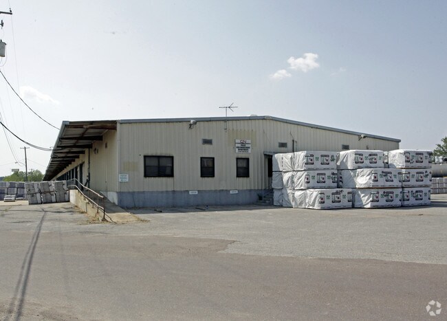
Truckterminal
Shelby
X
Tennessee
05035C0475E
33.90 AC
0
Southwest
2025
Memphis
022310
Memphis, TN-MS-AR
DEMOGRAPHICS near Industrial Ave
1 Mile
3 Mile
5 Mile
2024 Total Population
3,745
34,060
122,575
2029 Population
3,891
34,514
123,182
Pop Growth 2024-2029
+ 3.90%
+ 1.33%
+ 0.50%
Average Age
41
40
39
2024 Total Households
1,567
13,786
52,608
HH Growth 2024-2029
+ 3.83%
+ 1.21%
+ 0.40%
Median Household Inc
$22,663
$27,707
$35,394
Avg Household Size
2.30
2.40
2.20
2024 Avg HH Vehicles
1.00
1.00
1.00
Median Home Value
$66,213
$64,882
$79,921
Median Year Built
1954
1957
1959
Nearby Places
Map Layers
Map Styles
 Street
 Aerial
- Restaurants
- Banks
- Shops
- Fitness
- Groceries
PUBLIC TRANSPORTATION
COMMUTER RAIL
Central Station (Riverfront Loop - Memphis Area Transit Authority Trolley (MataTrolley))
DRIVE
WALK
Distance
Central Station (Riverfront Loop - Memphis Area Transit Authority Trolley (MataTrolley))
8 min
4.4 mi
AIRPORT
Memphis International
DRIVE
WALK
Distance
Memphis International
18 min
8.0 mi
Nearby Properties
Address
Land Use
TOTAL SIZE
Lot Size
Zoning
Address
Land Use
TOTAL SIZE
Lot Size
Zoning
438,763 SF
64.67 AC
IH
Address
Land Use
TOTAL SIZE
Lot Size
Zoning
386,565 SF
29.49 AC
IH
Address
Land Use
TOTAL SIZE
Lot Size
Zoning
48,729 SF
3.66 AC
BR
Address
Land Use
TOTAL SIZE
Lot Size
Zoning
105,841 SF
7.45 AC
IH
Address
Land Use
TOTAL SIZE
Lot Size
Zoning
253,883 SF
37.28 AC
IH
Address
Land Use
TOTAL SIZE
Lot Size
Zoning
95,307 SF
25.91 AC
RU-3
Address
Land Use
TOTAL SIZE
Lot Size
Zoning
342,931 SF
20.87 AC
IH
Address
Land Use
TOTAL SIZE
Lot Size
Zoning
222,777 SF
119.84 AC
IH
Address
Land Use
TOTAL SIZE
Lot Size
Zoning
238,010 SF
16.58 AC
IH
Address
Land Use
TOTAL SIZE
Lot Size
Zoning
381.30 AC
R-15
Address
Land Use
TOTAL SIZE
Lot Size
Zoning
147,890 SF
16.92 AC
EMP
Address
Land Use
TOTAL SIZE
Lot Size
Zoning
23,094 SF
2.92 AC
BR
Address
Land Use
TOTAL SIZE
Lot Size
Zoning
233,060 SF
20 AC
EMP
Address
Land Use
TOTAL SIZE
Lot Size
Zoning
545,525 SF
31.04 AC
EMP
Address
Land Use
TOTAL SIZE
Lot Size
Zoning
316,830 SF
23.55 AC
EMP
Address
Land Use
TOTAL SIZE
Lot Size
Zoning
536,821 SF
32.62 AC
EMP
Address
Land Use
TOTAL SIZE
Lot Size
Zoning
54,000 SF
293.13 AC
IH
Address
Land Use
TOTAL SIZE
Lot Size
Zoning
24,409 SF
0.62 AC
BR
Address
Land Use
TOTAL SIZE
Lot Size
Zoning
4,000 SF
12.32 AC
IH
Address
Land Use
TOTAL SIZE
Lot Size
Zoning
13,978 SF
7 AC
RU-3
Address
Land Use
TOTAL SIZE
Lot Size
Zoning
65.47 AC
IH
Address
Land Use
TOTAL SIZE
Lot Size
Zoning
19,848 SF
3.61 AC
RU-3
Address
Land Use
TOTAL SIZE
Lot Size
Zoning
371,916 SF
19.08 AC
IH
Address
Land Use
TOTAL SIZE
Lot Size
Zoning
66,720 SF
7.19 AC
IH
Address
Land Use
TOTAL SIZE
Lot Size
Zoning
249,882 SF
13.11 AC
IH
Address
Land Use
TOTAL SIZE
Lot Size
Zoning
13,630 SF
3.02 AC
RU-3
Address
Land Use
TOTAL SIZE
Lot Size
Zoning
3.93 AC
R-R
Address
Land Use
TOTAL SIZE
Lot Size
Zoning
44,756 SF
1.77 AC
R-6
Address
Land Use
TOTAL SIZE
Lot Size
Zoning
370,000 SF
20.28 AC
EMP
Address
Land Use
TOTAL SIZE
Lot Size
Zoning
62,285 SF
6.66 AC
RU-3
The World's #1 Commercial Real Estate Marketplace
Connect with us
© 2026 CoStar Group
The information above has been obtained from sources believed reliable. While we do not doubt its accuracy we have not verified it and make no guarantee, warranty or representation about it. It is your responsibility to independently confirm its accuracy and completeness. Any projections, opinions, assumptions, or estimates used are for example only and do not represent the current or future performance of the property. The value of this transaction to you depends on tax and other factors which should be evaluated by your tax, financial, and legal advisors. You and your advisors should conduct a careful, independent investigation of the property to determine to your satisfaction the suitability of the property for your needs.