Property Record
Interstate 35 Rd, Milford, TX 76670


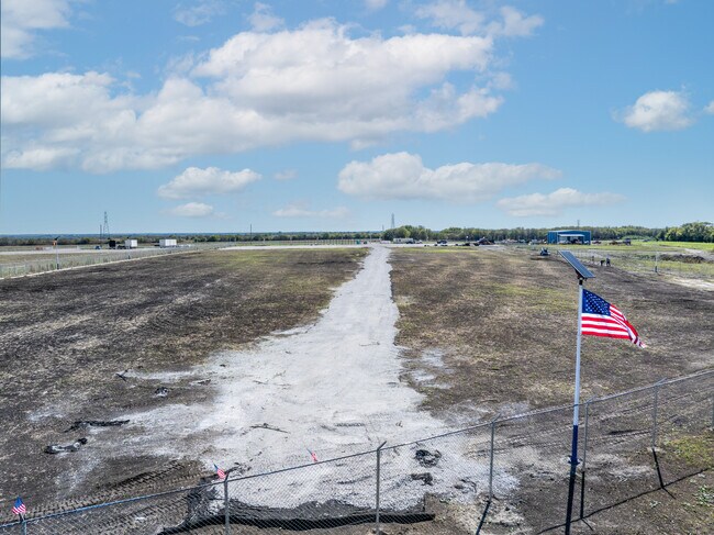
Property Detail
Interstate 35 Rd
Dallas-Fort Worth-Arlington, TX
191 J L CHERINO 8.572 AC
292109
ELLIS
Agriculturalland
Texas
2024
8.56 AC
2025
Ellis County
061000
Dallas/Ft Worth
NEARBY LISTINGS FOR SALE OR LEASE
-
-
View all Milford listings for sale on LoopNet.com
DEMOGRAPHICS near Interstate 35 Rd
1 mile
3 mile
5 mile
2025 Total Population
40
1,985
4,432
2030 Population
45
2,290
5,123
Pop Growth 2025-2030
+ 12.50%
+ 15.37%
+ 15.59%
Average Age
43
40
40
2025 Total Households
14
719
1,609
HH Growth 2025-2030
+ 14.29%
+ 15.58%
+ 15.79%
Median Household Inc
$93,749
$66,346
$59,140
Avg Household Size
2.80
2.80
2.70
2025 Avg HH Vehicles
2.00
2.00
2.00
Median Home Value
$350,000
$284,258
$256,499
Median Year Built
1982
1983
1985
Nearby Places
Map Layers
Map Styles
 Street
 Aerial
Transit
 Traffic
 Biking
Places
Listings with unknown addresses are not visible on the map
- Restaurants
- Banks
- Shops
- Fitness
- Groceries
SALE & LEASE HISTORY
LISTING DATE
SALE/LEASE

Nov 18, 2024
For Sale
Nearby Properties
Address
Land Use
TOTAL SIZE
Lot Size
Zoning
Address
Land Use
TOTAL SIZE
Lot Size
Zoning
70,968 SF
11.02 AC
Address
Land Use
TOTAL SIZE
Lot Size
Zoning
1,280 SF
35 AC
Address
Land Use
TOTAL SIZE
Lot Size
Zoning
13,044 SF
15.45 AC
Address
Land Use
TOTAL SIZE
Lot Size
Zoning
76,870 SF
38.89 AC
Address
Land Use
TOTAL SIZE
Lot Size
Zoning
28,797 SF
2.96 AC
Address
Land Use
TOTAL SIZE
Lot Size
Zoning
16,588 SF
387.48 AC
Address
Land Use
TOTAL SIZE
Lot Size
Zoning
34,200 SF
2.47 AC
Address
Land Use
TOTAL SIZE
Lot Size
Zoning
20,665 SF
4.96 AC
Address
Land Use
TOTAL SIZE
Lot Size
Zoning
15,072 SF
5.59 AC
Address
Land Use
TOTAL SIZE
Lot Size
Zoning
29 SF
11.92 AC
Address
Land Use
TOTAL SIZE
Lot Size
Zoning
8,550 SF
1.97 AC
Address
Land Use
TOTAL SIZE
Lot Size
Zoning
6,338 SF
1,915.01 AC
Address
Land Use
TOTAL SIZE
Lot Size
Zoning
21.21 AC
Address
Land Use
TOTAL SIZE
Lot Size
Zoning
4,726 SF
94.41 AC
Address
Land Use
TOTAL SIZE
Lot Size
Zoning
11,550 SF
4.69 AC
Address
Land Use
TOTAL SIZE
Lot Size
Zoning
1,560 SF
95.27 AC
Address
Land Use
TOTAL SIZE
Lot Size
Zoning
16,200 SF
1.26 AC
Address
Land Use
TOTAL SIZE
Lot Size
Zoning
10,810 SF
0.81 AC
Address
Land Use
TOTAL SIZE
Lot Size
Zoning
2,632 SF
22.51 AC
Address
Land Use
TOTAL SIZE
Lot Size
Zoning
1,400 SF
144.89 AC
Address
Land Use
TOTAL SIZE
Lot Size
Zoning
52.52 AC
Address
Land Use
TOTAL SIZE
Lot Size
Zoning
4,946 SF
2.45 AC
Address
Land Use
TOTAL SIZE
Lot Size
Zoning
4,071 SF
5.60 AC
Address
Land Use
TOTAL SIZE
Lot Size
Zoning
44.10 AC
Address
Land Use
TOTAL SIZE
Lot Size
Zoning
6,926 SF
27.28 AC
Address
Land Use
TOTAL SIZE
Lot Size
Zoning
11 SF
0.96 AC
Address
Land Use
TOTAL SIZE
Lot Size
Zoning
3,327 SF
11.72 AC
Address
Land Use
TOTAL SIZE
Lot Size
Zoning
1 SF
0.45 AC
Address
Land Use
TOTAL SIZE
Lot Size
Zoning
70.90 AC
Address
Land Use
TOTAL SIZE
Lot Size
Zoning
3,428 SF
6.87 AC
The World's #1 Commercial Real Estate Marketplace
Connect with us
© 2026 CoStar Group
The information above has been obtained from sources believed reliable. While we do not doubt its accuracy we have not verified it and make no guarantee, warranty or representation about it. It is your responsibility to independently confirm its accuracy and completeness. Any projections, opinions, assumptions, or estimates used are for example only and do not represent the current or future performance of the property. The value of this transaction to you depends on tax and other factors which should be evaluated by your tax, financial, and legal advisors. You and your advisors should conduct a careful, independent investigation of the property to determine to your satisfaction the suitability of the property for your needs.