Property Record
Interstate 35, Waxahachie, TX 75165

NEARBY LISTINGS FOR SALE OR LEASE
Property Detail
Interstate 35
Dallas-Fort Worth-Arlington, TX
E S Newton
188453
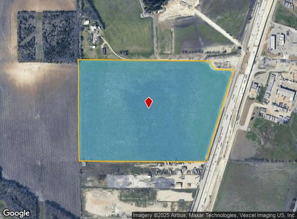
790 E C NEWTON 58.706 ACRES
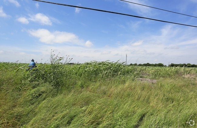
Agriculturalland
Ellis
X
Texas
48139C0180G
58.71 AC
2024
Ellis County
2025
Dallas/Ft Worth
060300
DEMOGRAPHICS near Interstate 35
1 Mile
3 Mile
5 Mile
2024 Total Population
49
21,306
70,978
2029 Population
61
26,922
89,702
Pop Growth 2024-2029
+ 24.49%
+ 26.36%
+ 26.38%
Average Age
39
37
37
2024 Total Households
17
7,408
24,453
HH Growth 2024-2029
+ 23.53%
+ 26.42%
+ 26.60%
Median Household Inc
$120,833
$102,052
$97,495
Avg Household Size
2.80
2.90
2.80
2024 Avg HH Vehicles
3.00
2.00
2.00
Median Home Value
$333,333
$282,932
$276,681
Median Year Built
2003
2005
2001
Nearby Places
Map Layers
Map Styles
 Street
 Aerial
- Restaurants
- Banks
- Shops
- Fitness
- Groceries
PUBLIC TRANSPORTATION
AIRPORT
Dallas Love Field
DRIVE
WALK
Distance
Dallas Love Field
40 min
29.3 mi
Freight Ports
Port of Shreveport
DRIVE
WALK
Distance
Port of Shreveport
226 min
210.4 mi
SALE & LEASE HISTORY
LISTING DATE
SALE/LEASE

Sep 24, 2016
For Sale
Sep 24, 2016
For Sale
Jan 27, 2017
For Sale
Aug 26, 2021
For Sale
Nearby Properties
Address
Land Use
TOTAL SIZE
Lot Size
Zoning
Address
Land Use
TOTAL SIZE
Lot Size
Zoning
488,705 SF
43.76 AC
Address
Land Use
TOTAL SIZE
Lot Size
Zoning
146,074 SF
42.83 AC
Address
Land Use
TOTAL SIZE
Lot Size
Zoning
448,643 SF
8.93 AC
Address
Land Use
TOTAL SIZE
Lot Size
Zoning
643,064 SF
42.15 AC
Address
Land Use
TOTAL SIZE
Lot Size
Zoning
259,166 SF
11.07 AC
Address
Land Use
TOTAL SIZE
Lot Size
Zoning
675,375 SF
59.26 AC
Address
Land Use
TOTAL SIZE
Lot Size
Zoning
177,000 SF
20.25 AC
Address
Land Use
TOTAL SIZE
Lot Size
Zoning
708,800 SF
149.18 AC
Address
Land Use
TOTAL SIZE
Lot Size
Zoning
198,180 SF
11.48 AC
Address
Land Use
TOTAL SIZE
Lot Size
Zoning
1,123,347 SF
74.97 AC
Address
Land Use
TOTAL SIZE
Lot Size
Zoning
413,050 SF
54.30 AC
Address
Land Use
TOTAL SIZE
Lot Size
Zoning
85,823 SF
56.24 AC
Address
Land Use
TOTAL SIZE
Lot Size
Zoning
118,782 SF
5.11 AC
Address
Land Use
TOTAL SIZE
Lot Size
Zoning
326,740 SF
23.01 AC
Address
Land Use
TOTAL SIZE
Lot Size
Zoning
352,350 SF
18.78 AC
Address
Land Use
TOTAL SIZE
Lot Size
Zoning
568,234 SF
65.79 AC
Address
Land Use
TOTAL SIZE
Lot Size
Zoning
886,858 SF
8.60 AC
Address
Land Use
TOTAL SIZE
Lot Size
Zoning
92,475 SF
12.38 AC
Address
Land Use
TOTAL SIZE
Lot Size
Zoning
326,130 SF
18.48 AC
Address
Land Use
TOTAL SIZE
Lot Size
Zoning
115,544 SF
6.70 AC
Address
Land Use
TOTAL SIZE
Lot Size
Zoning
120,587 SF
23.95 AC
Address
Land Use
TOTAL SIZE
Lot Size
Zoning
92,860 SF
26.02 AC
Address
Land Use
TOTAL SIZE
Lot Size
Zoning
Address
Land Use
TOTAL SIZE
Lot Size
Zoning
109,423 SF
7.04 AC
Address
Land Use
TOTAL SIZE
Lot Size
Zoning
205,027 SF
22.65 AC
Address
Land Use
TOTAL SIZE
Lot Size
Zoning
60,041 SF
6.76 AC
Address
Land Use
TOTAL SIZE
Lot Size
Zoning
79,244 SF
11.28 AC
Address
Land Use
TOTAL SIZE
Lot Size
Zoning
871,497 SF
134.08 AC
Address
Land Use
TOTAL SIZE
Lot Size
Zoning
86,360 SF
4.26 AC
Address
Land Use
TOTAL SIZE
Lot Size
Zoning
57,600 SF
5.86 AC
The World's #1 Commercial Real Estate Marketplace
Connect with us
© 2026 CoStar Group
The information above has been obtained from sources believed reliable. While we do not doubt its accuracy we have not verified it and make no guarantee, warranty or representation about it. It is your responsibility to independently confirm its accuracy and completeness. Any projections, opinions, assumptions, or estimates used are for example only and do not represent the current or future performance of the property. The value of this transaction to you depends on tax and other factors which should be evaluated by your tax, financial, and legal advisors. You and your advisors should conduct a careful, independent investigation of the property to determine to your satisfaction the suitability of the property for your needs.