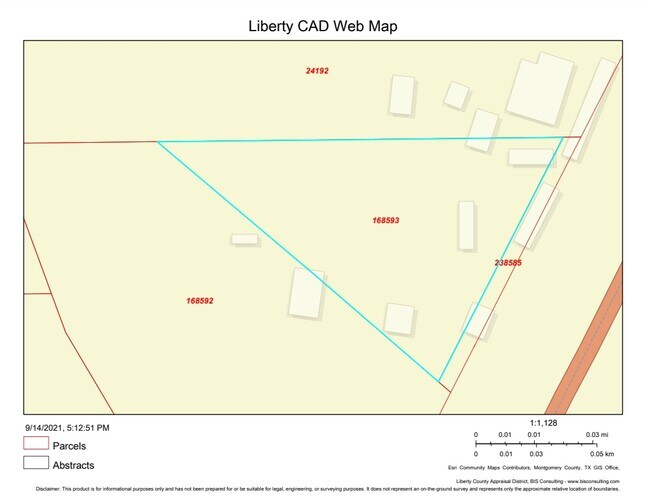
Property Record
W Of Highway 59, Liberty, TX 77575


NEARBY LISTINGS FOR SALE OR LEASE
Property Detail
W Of Highway 59
Houston-The Woodlands-Sugar Land, TX
C Harper
000209-000584-000
Liberty
Sfr
Texas
AE
3.29 AC
48407C0475C
Liberty County
1,540 SF
Houston
DEMOGRAPHICS near W Of Highway 59
1 Mile
3 Mile
5 Mile
2024 Total Population
136
11,215
29,439
2029 Population
178
14,703
38,125
Pop Growth 2024-2029
+ 30.88%
+ 31.10%
+ 29.51%
Average Age
34
36
36
2024 Total Households
42
3,798
9,564
HH Growth 2024-2029
+ 30.95%
+ 30.17%
+ 28.98%
Median Household Inc
$41,250
$46,686
$52,649
Avg Household Size
2.90
2.80
2.90
2024 Avg HH Vehicles
2.00
2.00
2.00
Median Home Value
$94,117
$129,913
$144,755
Median Year Built
1992
1984
1992
Nearby Places
Map Layers
Map Styles
 Street
 Aerial
- Restaurants
- Banks
- Shops
- Fitness
- Groceries
PUBLIC TRANSPORTATION
AIRPORT
George Bush Intcntl/Houston
DRIVE
WALK
Distance
George Bush Intcntl/Houston
38 min
32.0 mi
Freight Ports
Port of Houston
DRIVE
WALK
Distance
Port of Houston
59 min
47.2 mi
SALE & LEASE HISTORY
LISTING DATE
SALE/LEASE

Dec 21, 2020
For Sale
Nearby Properties
Address
Land Use
TOTAL SIZE
Lot Size
Zoning
Address
Land Use
TOTAL SIZE
Lot Size
Zoning
132,247 SF
25 AC
Address
Land Use
TOTAL SIZE
Lot Size
Zoning
165,962 SF
9.35 AC
Address
Land Use
TOTAL SIZE
Lot Size
Zoning
158,575 SF
14.28 AC
Address
Land Use
TOTAL SIZE
Lot Size
Zoning
43,267 SF
1.79 AC
Address
Land Use
TOTAL SIZE
Lot Size
Zoning
35,160 SF
1.23 AC
Address
Land Use
TOTAL SIZE
Lot Size
Zoning
42,962 SF
3.44 AC
Address
Land Use
TOTAL SIZE
Lot Size
Zoning
922.24 AC
Address
Land Use
TOTAL SIZE
Lot Size
Zoning
39,499 SF
1.72 AC
Address
Land Use
TOTAL SIZE
Lot Size
Zoning
2,028 SF
52.96 AC
Address
Land Use
TOTAL SIZE
Lot Size
Zoning
42,808 SF
15.61 AC
Address
Land Use
TOTAL SIZE
Lot Size
Zoning
35,031 SF
4.26 AC
Address
Land Use
TOTAL SIZE
Lot Size
Zoning
31,453 SF
4.61 AC
Address
Land Use
TOTAL SIZE
Lot Size
Zoning
32,211 SF
5.66 AC
Address
Land Use
TOTAL SIZE
Lot Size
Zoning
40,592 SF
33.55 AC
Address
Land Use
TOTAL SIZE
Lot Size
Zoning
32,600 SF
9.21 AC
5
Address
Land Use
TOTAL SIZE
Lot Size
Zoning
35,450 SF
17.90 AC
Address
Land Use
TOTAL SIZE
Lot Size
Zoning
30,990 SF
0.99 AC
Address
Land Use
TOTAL SIZE
Lot Size
Zoning
82,823 SF
1.57 AC
Address
Land Use
TOTAL SIZE
Lot Size
Zoning
93,030 SF
7.22 AC
Address
Land Use
TOTAL SIZE
Lot Size
Zoning
17,420 SF
1 AC
Address
Land Use
TOTAL SIZE
Lot Size
Zoning
44,785 SF
1.98 AC
Address
Land Use
TOTAL SIZE
Lot Size
Zoning
28,200 SF
0.69 AC
Address
Land Use
TOTAL SIZE
Lot Size
Zoning
27,134 SF
3.89 AC
Address
Land Use
TOTAL SIZE
Lot Size
Zoning
35,980 SF
2.75 AC
Address
Land Use
TOTAL SIZE
Lot Size
Zoning
32,629 SF
2.38 AC
Address
Land Use
TOTAL SIZE
Lot Size
Zoning
19,724 SF
6 AC
Address
Land Use
TOTAL SIZE
Lot Size
Zoning
11,480 SF
0.92 AC
Address
Land Use
TOTAL SIZE
Lot Size
Zoning
22,324 SF
0.69 AC
Address
Land Use
TOTAL SIZE
Lot Size
Zoning
17,158 SF
11.25 AC
Address
Land Use
TOTAL SIZE
Lot Size
Zoning
17,190 SF
2.07 AC
The World's #1 Commercial Real Estate Marketplace
Connect with us
© 2025 CoStar Group
The information above has been obtained from sources believed reliable. While we do not doubt its accuracy we have not verified it and make no guarantee, warranty or representation about it. It is your responsibility to independently confirm its accuracy and completeness. Any projections, opinions, assumptions, or estimates used are for example only and do not represent the current or future performance of the property. The value of this transaction to you depends on tax and other factors which should be evaluated by your tax, financial, and legal advisors. You and your advisors should conduct a careful, independent investigation of the property to determine to your satisfaction the suitability of the property for your needs.