Property Record
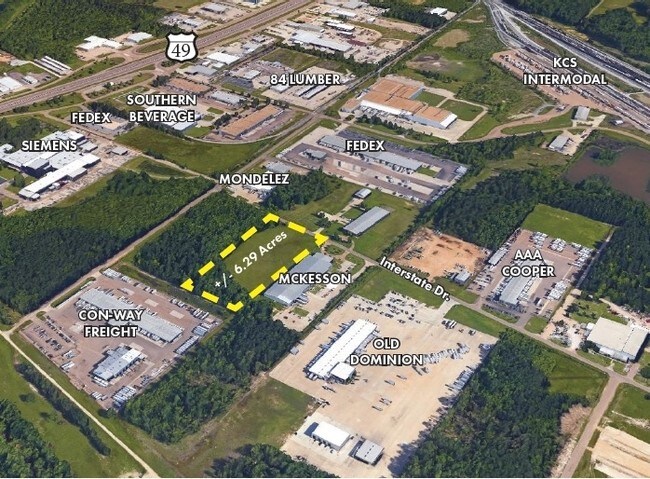
Interstate Dr, Richland, MS 39218

Property Detail
Interstate Dr
Jackson
LOT 700 X 712.1 X 696.12 X 789.75 IN SE4 NW4 S OF GREENBRIAR DR LESS 5.7 AC OFF THE EAST SIDE DB 498 PG 0078 0122085 DB 498 P
Jackson, MS
RANKIN
D07P-000003-00010
Mississippi
Commercialacreage
700
2024
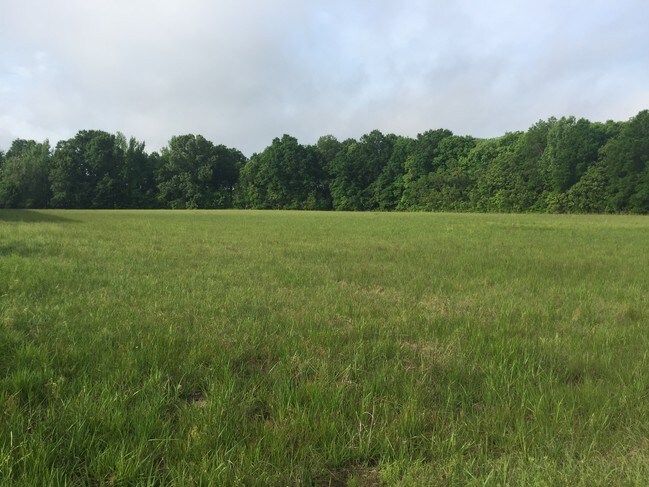
6.30 AC
2025
Outlying Rankin County
020401
NEARBY LISTINGS FOR SALE OR LEASE
DEMOGRAPHICS near Interstate Dr
1 mile
3 mile
5 mile
2025 Total Population
1,182
20,109
52,761
2030 Population
1,199
20,559
53,316
Pop Growth 2025-2030
+ 1.44%
+ 2.24%
+ 1.05%
Average Age
39
39
38
2025 Total Households
454
7,415
20,095
HH Growth 2025-2030
+ 1.54%
+ 2.40%
+ 1.02%
Median Household Inc
$51,905
$48,132
$45,078
Avg Household Size
2.60
2.50
2.30
2025 Avg HH Vehicles
2.00
2.00
2.00
Median Home Value
$142,723
$160,682
$150,447
Median Year Built
1978
1981
1975
Nearby Places
Map Layers
Map Styles
 Street
 Aerial
Transit
 Traffic
 Biking
Places
Listings with unknown addresses are not visible on the map
- Restaurants
- Banks
- Shops
- Fitness
- Groceries
PUBLIC TRANSPORTATION
COMMUTER RAIL
Jackson (City of New Orleans - Amtrak)
Drive
Walk
Distance
Jackson (City of New Orleans - Amtrak)
11 min
6.0 mi
AIRPORT
Jackson-Medgar Wiley Evers International
Drive
Walk
Distance
Jackson-Medgar Wiley Evers International
18 min
10.0 mi
Freight Ports
Port of Greater Baton Rouge
Drive
Walk
Distance
Port of Greater Baton Rouge
201 min
178.7 mi
SALE & LEASE HISTORY
LISTING DATE
SALE/LEASE

Apr 19, 2017
For Sale
Nearby Properties
Address
Land Use
TOTAL SIZE
Lot Size
Zoning
Address
Land Use
TOTAL SIZE
Lot Size
Zoning
94.48 AC
Address
Land Use
TOTAL SIZE
Lot Size
Zoning
62.33 AC
Address
Land Use
TOTAL SIZE
Lot Size
Zoning
40,148 SF
37.47 AC
Address
Land Use
TOTAL SIZE
Lot Size
Zoning
4,008 SF
8.30 AC
Address
Land Use
TOTAL SIZE
Lot Size
Zoning
2,348 SF
16.45 AC
Address
Land Use
TOTAL SIZE
Lot Size
Zoning
1,257 SF
2.65 AC
Address
Land Use
TOTAL SIZE
Lot Size
Zoning
139,417 SF
13.50 AC
Address
Land Use
TOTAL SIZE
Lot Size
Zoning
157,034 SF
17.28 AC
Address
Land Use
TOTAL SIZE
Lot Size
Zoning
67,442 SF
2.85 AC
Address
Land Use
TOTAL SIZE
Lot Size
Zoning
253,479 SF
17.08 AC
Address
Land Use
TOTAL SIZE
Lot Size
Zoning
71,705 SF
11.52 AC
Address
Land Use
TOTAL SIZE
Lot Size
Zoning
70,433 SF
2.53 AC
Address
Land Use
TOTAL SIZE
Lot Size
Zoning
7,840 SF
10.34 AC
Address
Land Use
TOTAL SIZE
Lot Size
Zoning
10,086 SF
2.41 AC
Address
Land Use
TOTAL SIZE
Lot Size
Zoning
123,308 SF
20.88 AC
Address
Land Use
TOTAL SIZE
Lot Size
Zoning
58,208 SF
2.41 AC
Address
Land Use
TOTAL SIZE
Lot Size
Zoning
24,081 SF
24.48 AC
Address
Land Use
TOTAL SIZE
Lot Size
Zoning
16,095 SF
11.11 AC
Address
Land Use
TOTAL SIZE
Lot Size
Zoning
71,633 SF
25.94 AC
Address
Land Use
TOTAL SIZE
Lot Size
Zoning
28,073 SF
6.72 AC
Address
Land Use
TOTAL SIZE
Lot Size
Zoning
55,092 SF
2.21 AC
Address
Land Use
TOTAL SIZE
Lot Size
Zoning
7,648 SF
7.10 AC
Address
Land Use
TOTAL SIZE
Lot Size
Zoning
8,272 SF
8.15 AC
Address
Land Use
TOTAL SIZE
Lot Size
Zoning
214,011 SF
17.50 AC
Address
Land Use
TOTAL SIZE
Lot Size
Zoning
2,513 SF
7.10 AC
Address
Land Use
TOTAL SIZE
Lot Size
Zoning
5,595 SF
7.51 AC
Address
Land Use
TOTAL SIZE
Lot Size
Zoning
47,809 SF
1.75 AC
Address
Land Use
TOTAL SIZE
Lot Size
Zoning
4,131 SF
27.84 AC
Address
Land Use
TOTAL SIZE
Lot Size
Zoning
61,637 SF
10.77 AC
Address
Land Use
TOTAL SIZE
Lot Size
Zoning
12.74 AC
The World's #1 Commercial Real Estate Marketplace
Connect with us
© 2026 CoStar Group
The information above has been obtained from sources believed reliable. While we do not doubt its accuracy we have not verified it and make no guarantee, warranty or representation about it. It is your responsibility to independently confirm its accuracy and completeness. Any projections, opinions, assumptions, or estimates used are for example only and do not represent the current or future performance of the property. The value of this transaction to you depends on tax and other factors which should be evaluated by your tax, financial, and legal advisors. You and your advisors should conduct a careful, independent investigation of the property to determine to your satisfaction the suitability of the property for your needs.