Property Record
Intervale Rd, New Gloucester, ME 04260


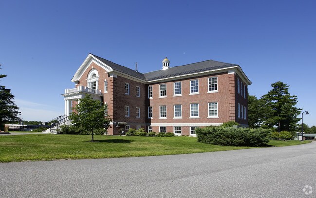
Property Detail
Intervale Rd
0004-0005
CUMBERLAND
Commercialofficeresidentialmixeduse
Maine
19
5
B and X Area of moderate flood hazard, usually the area between the limits of the 100-year and 500-year floods.
213 AC
2025
NE Cumberland County
2025
Portland/South Portland
011500
Portland-South Portland, ME
NEARBY LISTINGS FOR SALE OR LEASE
-
-
View all New Gloucester listings for sale on LoopNet.com
DEMOGRAPHICS near Intervale Rd
1 mile
3 mile
5 mile
2025 Total Population
155
3,146
10,524
2030 Population
154
3,140
10,566
Pop Growth 2025-2030
(0.65%)
(0.19%)
+ 0.40%
Average Age
44
42
42
2025 Total Households
61
1,221
4,120
HH Growth 2025-2030
(1.64%)
+ 0.08%
+ 0.61%
Median Household Inc
$129,167
$110,449
$115,238
Avg Household Size
2.60
2.60
2.50
2025 Avg HH Vehicles
2.00
2.00
2.00
Median Home Value
$430,000
$390,812
$384,332
Median Year Built
1985
1984
1984
Nearby Places
Map Layers
Map Styles
 Street
 Aerial
Transit
 Traffic
 Biking
Places
Listings with unknown addresses are not visible on the map
- Restaurants
- Banks
- Shops
- Fitness
- Groceries
PUBLIC TRANSPORTATION
AIRPORT
Portland International Jetport
Drive
Walk
Distance
Portland International Jetport
41 min
25.8 mi
Nearby Properties
Address
Land Use
TOTAL SIZE
Lot Size
Zoning
Address
Land Use
TOTAL SIZE
Lot Size
Zoning
9,340 SF
58.60 AC
RA
Address
Land Use
TOTAL SIZE
Lot Size
Zoning
7.40 AC
Address
Land Use
TOTAL SIZE
Lot Size
Zoning
32.76 AC
14
Address
Land Use
TOTAL SIZE
Lot Size
Zoning
147.49 AC
RA
Address
Land Use
TOTAL SIZE
Lot Size
Zoning
90.16 AC
RA
Address
Land Use
TOTAL SIZE
Lot Size
Zoning
3,544 SF
71 AC
RA
Address
Land Use
TOTAL SIZE
Lot Size
Zoning
720 SF
103.60 AC
RA
Address
Land Use
TOTAL SIZE
Lot Size
Zoning
4,852 SF
1 AC
RA
Address
Land Use
TOTAL SIZE
Lot Size
Zoning
4,928 SF
26.80 AC
BUSINE
Address
Land Use
TOTAL SIZE
Lot Size
Zoning
6,653 SF
3 AC
RA
Address
Land Use
TOTAL SIZE
Lot Size
Zoning
5,984 SF
1.84 AC
RA
Address
Land Use
TOTAL SIZE
Lot Size
Zoning
960 SF
4 AC
RA
Address
Land Use
TOTAL SIZE
Lot Size
Zoning
4,455 SF
5.10 AC
Address
Land Use
TOTAL SIZE
Lot Size
Zoning
216 AC
RA
Address
Land Use
TOTAL SIZE
Lot Size
Zoning
61 AC
RA
Address
Land Use
TOTAL SIZE
Lot Size
Zoning
48 AC
RA
Address
Land Use
TOTAL SIZE
Lot Size
Zoning
42.09 AC
BB
Address
Land Use
TOTAL SIZE
Lot Size
Zoning
153.56 AC
RA
Address
Land Use
TOTAL SIZE
Lot Size
Zoning
5 AC
BUSINE
Address
Land Use
TOTAL SIZE
Lot Size
Zoning
2,480 SF
20 AC
RA
Address
Land Use
TOTAL SIZE
Lot Size
Zoning
589 SF
4.03 AC
RA
Address
Land Use
TOTAL SIZE
Lot Size
Zoning
113.07 AC
RA
Address
Land Use
TOTAL SIZE
Lot Size
Zoning
1,500 SF
1.90 AC
BUSINE
Address
Land Use
TOTAL SIZE
Lot Size
Zoning
1,972 SF
4.32 AC
Address
Land Use
TOTAL SIZE
Lot Size
Zoning
86.60 AC
RA
Address
Land Use
TOTAL SIZE
Lot Size
Zoning
25.45 AC
MEDIUM
Address
Land Use
TOTAL SIZE
Lot Size
Zoning
29 AC
MEDIUM
Address
Land Use
TOTAL SIZE
Lot Size
Zoning
9.90 AC
BB
Address
Land Use
TOTAL SIZE
Lot Size
Zoning
26.75 AC
RA
The World's #1 Commercial Real Estate Marketplace
Connect with us
© 2026 CoStar Group
The information above has been obtained from sources believed reliable. While we do not doubt its accuracy we have not verified it and make no guarantee, warranty or representation about it. It is your responsibility to independently confirm its accuracy and completeness. Any projections, opinions, assumptions, or estimates used are for example only and do not represent the current or future performance of the property. The value of this transaction to you depends on tax and other factors which should be evaluated by your tax, financial, and legal advisors. You and your advisors should conduct a careful, independent investigation of the property to determine to your satisfaction the suitability of the property for your needs.