Property Record
Janet Dr, Searcy, AR 72143

Property Detail
Janet Dr
016-10633-008
PT S 1/2 NW LYING N & W JANET DR & S OF ONDRA ST BEING 322.42 X 340.28 X 45 X 76.79 X 344.19 X 814.13 X 123.98
Commercialnec
WHITE
B and X Area of moderate flood hazard, usually the area between the limits of the 100-year and 500-year floods.
Arkansas
2025
4.25 AC
2025
Arkansas North Area
070901
Other Market Areas
13,261 SF
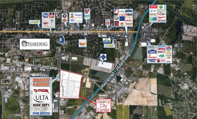
Searcy, AR
NEARBY LISTINGS FOR SALE OR LEASE
-
-
-
No Photo
-
-
View all Searcy listings for sale on LoopNet.com
DEMOGRAPHICS near Janet Dr
1 mile
3 mile
5 mile
2025 Total Population
709
19,039
30,682
2030 Population
707
19,556
31,420
Pop Growth 2025-2030
(0.28%)
+ 2.72%
+ 2.41%
Average Age
36
38
39
2025 Total Households
303
7,390
11,893
HH Growth 2025-2030
(0.33%)
+ 2.94%
+ 2.60%
Median Household Inc
$42,500
$42,046
$51,512
Avg Household Size
2.10
2.30
2.40
2025 Avg HH Vehicles
1.00
2.00
2.00
Median Home Value
$157,142
$178,582
$188,800
Median Year Built
1980
1986
1989
Nearby Places
Map Layers
Map Styles
 Street
 Aerial
Layers
 Traffic
 Biking
Places
Listings with unknown addresses are not visible on the map
- Restaurants
- Banks
- Shops
- Fitness
- Groceries
SALE & LEASE HISTORY
LISTING DATE
SALE/LEASE

Sep 21, 2018
For Sale
Nearby Properties
Address
Land Use
TOTAL SIZE
Lot Size
Zoning
Address
Land Use
TOTAL SIZE
Lot Size
Zoning
33,565 SF
8.86 AC
Address
Land Use
TOTAL SIZE
Lot Size
Zoning
1,130,125 SF
144.30 AC
Address
Land Use
TOTAL SIZE
Lot Size
Zoning
34,803 SF
13.21 AC
Address
Land Use
TOTAL SIZE
Lot Size
Zoning
22,770 SF
0.50 AC
Address
Land Use
TOTAL SIZE
Lot Size
Zoning
57,021 SF
1.75 AC
Address
Land Use
TOTAL SIZE
Lot Size
Zoning
31,682 SF
2.69 AC
Address
Land Use
TOTAL SIZE
Lot Size
Zoning
188,454 SF
53.15 AC
Address
Land Use
TOTAL SIZE
Lot Size
Zoning
3,780 SF
29.27 AC
Address
Land Use
TOTAL SIZE
Lot Size
Zoning
7,763 SF
6.48 AC
Address
Land Use
TOTAL SIZE
Lot Size
Zoning
56,820 SF
8.50 AC
Address
Land Use
TOTAL SIZE
Lot Size
Zoning
110,398 SF
10.39 AC
Address
Land Use
TOTAL SIZE
Lot Size
Zoning
64,669 SF
41.21 AC
Address
Land Use
TOTAL SIZE
Lot Size
Zoning
36,175 SF
19.62 AC
Address
Land Use
TOTAL SIZE
Lot Size
Zoning
81,577 SF
4.33 AC
Address
Land Use
TOTAL SIZE
Lot Size
Zoning
16,573 SF
0.98 AC
Address
Land Use
TOTAL SIZE
Lot Size
Zoning
20,685 SF
9.29 AC
Address
Land Use
TOTAL SIZE
Lot Size
Zoning
112,151 SF
7.74 AC
Address
Land Use
TOTAL SIZE
Lot Size
Zoning
55,772 SF
4.02 AC
Address
Land Use
TOTAL SIZE
Lot Size
Zoning
79,336 SF
12.78 AC
Address
Land Use
TOTAL SIZE
Lot Size
Zoning
25,248 SF
4.70 AC
Address
Land Use
TOTAL SIZE
Lot Size
Zoning
17,924 SF
6.20 AC
Address
Land Use
TOTAL SIZE
Lot Size
Zoning
63,334 SF
14.08 AC
Address
Land Use
TOTAL SIZE
Lot Size
Zoning
8,018 SF
7.53 AC
Address
Land Use
TOTAL SIZE
Lot Size
Zoning
9,000 SF
1 AC
Address
Land Use
TOTAL SIZE
Lot Size
Zoning
42,746 SF
5.56 AC
Address
Land Use
TOTAL SIZE
Lot Size
Zoning
91,577 SF
7.06 AC
Address
Land Use
TOTAL SIZE
Lot Size
Zoning
264,753 SF
4.40 AC
The World's #1 Commercial Real Estate Marketplace
Connect with us
© 2026 CoStar Group
The information above has been obtained from sources believed reliable. While we do not doubt its accuracy we have not verified it and make no guarantee, warranty or representation about it. It is your responsibility to independently confirm its accuracy and completeness. Any projections, opinions, assumptions, or estimates used are for example only and do not represent the current or future performance of the property. The value of this transaction to you depends on tax and other factors which should be evaluated by your tax, financial, and legal advisors. You and your advisors should conduct a careful, independent investigation of the property to determine to your satisfaction the suitability of the property for your needs.