Property Record
Jeff Ates Rd, Milton, FL 32583
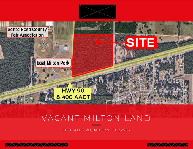

This Property Is For Sale
Property Detail
Jeff Ates Rd
33-2N-27-0000-00300-0000
*NEW DESC 2022 PER DEED* (PARCEL A ) COM AT THE NW COR OF SEC 33 T2 N R27 W SRC FL THN S 87*2242 E 2630.81 FT ALONG THE N LN OF SAID SEC 33 TO THE WLY R/W LN OF JEFF ATES ROAD (R/W UNKNOWN) THN S 03*3457 W 605.04 FT ALONG SAID WLY R/W LN TO THE POB T
Industrialacreage
SANTA ROSA
M2
Florida
B and X Area of moderate flood hazard, usually the area between the limits of the 100-year and 500-year floods.
39.10 AC
2024
SE Santa Rosa County
2025
Pensacola
010709
Pensacola-Ferry Pass-Brent, FL
NEARBY LISTINGS FOR SALE OR LEASE
DEMOGRAPHICS near Jeff Ates Rd
1 mile
3 mile
5 mile
2024 Total Population
3,427
9,349
18,131
2029 Population
3,819
10,604
20,732
Pop Growth 2024-2029
+ 11.44%
+ 13.42%
+ 14.35%
Average Age
40
41
42
2024 Total Households
633
2,391
5,735
HH Growth 2024-2029
+ 17.22%
+ 17.19%
+ 16.37%
Median Household Inc
$61,500
$58,559
$63,373
Avg Household Size
2.50
2.50
2.50
2024 Avg HH Vehicles
2.00
2.00
2.00
Median Home Value
$180,391
$211,158
$204,561
Median Year Built
2005
1997
1995
Nearby Places
Map Layers
Map Styles
 Street
 Aerial
Transit
 Traffic
 Biking
Places
Listings with unknown addresses are not visible on the map
- Restaurants
- Banks
- Shops
- Fitness
- Groceries
PUBLIC TRANSPORTATION
AIRPORT
Pensacola International
Drive
Walk
Distance
Pensacola International
35 min
24.1 mi
Freight Ports
Port of Mobile
Drive
Walk
Distance
Port of Mobile
84 min
74.1 mi
Nearby Properties
Address
Land Use
TOTAL SIZE
Lot Size
Zoning
Address
Land Use
TOTAL SIZE
Lot Size
Zoning
342,125 SF
58.46 AC
M2
Address
Land Use
TOTAL SIZE
Lot Size
Zoning
281,607 SF
306.03 AC
M2
Address
Land Use
TOTAL SIZE
Lot Size
Zoning
183,076 SF
85.91 AC
M2
Address
Land Use
TOTAL SIZE
Lot Size
Zoning
198,543 SF
34.63 AC
M2
Address
Land Use
TOTAL SIZE
Lot Size
Zoning
31,124 SF
36.55 AC
AG-RR
Address
Land Use
TOTAL SIZE
Lot Size
Zoning
258,149 SF
8.42 AC
M2
Address
Land Use
TOTAL SIZE
Lot Size
Zoning
197,050 SF
29.93 AC
M2
Address
Land Use
TOTAL SIZE
Lot Size
Zoning
141,508 SF
26.62 AC
M2
Address
Land Use
TOTAL SIZE
Lot Size
Zoning
164,844 SF
8.33 AC
M2
Address
Land Use
TOTAL SIZE
Lot Size
Zoning
52,817 SF
79.32 AC
M1
Address
Land Use
TOTAL SIZE
Lot Size
Zoning
67,182 SF
9.54 AC
M2
Address
Land Use
TOTAL SIZE
Lot Size
Zoning
47,976 SF
102.61 AC
M2
Address
Land Use
TOTAL SIZE
Lot Size
Zoning
186.32 AC
HCD
Address
Land Use
TOTAL SIZE
Lot Size
Zoning
82,869 SF
10 AC
M2
Address
Land Use
TOTAL SIZE
Lot Size
Zoning
9,030 SF
20.47 AC
HCD
Address
Land Use
TOTAL SIZE
Lot Size
Zoning
72,675 SF
20 AC
M2
Address
Land Use
TOTAL SIZE
Lot Size
Zoning
103,000 SF
7.24 AC
M2
Address
Land Use
TOTAL SIZE
Lot Size
Zoning
89,249 SF
66.21 AC
AG-RR
Address
Land Use
TOTAL SIZE
Lot Size
Zoning
81,521 SF
7.63 AC
M2
Address
Land Use
TOTAL SIZE
Lot Size
Zoning
51,765 SF
14 AC
M2
Address
Land Use
TOTAL SIZE
Lot Size
Zoning
2,409 SF
158.24 AC
M2
Address
Land Use
TOTAL SIZE
Lot Size
Zoning
83,222 SF
7 AC
M2
Address
Land Use
TOTAL SIZE
Lot Size
Zoning
38,619 SF
2.31 AC
HCD
Address
Land Use
TOTAL SIZE
Lot Size
Zoning
199.56 AC
AG-RR
Address
Land Use
TOTAL SIZE
Lot Size
Zoning
33,570 SF
4.25 AC
HCD
Address
Land Use
TOTAL SIZE
Lot Size
Zoning
33,454 SF
13.16 AC
M2
Address
Land Use
TOTAL SIZE
Lot Size
Zoning
82,362 SF
6.95 AC
M2
Address
Land Use
TOTAL SIZE
Lot Size
Zoning
20,964 SF
26.97 AC
M2
Address
Land Use
TOTAL SIZE
Lot Size
Zoning
15,067 SF
3.09 AC
M2
Address
Land Use
TOTAL SIZE
Lot Size
Zoning
20,468 SF
16 AC
M2
The World's #1 Commercial Real Estate Marketplace
Connect with us
© 2026 CoStar Group
The information above has been obtained from sources believed reliable. While we do not doubt its accuracy we have not verified it and make no guarantee, warranty or representation about it. It is your responsibility to independently confirm its accuracy and completeness. Any projections, opinions, assumptions, or estimates used are for example only and do not represent the current or future performance of the property. The value of this transaction to you depends on tax and other factors which should be evaluated by your tax, financial, and legal advisors. You and your advisors should conduct a careful, independent investigation of the property to determine to your satisfaction the suitability of the property for your needs.