Property Record
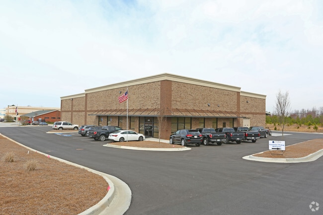
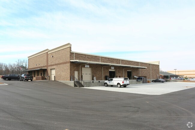
408 Jesse Cronic Rd, Braselton, GA 30517

Property Detail
408 Jesse Cronic Rd
119-004J2D
LOT 8 (2.00 AC) PLAT BK 76 PG 168
Manufacturinglight
JACKSON
M1
Georgia
B and X Area of moderate flood hazard, usually the area between the limits of the 100-year and 500-year floods.
8
2025
2 AC
2025
Braselton/W Jackson
010106
Atlanta
15,000 SF
Jefferson, GA
NEARBY LISTINGS FOR SALE OR LEASE
DEMOGRAPHICS near 408 Jesse Cronic Rd
1 mile
3 mile
5 mile
2025 Total Population
1,198
21,055
49,933
2030 Population
1,484
25,160
57,719
Pop Growth 2025-2030
+ 23.87%
+ 19.50%
+ 15.59%
Average Age
38
38
40
2025 Total Households
424
7,207
17,294
HH Growth 2025-2030
+ 24.06%
+ 19.73%
+ 15.58%
Median Household Inc
$94,143
$100,363
$105,158
Avg Household Size
2.80
2.90
2.90
2025 Avg HH Vehicles
2.00
2.00
2.00
Median Home Value
$381,848
$394,375
$423,572
Median Year Built
2010
2010
2008
Nearby Places
Map Layers
Map Styles
 Street
 Aerial
Layers
 Traffic
 Biking
Places
Listings with unknown addresses are not visible on the map
- Restaurants
- Banks
- Shops
- Fitness
- Groceries
Nearby Properties
Address
Land Use
TOTAL SIZE
Lot Size
Zoning
Address
Land Use
TOTAL SIZE
Lot Size
Zoning
979,317 SF
107.36 AC
001
Address
Land Use
TOTAL SIZE
Lot Size
Zoning
381,371 SF
77.27 AC
PUD
Address
Land Use
TOTAL SIZE
Lot Size
Zoning
750 SF
001
Address
Land Use
TOTAL SIZE
Lot Size
Zoning
160,277 SF
53.35 AC
PUD
Address
Land Use
TOTAL SIZE
Lot Size
Zoning
613,440 SF
50 AC
003
Address
Land Use
TOTAL SIZE
Lot Size
Zoning
805,954 SF
52.41 AC
003
Address
Land Use
TOTAL SIZE
Lot Size
Zoning
521,290 SF
23.64 AC
MD
Address
Land Use
TOTAL SIZE
Lot Size
Zoning
341,330 SF
71.15 AC
001
Address
Land Use
TOTAL SIZE
Lot Size
Zoning
510,720 SF
48.46 AC
M1
Address
Land Use
TOTAL SIZE
Lot Size
Zoning
348,990 SF
86.93 AC
M
Address
Land Use
TOTAL SIZE
Lot Size
Zoning
502,088 SF
36.84 AC
MD
Address
Land Use
TOTAL SIZE
Lot Size
Zoning
462,000 SF
30.12 AC
M1
Address
Land Use
TOTAL SIZE
Lot Size
Zoning
500,500 SF
53.92 AC
MI
Address
Land Use
TOTAL SIZE
Lot Size
Zoning
422,920 SF
24.67 AC
MD
Address
Land Use
TOTAL SIZE
Lot Size
Zoning
446,439 SF
30.47 AC
003
Address
Land Use
TOTAL SIZE
Lot Size
Zoning
438,375 SF
32.69 AC
Address
Land Use
TOTAL SIZE
Lot Size
Zoning
547,250 SF
47.51 AC
M1
Address
Land Use
TOTAL SIZE
Lot Size
Zoning
360,290 SF
35.90 AC
C
Address
Land Use
TOTAL SIZE
Lot Size
Zoning
42,053 SF
40.85 AC
PUD
Address
Land Use
TOTAL SIZE
Lot Size
Zoning
222,000 SF
20.59 AC
003
Address
Land Use
TOTAL SIZE
Lot Size
Zoning
5,220 SF
53.11 AC
PUD
Address
Land Use
TOTAL SIZE
Lot Size
Zoning
554,285 SF
70.18 AC
Address
Land Use
TOTAL SIZE
Lot Size
Zoning
240,946 SF
21.51 AC
004
Address
Land Use
TOTAL SIZE
Lot Size
Zoning
73,810 SF
34.67 AC
GC
Address
Land Use
TOTAL SIZE
Lot Size
Zoning
23.08 AC
MD
Address
Land Use
TOTAL SIZE
Lot Size
Zoning
209,040 SF
15.99 AC
MD
Address
Land Use
TOTAL SIZE
Lot Size
Zoning
76,566 SF
10.33 AC
PUD
Address
Land Use
TOTAL SIZE
Lot Size
Zoning
78.59 AC
004
Address
Land Use
TOTAL SIZE
Lot Size
Zoning
131,875 SF
18.93 AC
C
Address
Land Use
TOTAL SIZE
Lot Size
Zoning
76,792 SF
19.31 AC
003
The World's #1 Commercial Real Estate Marketplace
Connect with us
© 2026 CoStar Group
The information above has been obtained from sources believed reliable. While we do not doubt its accuracy we have not verified it and make no guarantee, warranty or representation about it. It is your responsibility to independently confirm its accuracy and completeness. Any projections, opinions, assumptions, or estimates used are for example only and do not represent the current or future performance of the property. The value of this transaction to you depends on tax and other factors which should be evaluated by your tax, financial, and legal advisors. You and your advisors should conduct a careful, independent investigation of the property to determine to your satisfaction the suitability of the property for your needs.