Property Record
Jimmie Kerr Rd, Graham, NC 27253

NEARBY LISTINGS FOR SALE OR LEASE
Property Detail
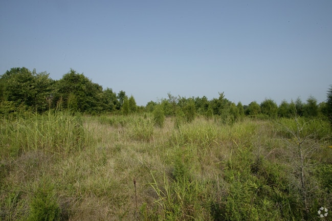
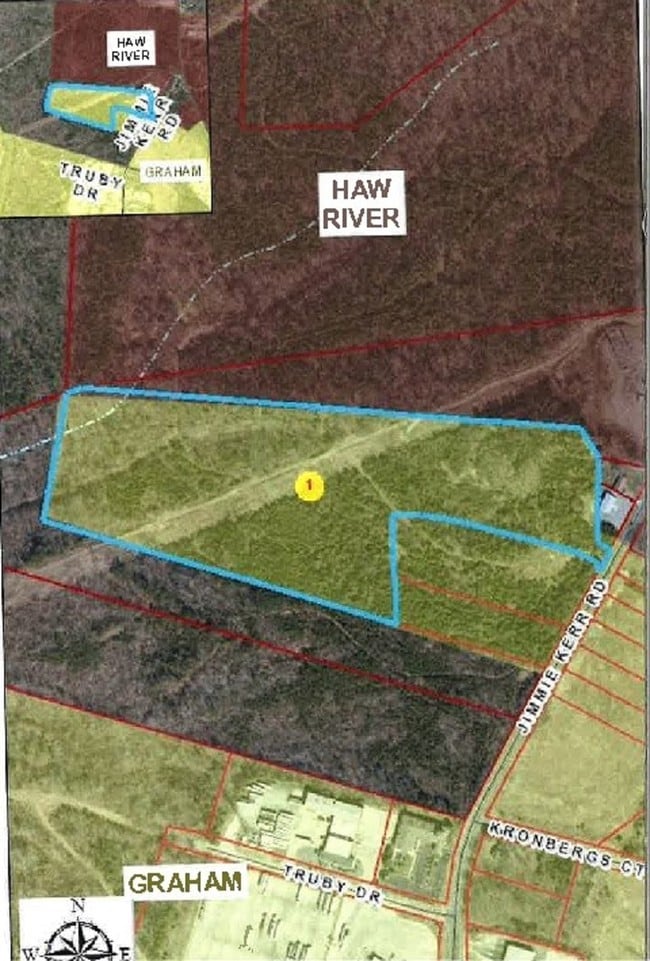
Jimmie Kerr Rd
152812
EXIT 150 I-40/85 13-14-6C
Privateschool
Alamance
X
North Carolina
3710889400K
3.17 AC
2025
SE Alamance County
2025
Greensboro/Winston-Salem
021102
Burlington, NC
DEMOGRAPHICS near Jimmie Kerr Rd
1 Mile
3 Mile
5 Mile
2024 Total Population
557
24,925
77,038
2029 Population
617
27,081
83,630
Pop Growth 2024-2029
+ 10.77%
+ 8.65%
+ 8.56%
Average Age
38
39
39
2024 Total Households
235
10,072
30,779
HH Growth 2024-2029
+ 11.06%
+ 8.91%
+ 8.76%
Median Household Inc
$58,461
$49,773
$51,708
Avg Household Size
2.30
2.40
2.40
2024 Avg HH Vehicles
2.00
2.00
2.00
Median Home Value
$202,857
$160,665
$176,924
Median Year Built
1998
1986
1985
Nearby Places
Map Layers
Map Styles
 Street
 Aerial
- Restaurants
- Banks
- Shops
- Fitness
- Groceries
PUBLIC TRANSPORTATION
COMMUTER RAIL
Burlington Station (Piedmont - North Carolina by Train (NC Train))
DRIVE
WALK
Distance
Burlington Station (Piedmont - North Carolina by Train (NC Train))
12 min
6.2 mi
Freight Ports
Virginia Port Authority - Richmond
DRIVE
WALK
Distance
Virginia Port Authority - Richmond
204 min
177.2 mi
SALE & LEASE HISTORY
LISTING DATE
SALE/LEASE

Jul 26, 2017
For Sale
Nearby Properties
Address
Land Use
TOTAL SIZE
Lot Size
Zoning
Address
Land Use
TOTAL SIZE
Lot Size
Zoning
22,500 SF
100.73 AC
Address
Land Use
TOTAL SIZE
Lot Size
Zoning
159,629 SF
82.81 AC
Address
Land Use
TOTAL SIZE
Lot Size
Zoning
27,803 SF
13.10 AC
B 2
Address
Land Use
TOTAL SIZE
Lot Size
Zoning
48,136 SF
14.57 AC
B 2
Address
Land Use
TOTAL SIZE
Lot Size
Zoning
333,775 SF
46.14 AC
Address
Land Use
TOTAL SIZE
Lot Size
Zoning
37,502 SF
17.48 AC
CR
Address
Land Use
TOTAL SIZE
Lot Size
Zoning
27,803 SF
11.53 AC
Address
Land Use
TOTAL SIZE
Lot Size
Zoning
296,940 SF
33.78 AC
Address
Land Use
TOTAL SIZE
Lot Size
Zoning
10,368 SF
11.35 AC
R MF
Address
Land Use
TOTAL SIZE
Lot Size
Zoning
5,246 SF
89.50 AC
Address
Land Use
TOTAL SIZE
Lot Size
Zoning
296,940 SF
36 AC
Address
Land Use
TOTAL SIZE
Lot Size
Zoning
31,920 SF
4.59 AC
R MF
Address
Land Use
TOTAL SIZE
Lot Size
Zoning
7,192 SF
14.08 AC
RMF
Address
Land Use
TOTAL SIZE
Lot Size
Zoning
9,008 SF
6.23 AC
R MF
Address
Land Use
TOTAL SIZE
Lot Size
Zoning
45,321 SF
31 AC
R 12
Address
Land Use
TOTAL SIZE
Lot Size
Zoning
8,312 SF
10.41 AC
Address
Land Use
TOTAL SIZE
Lot Size
Zoning
139,530 SF
21.73 AC
Address
Land Use
TOTAL SIZE
Lot Size
Zoning
81,675 SF
21.18 AC
I 2
Address
Land Use
TOTAL SIZE
Lot Size
Zoning
20,000 SF
8.48 AC
B 2
Address
Land Use
TOTAL SIZE
Lot Size
Zoning
20,873 SF
3.32 AC
B 2
Address
Land Use
TOTAL SIZE
Lot Size
Zoning
55,526 SF
5.96 AC
I 1
Address
Land Use
TOTAL SIZE
Lot Size
Zoning
3,600 SF
6.80 AC
R 18
Address
Land Use
TOTAL SIZE
Lot Size
Zoning
6,336 SF
48.57 AC
B2
Address
Land Use
TOTAL SIZE
Lot Size
Zoning
177,340 SF
19.50 AC
Address
Land Use
TOTAL SIZE
Lot Size
Zoning
44,736 SF
14.17 AC
R 12
Address
Land Use
TOTAL SIZE
Lot Size
Zoning
27,076 SF
25.34 AC
R 9
Address
Land Use
TOTAL SIZE
Lot Size
Zoning
6,468 SF
17.42 AC
Address
Land Use
TOTAL SIZE
Lot Size
Zoning
2,724 SF
26.50 AC
Address
Land Use
TOTAL SIZE
Lot Size
Zoning
62,746 SF
4.50 AC
B 2
Address
Land Use
TOTAL SIZE
Lot Size
Zoning
45,030 SF
5.95 AC
B 2
The World's #1 Commercial Real Estate Marketplace
Connect with us
© 2025 CoStar Group
The information above has been obtained from sources believed reliable. While we do not doubt its accuracy we have not verified it and make no guarantee, warranty or representation about it. It is your responsibility to independently confirm its accuracy and completeness. Any projections, opinions, assumptions, or estimates used are for example only and do not represent the current or future performance of the property. The value of this transaction to you depends on tax and other factors which should be evaluated by your tax, financial, and legal advisors. You and your advisors should conduct a careful, independent investigation of the property to determine to your satisfaction the suitability of the property for your needs.