Property Record
John Reddit Dt, Lufkin, TX 75901

Save to a Folder
{{folder.Name}}
{{folder.ListingIds.length}} Properties
{{folder.ListingIds.length}} Property
Create a New Folder
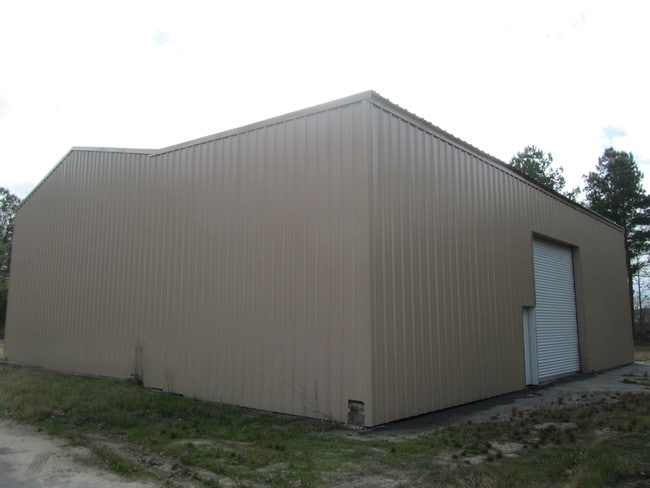
Property Detail
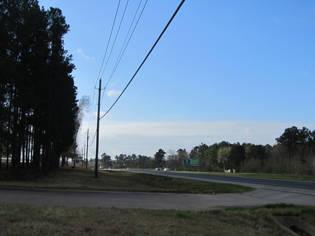
John Reddit Dt
Lufkin, TX
3A164 ANGELINA STEEL SUB LOT 1 REV BLK 1 LOT 1A
150139
ANGELINA
Commercialnec
Texas
B and X Area of moderate flood hazard, usually the area between the limits of the 100-year and 500-year floods.
1a
2024
2 AC
2025
Texas East Area
000800
Other Market Areas
3,600 SF
NEARBY LISTINGS FOR SALE OR LEASE
DEMOGRAPHICS near John Reddit Dt
1 mile
3 mile
5 mile
2025 Total Population
1,949
27,177
46,867
2030 Population
1,976
27,351
47,180
Pop Growth 2025-2030
+ 1.39%
+ 0.64%
+ 0.67%
Average Age
40
38
38
2025 Total Households
786
10,286
17,574
HH Growth 2025-2030
+ 1.15%
+ 0.66%
+ 0.68%
Median Household Inc
$48,920
$47,787
$52,693
Avg Household Size
2.20
2.50
2.50
2025 Avg HH Vehicles
2.00
2.00
2.00
Median Home Value
$180,136
$151,733
$171,021
Median Year Built
1990
1978
1980
Nearby Places
Map Layers
Map Styles
 Street
 Aerial
Layers
 Traffic
 Biking
Places
Listings with unknown addresses are not visible on the map
- Restaurants
- Banks
- Shops
- Fitness
- Groceries
SALE & LEASE HISTORY
LISTING DATE
SALE/LEASE

Sep 24, 2016
For Sale
Nearby Properties
Address
Land Use
TOTAL SIZE
Lot Size
Zoning
Address
Land Use
TOTAL SIZE
Lot Size
Zoning
9,222 SF
10.69 AC
Address
Land Use
TOTAL SIZE
Lot Size
Zoning
34,528 SF
1.86 AC
CBD
Address
Land Use
TOTAL SIZE
Lot Size
Zoning
104,432 SF
10.06 AC
LM
Address
Land Use
TOTAL SIZE
Lot Size
Zoning
194,526 SF
14.99 AC
LBSU
Address
Land Use
TOTAL SIZE
Lot Size
Zoning
2,319 SF
19.10 AC
Address
Land Use
TOTAL SIZE
Lot Size
Zoning
31,467 SF
41.44 AC
RL
Address
Land Use
TOTAL SIZE
Lot Size
Zoning
14,514 SF
12.90 AC
RL
Address
Land Use
TOTAL SIZE
Lot Size
Zoning
46,368 SF
7 AC
Address
Land Use
TOTAL SIZE
Lot Size
Zoning
423,495 SF
87.05 AC
LM
Address
Land Use
TOTAL SIZE
Lot Size
Zoning
107,432 SF
11.25 AC
A
Address
Land Use
TOTAL SIZE
Lot Size
Zoning
54,239 SF
7.51 AC
Address
Land Use
TOTAL SIZE
Lot Size
Zoning
70,046 SF
9 AC
LM
Address
Land Use
TOTAL SIZE
Lot Size
Zoning
34,536 SF
5.56 AC
Address
Land Use
TOTAL SIZE
Lot Size
Zoning
34,696 SF
2.76 AC
LBSU
Address
Land Use
TOTAL SIZE
Lot Size
Zoning
57,588 SF
5.07 AC
Address
Land Use
TOTAL SIZE
Lot Size
Zoning
32,834 SF
3.40 AC
LM
Address
Land Use
TOTAL SIZE
Lot Size
Zoning
199,212 SF
36.43 AC
LMSU
Address
Land Use
TOTAL SIZE
Lot Size
Zoning
8,060 SF
6.53 AC
RS
Address
Land Use
TOTAL SIZE
Lot Size
Zoning
61,488 SF
0.90 AC
CBSU
Address
Land Use
TOTAL SIZE
Lot Size
Zoning
119,266 SF
10.36 AC
A
Address
Land Use
TOTAL SIZE
Lot Size
Zoning
57,883 SF
11.79 AC
C
Address
Land Use
TOTAL SIZE
Lot Size
Zoning
Address
Land Use
TOTAL SIZE
Lot Size
Zoning
4,056 SF
7.44 AC
Address
Land Use
TOTAL SIZE
Lot Size
Zoning
26,890 SF
1.31 AC
LM
Address
Land Use
TOTAL SIZE
Lot Size
Zoning
5,620 SF
11.78 AC
RLSU
Address
Land Use
TOTAL SIZE
Lot Size
Zoning
33,004 SF
2.74 AC
CSU
Address
Land Use
TOTAL SIZE
Lot Size
Zoning
12,615 SF
2.07 AC
LBD
Address
Land Use
TOTAL SIZE
Lot Size
Zoning
1,512 SF
6.31 AC
RL
Address
Land Use
TOTAL SIZE
Lot Size
Zoning
24,445 SF
0.94 AC
CB
Address
Land Use
TOTAL SIZE
Lot Size
Zoning
22,759 SF
2.35 AC
RL
The World's #1 Commercial Real Estate Marketplace
Connect with us
© 2026 CoStar Group
The information above has been obtained from sources believed reliable. While we do not doubt its accuracy we have not verified it and make no guarantee, warranty or representation about it. It is your responsibility to independently confirm its accuracy and completeness. Any projections, opinions, assumptions, or estimates used are for example only and do not represent the current or future performance of the property. The value of this transaction to you depends on tax and other factors which should be evaluated by your tax, financial, and legal advisors. You and your advisors should conduct a careful, independent investigation of the property to determine to your satisfaction the suitability of the property for your needs.