Property Record
Johnson Rd, Milton, FL 32583
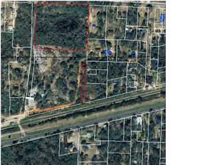

Property Detail
Johnson Rd
01-1N-28-0000-06700-0000
NW4 OF NW4 LESS BK A34 PG 300 LESS R/W IN OR 230 PG 222 LESS OR 316 PG 271 LESS OR 350 PG 525 LESS OR 503 PG 377 LESS OR 512 PG 465 466 & 467 LESS OR 676 PG 314 LESS OR 753 PG 69 LESS PARCEL 2 OF OR 754 PG 119 LESS OR 755 PG 625 LESS OR 760 PG 367 LE
Commercialacreage
SANTA ROSA
HCD
Florida
B and X Area of moderate flood hazard, usually the area between the limits of the 100-year and 500-year floods.
5.48 AC
2024
SE Santa Rosa County
2025
Pensacola
010709
Pensacola-Ferry Pass-Brent, FL
NEARBY LISTINGS FOR SALE OR LEASE
DEMOGRAPHICS near Johnson Rd
1 mile
3 mile
5 mile
2025 Total Population
1,519
17,135
44,654
2030 Population
1,658
18,556
48,478
Pop Growth 2025-2030
+ 9.15%
+ 8.29%
+ 8.56%
Average Age
43
41
41
2025 Total Households
595
5,722
16,066
HH Growth 2025-2030
+ 9.08%
+ 8.76%
+ 8.71%
Median Household Inc
$63,900
$65,587
$74,121
Avg Household Size
2.50
2.50
2.50
2025 Avg HH Vehicles
2.00
2.00
2.00
Median Home Value
$318,907
$234,542
$258,670
Median Year Built
1985
1985
1991
Nearby Places
Map Layers
Map Styles
 Street
 Aerial
Transit
 Traffic
 Biking
Places
Listings with unknown addresses are not visible on the map
- Restaurants
- Banks
- Shops
- Fitness
- Groceries
PUBLIC TRANSPORTATION
AIRPORT
Pensacola International
Drive
Walk
Distance
Pensacola International
36 min
22.5 mi
Nearby Properties
Address
Land Use
TOTAL SIZE
Lot Size
Zoning
Address
Land Use
TOTAL SIZE
Lot Size
Zoning
281,607 SF
306.03 AC
M2
Address
Land Use
TOTAL SIZE
Lot Size
Zoning
183,076 SF
85.91 AC
M2
Address
Land Use
TOTAL SIZE
Lot Size
Zoning
198,543 SF
34.63 AC
M2
Address
Land Use
TOTAL SIZE
Lot Size
Zoning
31,124 SF
36.55 AC
AG-RR
Address
Land Use
TOTAL SIZE
Lot Size
Zoning
80,314 SF
9.76 AC
C1
Address
Land Use
TOTAL SIZE
Lot Size
Zoning
8,223 SF
40 AC
Address
Land Use
TOTAL SIZE
Lot Size
Zoning
258,149 SF
8.42 AC
M2
Address
Land Use
TOTAL SIZE
Lot Size
Zoning
197,050 SF
29.93 AC
M2
Address
Land Use
TOTAL SIZE
Lot Size
Zoning
141,508 SF
26.62 AC
M2
Address
Land Use
TOTAL SIZE
Lot Size
Zoning
113,178 SF
8.61 AC
HCD
Address
Land Use
TOTAL SIZE
Lot Size
Zoning
151,842 SF
14.28 AC
C2
Address
Land Use
TOTAL SIZE
Lot Size
Zoning
164,844 SF
8.33 AC
M2
Address
Land Use
TOTAL SIZE
Lot Size
Zoning
68,026 SF
2.07 AC
RC1
Address
Land Use
TOTAL SIZE
Lot Size
Zoning
52,817 SF
79.32 AC
M1
Address
Land Use
TOTAL SIZE
Lot Size
Zoning
67,182 SF
9.54 AC
M2
Address
Land Use
TOTAL SIZE
Lot Size
Zoning
47,976 SF
102.61 AC
M2
Address
Land Use
TOTAL SIZE
Lot Size
Zoning
82,869 SF
10 AC
M2
Address
Land Use
TOTAL SIZE
Lot Size
Zoning
16,903 SF
11 AC
AG-RR
Address
Land Use
TOTAL SIZE
Lot Size
Zoning
10 AC
R1A
Address
Land Use
TOTAL SIZE
Lot Size
Zoning
40,142 SF
5.28 AC
R3
Address
Land Use
TOTAL SIZE
Lot Size
Zoning
103,000 SF
7.24 AC
M2
Address
Land Use
TOTAL SIZE
Lot Size
Zoning
89,249 SF
66.21 AC
AG-RR
Address
Land Use
TOTAL SIZE
Lot Size
Zoning
81,521 SF
7.63 AC
M2
Address
Land Use
TOTAL SIZE
Lot Size
Zoning
60,717 SF
4.43 AC
HCD
Address
Land Use
TOTAL SIZE
Lot Size
Zoning
22.09 AC
PE
Address
Land Use
TOTAL SIZE
Lot Size
Zoning
35,405 SF
2.55 AC
R3
Address
Land Use
TOTAL SIZE
Lot Size
Zoning
48,463 SF
10.64 AC
R3
Address
Land Use
TOTAL SIZE
Lot Size
Zoning
51,765 SF
14 AC
M2
Address
Land Use
TOTAL SIZE
Lot Size
Zoning
24,801 SF
2.32 AC
C2
Address
Land Use
TOTAL SIZE
Lot Size
Zoning
43,399 SF
9.24 AC
R1A
The World's #1 Commercial Real Estate Marketplace
Connect with us
© 2026 CoStar Group
The information above has been obtained from sources believed reliable. While we do not doubt its accuracy we have not verified it and make no guarantee, warranty or representation about it. It is your responsibility to independently confirm its accuracy and completeness. Any projections, opinions, assumptions, or estimates used are for example only and do not represent the current or future performance of the property. The value of this transaction to you depends on tax and other factors which should be evaluated by your tax, financial, and legal advisors. You and your advisors should conduct a careful, independent investigation of the property to determine to your satisfaction the suitability of the property for your needs.