Property Record
Jungermann Rd, St Peters, MO 63376
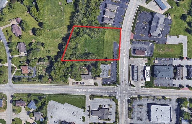

This Property Is For Sale
Property Detail
Jungermann Rd
St. Louis, MO-IL
PT NW 1/4 SW 1/4
3-0010-S009-00-0001.7000000
ST. CHARLES
Vacantlandnec
Missouri
AB1
1
B and X Area of moderate flood hazard, usually the area between the limits of the 100-year and 500-year floods.
1.92 AC
2024
St Charles County
2025
St. Louis
311311
NEARBY LISTINGS FOR SALE OR LEASE
DEMOGRAPHICS near Jungermann Rd
1 mile
3 mile
5 mile
2025 Total Population
10,473
93,437
170,939
2030 Population
10,764
96,196
176,228
Pop Growth 2025-2030
+ 2.78%
+ 2.95%
+ 3.09%
Average Age
43
42
42
2025 Total Households
4,224
37,066
69,001
HH Growth 2025-2030
+ 2.96%
+ 3.12%
+ 3.26%
Median Household Inc
$90,097
$94,063
$92,623
Avg Household Size
2.40
2.50
2.40
2025 Avg HH Vehicles
2.00
2.00
2.00
Median Home Value
$273,809
$293,725
$303,231
Median Year Built
1984
1986
1987
Nearby Places
Map Layers
Map Styles
 Street
 Aerial
Transit
 Traffic
 Biking
Places
Listings with unknown addresses are not visible on the map
- Restaurants
- Banks
- Shops
- Fitness
- Groceries
PUBLIC TRANSPORTATION
AIRPORT
St Louis Lambert International
Drive
Walk
Distance
St Louis Lambert International
28 min
18.6 mi
Nearby Properties
Address
Land Use
TOTAL SIZE
Lot Size
Zoning
Address
Land Use
TOTAL SIZE
Lot Size
Zoning
505,022 SF
27.35 AC
Address
Land Use
TOTAL SIZE
Lot Size
Zoning
98.15 AC
AF0
Address
Land Use
TOTAL SIZE
Lot Size
Zoning
80.67 AC
AF0
Address
Land Use
TOTAL SIZE
Lot Size
Zoning
279,526 SF
7.73 AC
Address
Land Use
TOTAL SIZE
Lot Size
Zoning
80,771 SF
41.99 AC
Address
Land Use
TOTAL SIZE
Lot Size
Zoning
433,744 SF
19.38 AC
Address
Land Use
TOTAL SIZE
Lot Size
Zoning
25,778 SF
5.62 AC
Address
Land Use
TOTAL SIZE
Lot Size
Zoning
337,411 SF
7.97 AC
Address
Land Use
TOTAL SIZE
Lot Size
Zoning
239,832 SF
10.25 AC
AC4
Address
Land Use
TOTAL SIZE
Lot Size
Zoning
56,430 SF
14.72 AC
AE8
Address
Land Use
TOTAL SIZE
Lot Size
Zoning
246,351 SF
9.69 AC
Address
Land Use
TOTAL SIZE
Lot Size
Zoning
55.46 AC
AF0
Address
Land Use
TOTAL SIZE
Lot Size
Zoning
219,966 SF
9.09 AC
Address
Land Use
TOTAL SIZE
Lot Size
Zoning
232,472 SF
11.88 AC
Address
Land Use
TOTAL SIZE
Lot Size
Zoning
73.54 AC
AF0
Address
Land Use
TOTAL SIZE
Lot Size
Zoning
23,262 SF
7.05 AC
Address
Land Use
TOTAL SIZE
Lot Size
Zoning
160,312 SF
6.82 AC
Address
Land Use
TOTAL SIZE
Lot Size
Zoning
168,863 SF
6.71 AC
AF0
Address
Land Use
TOTAL SIZE
Lot Size
Zoning
203,833 SF
13.92 AC
AE8
Address
Land Use
TOTAL SIZE
Lot Size
Zoning
187,472 SF
13.25 AC
AF0
Address
Land Use
TOTAL SIZE
Lot Size
Zoning
190,728 SF
8.04 AC
Address
Land Use
TOTAL SIZE
Lot Size
Zoning
Address
Land Use
TOTAL SIZE
Lot Size
Zoning
154,552 SF
17.29 AC
AF0
Address
Land Use
TOTAL SIZE
Lot Size
Zoning
462,313 SF
8.27 AC
Address
Land Use
TOTAL SIZE
Lot Size
Zoning
137,128 SF
12.07 AC
AD8
Address
Land Use
TOTAL SIZE
Lot Size
Zoning
21,240 SF
3.58 AC
AF0
Address
Land Use
TOTAL SIZE
Lot Size
Zoning
12,180 SF
21.86 AC
Address
Land Use
TOTAL SIZE
Lot Size
Zoning
203,405 SF
19.84 AC
Address
Land Use
TOTAL SIZE
Lot Size
Zoning
46.68 AC
AF0
Address
Land Use
TOTAL SIZE
Lot Size
Zoning
34,104 SF
5.80 AC
The World's #1 Commercial Real Estate Marketplace
Connect with us
© 2026 CoStar Group
The information above has been obtained from sources believed reliable. While we do not doubt its accuracy we have not verified it and make no guarantee, warranty or representation about it. It is your responsibility to independently confirm its accuracy and completeness. Any projections, opinions, assumptions, or estimates used are for example only and do not represent the current or future performance of the property. The value of this transaction to you depends on tax and other factors which should be evaluated by your tax, financial, and legal advisors. You and your advisors should conduct a careful, independent investigation of the property to determine to your satisfaction the suitability of the property for your needs.