Property Record
K-57 Highway, Junction City, KS 66441

Save to a Folder
{{folder.Name}}
{{folder.ListingIds.length}} Properties
{{folder.ListingIds.length}} Property
Create a New Folder
Property Detail
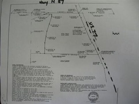
K-57 Highway
048-28-0-00-00-005.00-0
S28, T11, R05, ACRES 67.8, E 1/2 SE 1/4 LESS BLUESTEM SUB & ROW
Agriculturalland
GEARY
A
Kansas
A Areas with a 1% annual chance of flooding and a 26% chance of flooding over the life of a 30-year mortgage.
70.40 AC
2025
I-70 Corridor
2025
Other Market Areas
000402
Manhattan, KS
NEARBY LISTINGS FOR SALE OR LEASE
-
-
View all Junction City listings for sale on LoopNet.com
DEMOGRAPHICS near K-57 Highway
1 mile
3 mile
5 mile
2025 Total Population
357
14,992
38,105
2030 Population
350
14,694
37,492
Pop Growth 2025-2030
(1.96%)
(1.99%)
(1.61%)
Average Age
30
32
31
2025 Total Households
118
5,507
12,669
HH Growth 2025-2030
(2.54%)
(2.00%)
(1.82%)
Median Household Inc
$71,817
$53,267
$56,477
Avg Household Size
2.90
2.60
2.60
2025 Avg HH Vehicles
2.00
2.00
2.00
Median Home Value
$206,522
$153,221
$169,590
Median Year Built
2006
1988
1989
Nearby Places
Map Layers
Map Styles
 Street
 Aerial
Layers
 Traffic
 Biking
Places
Listings with unknown addresses are not visible on the map
- Restaurants
- Banks
- Shops
- Fitness
- Groceries
PUBLIC TRANSPORTATION
AIRPORT
Manhattan Regional
Drive
Walk
Distance
Manhattan Regional
28 min
17.6 mi
Freight Ports
Tulsa Port Of Catoosa
Drive
Walk
Distance
Tulsa Port Of Catoosa
331 min
258.3 mi
Nearby Properties
Address
Land Use
TOTAL SIZE
Lot Size
Zoning
Address
Land Use
TOTAL SIZE
Lot Size
Zoning
402,268 SF
157.50 AC
A
Address
Land Use
TOTAL SIZE
Lot Size
Zoning
177,550 SF
68.20 AC
A
Address
Land Use
TOTAL SIZE
Lot Size
Zoning
126,667 SF
3.17 AC
RM
Address
Land Use
TOTAL SIZE
Lot Size
Zoning
11,679 SF
49.73 AC
Address
Land Use
TOTAL SIZE
Lot Size
Zoning
62,043 SF
3.17 AC
CS
Address
Land Use
TOTAL SIZE
Lot Size
Zoning
16,320 SF
6.78 AC
Address
Land Use
TOTAL SIZE
Lot Size
Zoning
56,546 SF
7.39 AC
RG
Address
Land Use
TOTAL SIZE
Lot Size
Zoning
20,898 SF
5.87 AC
CR
Address
Land Use
TOTAL SIZE
Lot Size
Zoning
16,235 SF
5.90 AC
Address
Land Use
TOTAL SIZE
Lot Size
Zoning
36,456 SF
2.72 AC
CS
Address
Land Use
TOTAL SIZE
Lot Size
Zoning
2,816 SF
297.83 AC
A
Address
Land Use
TOTAL SIZE
Lot Size
Zoning
35,160 SF
2.30 AC
RS
Address
Land Use
TOTAL SIZE
Lot Size
Zoning
832 SF
189 AC
AP
Address
Land Use
TOTAL SIZE
Lot Size
Zoning
633.45 AC
A
Address
Land Use
TOTAL SIZE
Lot Size
Zoning
617.75 AC
A
Address
Land Use
TOTAL SIZE
Lot Size
Zoning
609.95 AC
A
Address
Land Use
TOTAL SIZE
Lot Size
Zoning
23,328 SF
10 AC
RD
Address
Land Use
TOTAL SIZE
Lot Size
Zoning
20,827 SF
4.20 AC
Address
Land Use
TOTAL SIZE
Lot Size
Zoning
427.59 AC
A
Address
Land Use
TOTAL SIZE
Lot Size
Zoning
1,710 SF
2.40 AC
CSP
Address
Land Use
TOTAL SIZE
Lot Size
Zoning
224,490 SF
11 AC
Address
Land Use
TOTAL SIZE
Lot Size
Zoning
356.79 AC
A
Address
Land Use
TOTAL SIZE
Lot Size
Zoning
634.48 AC
A
Address
Land Use
TOTAL SIZE
Lot Size
Zoning
503.71 AC
A
Address
Land Use
TOTAL SIZE
Lot Size
Zoning
2,064 SF
42 AC
Address
Land Use
TOTAL SIZE
Lot Size
Zoning
247.45 AC
A
Address
Land Use
TOTAL SIZE
Lot Size
Zoning
479.78 AC
A
Address
Land Use
TOTAL SIZE
Lot Size
Zoning
6,696 SF
1.94 AC
RS
Address
Land Use
TOTAL SIZE
Lot Size
Zoning
19,600 SF
2.67 AC
IL
Address
Land Use
TOTAL SIZE
Lot Size
Zoning
1,800 SF
12.70 AC
RS
The World's #1 Commercial Real Estate Marketplace
Connect with us
© 2026 CoStar Group
The information above has been obtained from sources believed reliable. While we do not doubt its accuracy we have not verified it and make no guarantee, warranty or representation about it. It is your responsibility to independently confirm its accuracy and completeness. Any projections, opinions, assumptions, or estimates used are for example only and do not represent the current or future performance of the property. The value of this transaction to you depends on tax and other factors which should be evaluated by your tax, financial, and legal advisors. You and your advisors should conduct a careful, independent investigation of the property to determine to your satisfaction the suitability of the property for your needs.