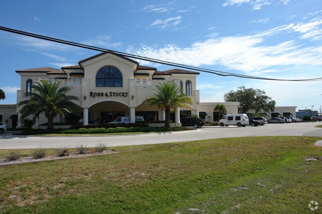
Property Record
Kai Dr, Sarasota, FL 34231

Property Detail
Kai Dr
North Port-Bradenton-Sarasota, FL
BEG AT NW COR OF LOT 12, BLK B, BREEZEWOOD ACRES SUB, TH S 0-04-01 W 114 FT TH S 89-57-04 E 58.3 FT TH S 28-00-59 E 58.18 FT TH S 0-07-01 W 318.67 FT TH S 84 -24-31 W 78.23 FT TH N 5-35-29 W 5 FT TH S
0112-06-0029
SARASOTA
Residentialacreage
Florida
RSF3
12
B and X Area of moderate flood hazard, usually the area between the limits of the 100-year and 500-year floods.
0.99 AC
2024
Sarasota
2025
Tampa/St Petersburg
002004
NEARBY LISTINGS FOR SALE OR LEASE
DEMOGRAPHICS near Kai Dr
1 mile
3 mile
5 mile
2025 Total Population
6,426
53,062
118,604
2030 Population
6,849
57,559
127,347
Pop Growth 2025-2030
+ 6.58%
+ 8.47%
+ 7.37%
Average Age
56
54
52
2025 Total Households
3,327
26,660
56,633
HH Growth 2025-2030
+ 6.58%
+ 8.66%
+ 7.53%
Median Household Inc
$70,246
$81,811
$84,318
Avg Household Size
1.80
1.90
2.00
2025 Avg HH Vehicles
2.00
2.00
2.00
Median Home Value
$445,348
$537,943
$554,730
Median Year Built
1975
1982
1983
Nearby Places
Map Layers
Map Styles
 Street
 Aerial
Transit
 Traffic
 Biking
Places
Listings with unknown addresses are not visible on the map
- Restaurants
- Banks
- Shops
- Fitness
- Groceries
PUBLIC TRANSPORTATION
AIRPORT
Sarasota/Bradenton International
Drive
Walk
Distance
Sarasota/Bradenton International
23 min
12.2 mi
Freight Ports
Port Manatee
Drive
Walk
Distance
Port Manatee
48 min
35.2 mi
Nearby Properties
Address
Land Use
TOTAL SIZE
Lot Size
Zoning
Address
Land Use
TOTAL SIZE
Lot Size
Zoning
588,839 SF
42.33 AC
GU
Address
Land Use
TOTAL SIZE
Lot Size
Zoning
530,029 SF
14.92 AC
RMF4
Address
Land Use
TOTAL SIZE
Lot Size
Zoning
912,253 SF
43.46 AC
PID
Address
Land Use
TOTAL SIZE
Lot Size
Zoning
432,668 SF
72.05 AC
GU
Address
Land Use
TOTAL SIZE
Lot Size
Zoning
318,414 SF
22.35 AC
RMF1
Address
Land Use
TOTAL SIZE
Lot Size
Zoning
242,685 SF
26.67 AC
RMF1
Address
Land Use
TOTAL SIZE
Lot Size
Zoning
258,994 SF
20.03 AC
PCD
Address
Land Use
TOTAL SIZE
Lot Size
Zoning
312,294 SF
40.21 AC
OPI
Address
Land Use
TOTAL SIZE
Lot Size
Zoning
286,775 SF
10.85 AC
RMF3
Address
Land Use
TOTAL SIZE
Lot Size
Zoning
332,822 SF
34.74 AC
CG
Address
Land Use
TOTAL SIZE
Lot Size
Zoning
150,433 SF
10.55 AC
RMF4
Address
Land Use
TOTAL SIZE
Lot Size
Zoning
157,854 SF
8.32 AC
OPI
Address
Land Use
TOTAL SIZE
Lot Size
Zoning
223,929 SF
28.24 AC
RMF1
Address
Land Use
TOTAL SIZE
Lot Size
Zoning
17,785 SF
56.32 AC
RMF2
Address
Land Use
TOTAL SIZE
Lot Size
Zoning
87,816 SF
24.83 AC
ILW
Address
Land Use
TOTAL SIZE
Lot Size
Zoning
148,339 SF
12.86 AC
CG
Address
Land Use
TOTAL SIZE
Lot Size
Zoning
373,288 SF
53.07 AC
PID
Address
Land Use
TOTAL SIZE
Lot Size
Zoning
233,075 SF
19.49 AC
RMF2
Address
Land Use
TOTAL SIZE
Lot Size
Zoning
80,038 SF
28.10 AC
ILW
Address
Land Use
TOTAL SIZE
Lot Size
Zoning
133,430 SF
19.60 AC
GU
Address
Land Use
TOTAL SIZE
Lot Size
Zoning
140,372 SF
14.31 AC
CG
Address
Land Use
TOTAL SIZE
Lot Size
Zoning
56,885 SF
10.14 AC
ILW
Address
Land Use
TOTAL SIZE
Lot Size
Zoning
123,338 SF
8.53 AC
OPI
Address
Land Use
TOTAL SIZE
Lot Size
Zoning
145,945 SF
13.93 AC
CG
Address
Land Use
TOTAL SIZE
Lot Size
Zoning
96,425 SF
8.59 AC
OPI
Address
Land Use
TOTAL SIZE
Lot Size
Zoning
139,974 SF
6.07 AC
RMF4
Address
Land Use
TOTAL SIZE
Lot Size
Zoning
184,766 SF
12.70 AC
RMF3
Address
Land Use
TOTAL SIZE
Lot Size
Zoning
86,102 SF
5.23 AC
RMF3
Address
Land Use
TOTAL SIZE
Lot Size
Zoning
46,727 SF
38.73 AC
CG
Address
Land Use
TOTAL SIZE
Lot Size
Zoning
67,363 SF
5.71 AC
CG
The World's #1 Commercial Real Estate Marketplace
Connect with us
© 2026 CoStar Group
The information above has been obtained from sources believed reliable. While we do not doubt its accuracy we have not verified it and make no guarantee, warranty or representation about it. It is your responsibility to independently confirm its accuracy and completeness. Any projections, opinions, assumptions, or estimates used are for example only and do not represent the current or future performance of the property. The value of this transaction to you depends on tax and other factors which should be evaluated by your tax, financial, and legal advisors. You and your advisors should conduct a careful, independent investigation of the property to determine to your satisfaction the suitability of the property for your needs.