Property Record
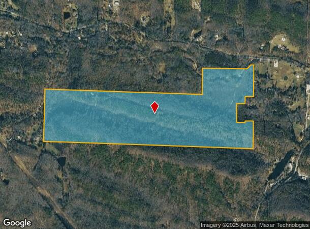
27921 Kanis Rd, Paron, AR 72122
NEARBY LISTINGS FOR SALE OR LEASE
-
-
View all Paron listings for sale on LoopNet.com
Property Detail
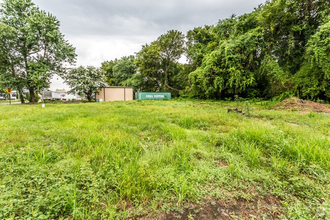
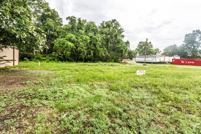
27921 Kanis Rd
63R-026-00-029-00
THE S 1/2 NE 1/4 SE 1/4, SECTION 26 T-2-N, R-15-W, PULASKI COUNTY, ARKANSAS MORE PARTICULARLY DESCRIBED AS COMMENCING AT THE SE CORNER NE 1/4 SE 1/4 THENCE N 885915 W 1317.94 FEET ALONG THE SOUTH LINE OF SAID NE 1/4 SE 1/ 4 TO THE SW CORNER OF NE 1/4
Agriculturalland
Pulaski
A
Arkansas
05119C0290G
176.46 AC
2025
Airport
2025
Little Rock/N Little Rock
004202
Little Rock-North Little Rock-Conway, AR
DEMOGRAPHICS near 27921 Kanis Rd
1 Mile
3 Mile
5 Mile
2024 Total Population
3,784
37,676
101,456
2029 Population
3,920
38,856
102,926
Pop Growth 2024-2029
+ 3.59%
+ 3.13%
+ 1.45%
Average Age
42
40
40
2024 Total Households
2,192
18,125
46,443
HH Growth 2024-2029
+ 3.01%
+ 3.04%
+ 1.47%
Median Household Inc
$27,380
$35,507
$43,063
Avg Household Size
1.70
1.90
2.00
2024 Avg HH Vehicles
1.00
1.00
1.00
Median Home Value
$163,824
$119,836
$144,175
Median Year Built
1963
1963
1967
Nearby Places
Map Layers
Map Styles
 Street
 Aerial
- Restaurants
- Banks
- Shops
- Fitness
- Groceries
PUBLIC TRANSPORTATION
AIRPORT
Bill and Hillary Clinton Ntl/Adams Field
DRIVE
WALK
Distance
Bill and Hillary Clinton Ntl/Adams Field
42 min
22.8 mi
Freight Ports
Port of Shreveport
DRIVE
WALK
Distance
Port of Shreveport
262 min
227.8 mi
SALE & LEASE HISTORY
LISTING DATE
SALE/LEASE

Aug 04, 2017
For Sale
Nearby Properties
Address
Land Use
TOTAL SIZE
Lot Size
Zoning
Address
Land Use
TOTAL SIZE
Lot Size
Zoning
32,051 SF
245.44 AC
Address
Land Use
TOTAL SIZE
Lot Size
Zoning
12,113 SF
5.28 AC
Address
Land Use
TOTAL SIZE
Lot Size
Zoning
15,698 SF
82 AC
Address
Land Use
TOTAL SIZE
Lot Size
Zoning
7,877 SF
10.10 AC
Address
Land Use
TOTAL SIZE
Lot Size
Zoning
9,596 SF
418.88 AC
Address
Land Use
TOTAL SIZE
Lot Size
Zoning
12,412 SF
1.22 AC
Address
Land Use
TOTAL SIZE
Lot Size
Zoning
1,840 SF
2.79 AC
Address
Land Use
TOTAL SIZE
Lot Size
Zoning
9,220 SF
1.87 AC
Address
Land Use
TOTAL SIZE
Lot Size
Zoning
2,960 SF
0.98 AC
Address
Land Use
TOTAL SIZE
Lot Size
Zoning
4,000 SF
1.39 AC
Address
Land Use
TOTAL SIZE
Lot Size
Zoning
4,860 SF
19.85 AC
Address
Land Use
TOTAL SIZE
Lot Size
Zoning
6,000 SF
3.02 AC
Address
Land Use
TOTAL SIZE
Lot Size
Zoning
7,932 SF
30.41 AC
Address
Land Use
TOTAL SIZE
Lot Size
Zoning
6,759 SF
4.10 AC
Address
Land Use
TOTAL SIZE
Lot Size
Zoning
1,733 SF
22.54 AC
Address
Land Use
TOTAL SIZE
Lot Size
Zoning
2,340 SF
1.07 AC
Address
Land Use
TOTAL SIZE
Lot Size
Zoning
12,600 SF
1.03 AC
Address
Land Use
TOTAL SIZE
Lot Size
Zoning
8.93 AC
Address
Land Use
TOTAL SIZE
Lot Size
Zoning
1,855 SF
0.82 AC
Address
Land Use
TOTAL SIZE
Lot Size
Zoning
6,174 SF
0.89 AC
Address
Land Use
TOTAL SIZE
Lot Size
Zoning
2,089 SF
3.98 AC
Address
Land Use
TOTAL SIZE
Lot Size
Zoning
2,051 SF
0.82 AC
Address
Land Use
TOTAL SIZE
Lot Size
Zoning
Address
Land Use
TOTAL SIZE
Lot Size
Zoning
5,187 SF
0.86 AC
Address
Land Use
TOTAL SIZE
Lot Size
Zoning
Address
Land Use
TOTAL SIZE
Lot Size
Zoning
7.07 AC
Address
Land Use
TOTAL SIZE
Lot Size
Zoning
8.75 AC
Address
Land Use
TOTAL SIZE
Lot Size
Zoning
9.95 AC
Address
Land Use
TOTAL SIZE
Lot Size
Zoning
Address
Land Use
TOTAL SIZE
Lot Size
Zoning
4,000 SF
1.84 AC
The World's #1 Commercial Real Estate Marketplace
Connect with us
© 2025 CoStar Group
The information above has been obtained from sources believed reliable. While we do not doubt its accuracy we have not verified it and make no guarantee, warranty or representation about it. It is your responsibility to independently confirm its accuracy and completeness. Any projections, opinions, assumptions, or estimates used are for example only and do not represent the current or future performance of the property. The value of this transaction to you depends on tax and other factors which should be evaluated by your tax, financial, and legal advisors. You and your advisors should conduct a careful, independent investigation of the property to determine to your satisfaction the suitability of the property for your needs.