Property Record
91 Malakole St, Kapolei, HI 96707

This Property Is For Sale
NEARBY LISTINGS FOR SALE OR LEASE
Property Detail
91 Malakole St
Urban Honolulu, HI
Area 66
1-9-1-014-048-0000
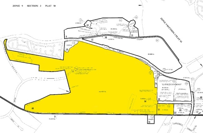
LOT 18250-A (66.329 AC) & LOT 18252 (9.234 AC) MAP 1689 LCAPP 1069
Culturalhistorical
Honolulu
D
Hawaii
15003C0312G
18252
2024
75.56 AC
2025
West Oahu
980300
Hawaii
DEMOGRAPHICS near 91 Malakole St
1 Mile
3 Mile
5 Mile
2024 Total Population
1,455
42,943
92,258
2029 Population
1,476
41,510
88,441
Pop Growth 2024-2029
+ 1.44%
(3.34%)
(4.14%)
Average Age
34
37
37
2024 Total Households
529
12,954
26,798
HH Growth 2024-2029
+ 1.32%
(3.81%)
(4.57%)
Median Household Inc
$108,024
$114,974
$113,449
Avg Household Size
2.60
3.10
3.30
2024 Avg HH Vehicles
2.00
2.00
2.00
Median Home Value
$707,770
$735,829
$718,742
Median Year Built
2011
1998
2000
Nearby Places
- Restaurants
- Banks
- Shops
- Fitness
- Groceries
PUBLIC TRANSPORTATION
AIRPORT
Daniel K Inouye International
DRIVE
WALK
Distance
Daniel K Inouye International
35 min
20.0 mi
Freight Ports
Honolulu Harbor, Oahu
DRIVE
WALK
Distance
Honolulu Harbor, Oahu
43 min
24.2 mi
Nearby Properties
Address
Land Use
TOTAL SIZE
Lot Size
Zoning
Address
Land Use
TOTAL SIZE
Lot Size
Zoning
1,193,532 SF
9.53 AC
Resort
Address
Land Use
TOTAL SIZE
Lot Size
Zoning
736 AC
F-1
Address
Land Use
TOTAL SIZE
Lot Size
Zoning
35,020 SF
454.39 AC
I-2
Address
Land Use
TOTAL SIZE
Lot Size
Zoning
1,963,629 SF
10.70 AC
Resort
Address
Land Use
TOTAL SIZE
Lot Size
Zoning
288,660 SF
10.94 AC
A-2
Address
Land Use
TOTAL SIZE
Lot Size
Zoning
447,096 SF
9.98 AC
A-2
Address
Land Use
TOTAL SIZE
Lot Size
Zoning
294,056 SF
11.69 AC
Resort
Address
Land Use
TOTAL SIZE
Lot Size
Zoning
80,641 SF
227.76 AC
I-2
Address
Land Use
TOTAL SIZE
Lot Size
Zoning
222.44 AC
I-3
Address
Land Use
TOTAL SIZE
Lot Size
Zoning
139.30 AC
F-1
Address
Land Use
TOTAL SIZE
Lot Size
Zoning
222.34 AC
I-3
Address
Land Use
TOTAL SIZE
Lot Size
Zoning
10 AC
Resort
Address
Land Use
TOTAL SIZE
Lot Size
Zoning
14.70 AC
Resort
Address
Land Use
TOTAL SIZE
Lot Size
Zoning
61,643 SF
116.66 AC
I-2
Address
Land Use
TOTAL SIZE
Lot Size
Zoning
307,171 SF
24.64 AC
I-2
Address
Land Use
TOTAL SIZE
Lot Size
Zoning
10,182 SF
10.30 AC
Resort
Address
Land Use
TOTAL SIZE
Lot Size
Zoning
46.69 AC
B-2
Address
Land Use
TOTAL SIZE
Lot Size
Zoning
334.93 AC
U/42/40
Address
Land Use
TOTAL SIZE
Lot Size
Zoning
7.22 AC
Resort
Address
Land Use
TOTAL SIZE
Lot Size
Zoning
222,228 SF
7.15 AC
B-2
Address
Land Use
TOTAL SIZE
Lot Size
Zoning
183,343 SF
15.27 AC
BMX-3
Address
Land Use
TOTAL SIZE
Lot Size
Zoning
149,923 SF
13.35 AC
B-2
Address
Land Use
TOTAL SIZE
Lot Size
Zoning
19.38 AC
A-2
Address
Land Use
TOTAL SIZE
Lot Size
Zoning
67.18 AC
AG-1
Address
Land Use
TOTAL SIZE
Lot Size
Zoning
238,418 SF
9.46 AC
F-1
Address
Land Use
TOTAL SIZE
Lot Size
Zoning
218,926 SF
11.87 AC
I-2
Address
Land Use
TOTAL SIZE
Lot Size
Zoning
158,113 SF
21.79 AC
B-2
Address
Land Use
TOTAL SIZE
Lot Size
Zoning
3,202 SF
7.81 AC
Resort
Address
Land Use
TOTAL SIZE
Lot Size
Zoning
226,260 SF
7.10 AC
I-2
The World's #1 Commercial Real Estate Marketplace
Connect with us
© 2025 CoStar Group
The information above has been obtained from sources believed reliable. While we do not doubt its accuracy we have not verified it and make no guarantee, warranty or representation about it. It is your responsibility to independently confirm its accuracy and completeness. Any projections, opinions, assumptions, or estimates used are for example only and do not represent the current or future performance of the property. The value of this transaction to you depends on tax and other factors which should be evaluated by your tax, financial, and legal advisors. You and your advisors should conduct a careful, independent investigation of the property to determine to your satisfaction the suitability of the property for your needs.