Property Record
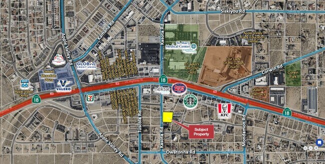
Kasota Rd, Apple Valley, CA 92307


Property Detail
Kasota Rd
Riverside-San Bernardino-Ontario, CA
TR NO 4492 DESERT KNOLLS ESTATES LOT 74 EX NLY 5 FT EX ST
0473-113-25
SAN BERNARDINO
Vacantlandnec
California
AE The base floodplain where base flood elevations are provided. AE Zones are now used on new format FIRMs instead of A1-A30 Zones.
74
2025
0.91 AC
2025
Mojave River Valley
009714
Inland Empire (California)
NEARBY LISTINGS FOR SALE OR LEASE
DEMOGRAPHICS near Kasota Rd
1 mile
3 mile
5 mile
2025 Total Population
6,013
36,711
122,828
2030 Population
6,088
37,217
125,178
Pop Growth 2025-2030
+ 1.25%
+ 1.38%
+ 1.91%
Average Age
39
37
37
2025 Total Households
2,080
11,818
38,952
HH Growth 2025-2030
+ 1.25%
+ 1.41%
+ 1.97%
Median Household Inc
$96,838
$60,032
$71,117
Avg Household Size
2.90
3.00
3.10
2025 Avg HH Vehicles
2.00
2.00
2.00
Median Home Value
$490,388
$444,143
$419,622
Median Year Built
1988
1983
1987
Nearby Places
Map Layers
Map Styles
 Street
 Aerial
Layers
 Traffic
 Biking
Places
Listings with unknown addresses are not visible on the map
- Restaurants
- Banks
- Shops
- Fitness
- Groceries
PUBLIC TRANSPORTATION
COMMUTER RAIL
Victorville Amtrak (Southwest Chief - Amtrak)
Drive
Walk
Distance
Victorville Amtrak (Southwest Chief - Amtrak)
3 min
2.0 mi
Freight Ports
Port of Long Beach
Drive
Walk
Distance
Port of Long Beach
119 min
100.8 mi
SALE & LEASE HISTORY
LISTING DATE
SALE/LEASE

Mar 13, 2019
For Sale
Aug 21, 2025
For Sale
Nearby Properties
Address
Land Use
TOTAL SIZE
Lot Size
Zoning
Address
Land Use
TOTAL SIZE
Lot Size
Zoning
Address
Land Use
TOTAL SIZE
Lot Size
Zoning
102,894 SF
12.27 AC
Address
Land Use
TOTAL SIZE
Lot Size
Zoning
172,153 SF
13.13 AC
Address
Land Use
TOTAL SIZE
Lot Size
Zoning
88,528 SF
89.31 AC
OS
Address
Land Use
TOTAL SIZE
Lot Size
Zoning
80,465 SF
4.85 AC
936
Address
Land Use
TOTAL SIZE
Lot Size
Zoning
103,804 SF
14.32 AC
Address
Land Use
TOTAL SIZE
Lot Size
Zoning
57,365 SF
5.61 AC
Address
Land Use
TOTAL SIZE
Lot Size
Zoning
26,980 SF
2.50 AC
Address
Land Use
TOTAL SIZE
Lot Size
Zoning
77,084 SF
6.83 AC
Address
Land Use
TOTAL SIZE
Lot Size
Zoning
177.89 AC
Address
Land Use
TOTAL SIZE
Lot Size
Zoning
27,455 SF
3.17 AC
Address
Land Use
TOTAL SIZE
Lot Size
Zoning
37,288 SF
5.92 AC
Address
Land Use
TOTAL SIZE
Lot Size
Zoning
88,419 SF
6.67 AC
Address
Land Use
TOTAL SIZE
Lot Size
Zoning
48,726 SF
2.56 AC
Address
Land Use
TOTAL SIZE
Lot Size
Zoning
12,504 SF
2.97 AC
Address
Land Use
TOTAL SIZE
Lot Size
Zoning
42,078 SF
4.85 AC
AP
Address
Land Use
TOTAL SIZE
Lot Size
Zoning
29,042 SF
2.62 AC
Address
Land Use
TOTAL SIZE
Lot Size
Zoning
49,851 SF
17.67 AC
Address
Land Use
TOTAL SIZE
Lot Size
Zoning
39,741 SF
3.68 AC
Address
Land Use
TOTAL SIZE
Lot Size
Zoning
15,408 SF
1.05 AC
Address
Land Use
TOTAL SIZE
Lot Size
Zoning
1.65 AC
Address
Land Use
TOTAL SIZE
Lot Size
Zoning
41,476 SF
3.66 AC
Address
Land Use
TOTAL SIZE
Lot Size
Zoning
97,754 SF
8.82 AC
Address
Land Use
TOTAL SIZE
Lot Size
Zoning
14,235 SF
1.15 AC
Address
Land Use
TOTAL SIZE
Lot Size
Zoning
610 AC
Address
Land Use
TOTAL SIZE
Lot Size
Zoning
27,661 SF
2.36 AC
Address
Land Use
TOTAL SIZE
Lot Size
Zoning
167.17 AC
Address
Land Use
TOTAL SIZE
Lot Size
Zoning
27,330 SF
1.17 AC
Address
Land Use
TOTAL SIZE
Lot Size
Zoning
14,989 SF
1.42 AC
The World's #1 Commercial Real Estate Marketplace
Connect with us
© 2026 CoStar Group
The information above has been obtained from sources believed reliable. While we do not doubt its accuracy we have not verified it and make no guarantee, warranty or representation about it. It is your responsibility to independently confirm its accuracy and completeness. Any projections, opinions, assumptions, or estimates used are for example only and do not represent the current or future performance of the property. The value of this transaction to you depends on tax and other factors which should be evaluated by your tax, financial, and legal advisors. You and your advisors should conduct a careful, independent investigation of the property to determine to your satisfaction the suitability of the property for your needs.