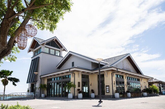
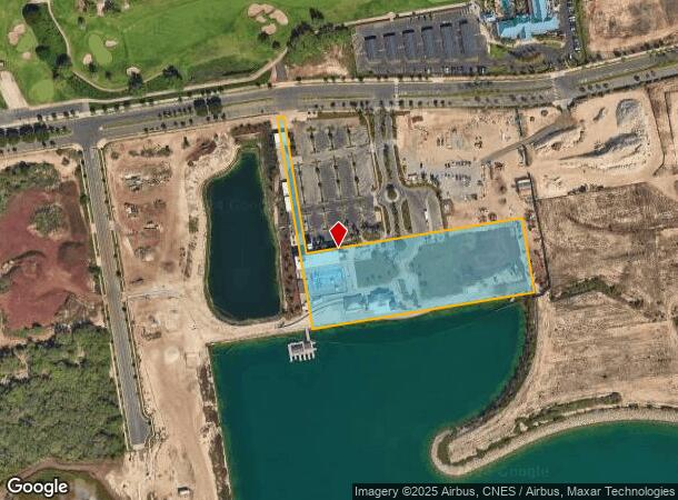
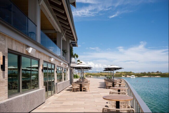
Property Record
Keoneula Blvd, Ewa Beach, HI 96706
NEARBY LISTINGS FOR SALE OR LEASE
-
-
View all Ewa Beach listings for lease on LoopNet.com
Property Detail
Keoneula Blvd
1-9-1-134-040-0000
LOT 6
Commercialnec
Honolulu
D
Hawaii
15003C0317G
6
2024
4.37 AC
2025
West Oahu
008408
Hawaii
22,561 SF
Urban Honolulu, HI
DEMOGRAPHICS near Keoneula Blvd
1 Mile
3 Mile
5 Mile
2024 Total Population
2,418
68,654
104,892
2029 Population
2,251
65,428
100,414
Pop Growth 2024-2029
(6.91%)
(4.70%)
(4.27%)
Average Age
36
36
36
2024 Total Households
716
19,446
29,739
HH Growth 2024-2029
(8.10%)
(5.11%)
(4.80%)
Median Household Inc
$160,080
$111,838
$111,821
Avg Household Size
3.30
3.30
3.30
2024 Avg HH Vehicles
2.00
2.00
2.00
Median Home Value
$850,888
$713,447
$724,359
Median Year Built
2011
2000
1998
Nearby Places
Map Layers
Map Styles
 Street
 Aerial
- Restaurants
- Banks
- Shops
- Fitness
- Groceries
PUBLIC TRANSPORTATION
AIRPORT
Daniel K Inouye International
DRIVE
WALK
Distance
Daniel K Inouye International
30 min
17.0 mi
Freight Ports
Honolulu Harbor, Oahu
DRIVE
WALK
Distance
Honolulu Harbor, Oahu
39 min
21.2 mi
SALE & LEASE HISTORY
LISTING DATE
SALE/LEASE

Oct 17, 2024
For Lease
Nearby Properties
Address
Land Use
TOTAL SIZE
Lot Size
Zoning
Address
Land Use
TOTAL SIZE
Lot Size
Zoning
736 AC
F-1
Address
Land Use
TOTAL SIZE
Lot Size
Zoning
645,869 SF
48.95 AC
AG-1
Address
Land Use
TOTAL SIZE
Lot Size
Zoning
139.30 AC
F-1
Address
Land Use
TOTAL SIZE
Lot Size
Zoning
48.66 AC
I-2
Address
Land Use
TOTAL SIZE
Lot Size
Zoning
2,225 SF
19.72 AC
AG-1
Address
Land Use
TOTAL SIZE
Lot Size
Zoning
45.60 AC
F-1
Address
Land Use
TOTAL SIZE
Lot Size
Zoning
238,418 SF
9.46 AC
F-1
Address
Land Use
TOTAL SIZE
Lot Size
Zoning
1,714 SF
200.33 AC
AG-1
Address
Land Use
TOTAL SIZE
Lot Size
Zoning
63,936 SF
62.24 AC
F-1
Address
Land Use
TOTAL SIZE
Lot Size
Zoning
29.14 AC
IMX-1
Address
Land Use
TOTAL SIZE
Lot Size
Zoning
9,768 SF
48.81 AC
F-1
Address
Land Use
TOTAL SIZE
Lot Size
Zoning
74,111 SF
26.27 AC
F-1
Address
Land Use
TOTAL SIZE
Lot Size
Zoning
41,964 SF
69.57 AC
F-1
Address
Land Use
TOTAL SIZE
Lot Size
Zoning
28.72 AC
F-1
Address
Land Use
TOTAL SIZE
Lot Size
Zoning
106,692 SF
5.02 AC
BMX-3
Address
Land Use
TOTAL SIZE
Lot Size
Zoning
105,618 SF
4.99 AC
BMX-3
Address
Land Use
TOTAL SIZE
Lot Size
Zoning
30.94 AC
F-1
Address
Land Use
TOTAL SIZE
Lot Size
Zoning
18,472 SF
22.07 AC
F-1
Address
Land Use
TOTAL SIZE
Lot Size
Zoning
14,608 SF
20.60 AC
F-1
Address
Land Use
TOTAL SIZE
Lot Size
Zoning
79,561 SF
1.40 AC
BMX-3
Address
Land Use
TOTAL SIZE
Lot Size
Zoning
20,134 SF
19.95 AC
F-1
Address
Land Use
TOTAL SIZE
Lot Size
Zoning
71,163 SF
1.47 AC
BMX-3
Address
Land Use
TOTAL SIZE
Lot Size
Zoning
60,135 SF
4.90 AC
B-2
Address
Land Use
TOTAL SIZE
Lot Size
Zoning
70,011 SF
3.74 AC
BMX-3
Address
Land Use
TOTAL SIZE
Lot Size
Zoning
72,444 SF
13.25 AC
F-1
Address
Land Use
TOTAL SIZE
Lot Size
Zoning
62,220 SF
3.69 AC
BMX-3
Address
Land Use
TOTAL SIZE
Lot Size
Zoning
14.26 AC
Resort
Address
Land Use
TOTAL SIZE
Lot Size
Zoning
31,599 SF
0.55 AC
AG-1
The World's #1 Commercial Real Estate Marketplace
Connect with us
© 2026 CoStar Group
The information above has been obtained from sources believed reliable. While we do not doubt its accuracy we have not verified it and make no guarantee, warranty or representation about it. It is your responsibility to independently confirm its accuracy and completeness. Any projections, opinions, assumptions, or estimates used are for example only and do not represent the current or future performance of the property. The value of this transaction to you depends on tax and other factors which should be evaluated by your tax, financial, and legal advisors. You and your advisors should conduct a careful, independent investigation of the property to determine to your satisfaction the suitability of the property for your needs.