Property Record
Keyser Point Rd, West Ocean City, MD 21842


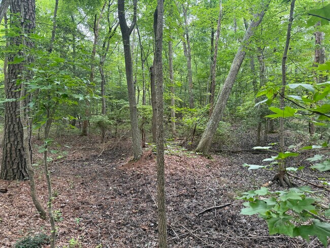
This Property Is For Sale
Property Detail
Keyser Point Rd
10-241561
PT LOT 11 5.132 ACS E SIDE KEYSER PT RD MINOR POR LDS OF H BROWN
Residentialacreage
WORCESTER
R-2
Maryland
B and X Area of moderate flood hazard, usually the area between the limits of the 100-year and 500-year floods.
11
2025
5.13 AC
2025
Ocean City
950100
Other Market Areas
1,838 SF
Ocean Pines, MD
NEARBY LISTINGS FOR SALE OR LEASE
DEMOGRAPHICS near Keyser Point Rd
1 mile
3 mile
5 mile
2025 Total Population
2,356
13,338
26,992
2030 Population
2,165
13,773
27,850
Pop Growth 2025-2030
(8.11%)
+ 3.26%
+ 3.18%
Average Age
43
45
47
2025 Total Households
921
5,809
11,743
HH Growth 2025-2030
(11.40%)
+ 2.15%
+ 2.37%
Median Household Inc
$104,545
$83,244
$87,803
Avg Household Size
2.30
2.10
2.10
2025 Avg HH Vehicles
2.00
2.00
2.00
Median Home Value
$479,786
$415,344
$394,079
Median Year Built
1996
1986
1986
Nearby Places
Map Layers
Map Styles
 Street
 Aerial
Layers
 Traffic
 Biking
Places
Listings with unknown addresses are not visible on the map
- Restaurants
- Banks
- Shops
- Fitness
- Groceries
PUBLIC TRANSPORTATION
AIRPORT
Salisbury-Ocean City Wicomico Regional
Drive
Walk
Distance
Salisbury-Ocean City Wicomico Regional
45 min
27.3 mi
Freight Ports
Port of Wilmington, RI
Drive
Walk
Distance
Port of Wilmington, RI
155 min
116.6 mi
Nearby Properties
Address
Land Use
TOTAL SIZE
Lot Size
Zoning
Address
Land Use
TOTAL SIZE
Lot Size
Zoning
249,984 SF
2.24 AC
R-3
Address
Land Use
TOTAL SIZE
Lot Size
Zoning
2,032 SF
9.49 AC
B-1
Address
Land Use
TOTAL SIZE
Lot Size
Zoning
34,402 SF
2.07 AC
R-3
Address
Land Use
TOTAL SIZE
Lot Size
Zoning
20,249 SF
166.55 AC
A2
Address
Land Use
TOTAL SIZE
Lot Size
Zoning
2,520 SF
53.60 AC
A-1
Address
Land Use
TOTAL SIZE
Lot Size
Zoning
182,200 SF
11.31 AC
LC-1
Address
Land Use
TOTAL SIZE
Lot Size
Zoning
115,544 SF
1.03 AC
R-2
Address
Land Use
TOTAL SIZE
Lot Size
Zoning
122,648 SF
3.02 AC
I-1
Address
Land Use
TOTAL SIZE
Lot Size
Zoning
111,993 SF
1.02 AC
R-3
Address
Land Use
TOTAL SIZE
Lot Size
Zoning
6,396 SF
21.15 AC
C2
Address
Land Use
TOTAL SIZE
Lot Size
Zoning
2,738 SF
19.91 AC
C2
Address
Land Use
TOTAL SIZE
Lot Size
Zoning
103,230 SF
1.03 AC
R-3
Address
Land Use
TOTAL SIZE
Lot Size
Zoning
145,813 SF
1.03 AC
R-3
Address
Land Use
TOTAL SIZE
Lot Size
Zoning
111,342 SF
0.90 AC
R3
Address
Land Use
TOTAL SIZE
Lot Size
Zoning
1,160 SF
1.72 AC
B-1
Address
Land Use
TOTAL SIZE
Lot Size
Zoning
102,771 SF
1.03 AC
R-3
Address
Land Use
TOTAL SIZE
Lot Size
Zoning
1,188 SF
2.07 AC
R-3
Address
Land Use
TOTAL SIZE
Lot Size
Zoning
87,607 SF
17.89 AC
R-2
Address
Land Use
TOTAL SIZE
Lot Size
Zoning
103,484 SF
21.24 AC
C3
Address
Land Use
TOTAL SIZE
Lot Size
Zoning
5,654 SF
0.79 AC
R-3
Address
Land Use
TOTAL SIZE
Lot Size
Zoning
193,229 SF
28.50 AC
C3
Address
Land Use
TOTAL SIZE
Lot Size
Zoning
41,361 SF
0.20 AC
BC-2
Address
Land Use
TOTAL SIZE
Lot Size
Zoning
11,261 SF
408.66 AC
R-1A
Address
Land Use
TOTAL SIZE
Lot Size
Zoning
73,088 SF
1.05 AC
R-3
Address
Land Use
TOTAL SIZE
Lot Size
Zoning
61,455 SF
1.03 AC
LC-1
Address
Land Use
TOTAL SIZE
Lot Size
Zoning
38,109 SF
0.49 AC
R-3
Address
Land Use
TOTAL SIZE
Lot Size
Zoning
2,660 SF
1.18 AC
B-1
Address
Land Use
TOTAL SIZE
Lot Size
Zoning
54,551 SF
0.33 AC
B-1
Address
Land Use
TOTAL SIZE
Lot Size
Zoning
7,308 SF
41 AC
A-1
Address
Land Use
TOTAL SIZE
Lot Size
Zoning
50,886 SF
1.44 AC
LC-1
The World's #1 Commercial Real Estate Marketplace
Connect with us
© 2026 CoStar Group
The information above has been obtained from sources believed reliable. While we do not doubt its accuracy we have not verified it and make no guarantee, warranty or representation about it. It is your responsibility to independently confirm its accuracy and completeness. Any projections, opinions, assumptions, or estimates used are for example only and do not represent the current or future performance of the property. The value of this transaction to you depends on tax and other factors which should be evaluated by your tax, financial, and legal advisors. You and your advisors should conduct a careful, independent investigation of the property to determine to your satisfaction the suitability of the property for your needs.