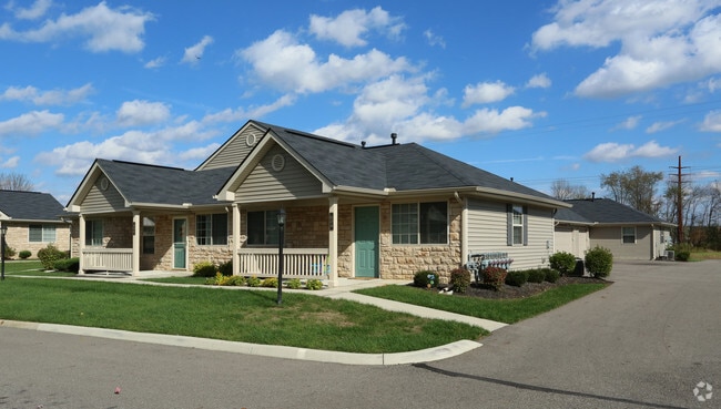
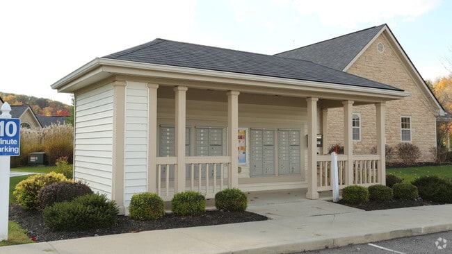
Property Record
King Rd, Newark, OH 43055

Property Detail
King Rd
Columbus, OH
15.879 AC LOT 3 & 5 R12 T2 Q3
096-286524-00.004
LICKING
Apartmenthouse5plusunits
Ohio
AE The base floodplain where base flood elevations are provided. AE Zones are now used on new format FIRMs instead of A1-A30 Zones.
3,5
2025
15.87 AC
2025
Licking County
751600
Columbus
1,768 SF
NEARBY LISTINGS FOR SALE OR LEASE
-
-
View all Newark listings for sale on LoopNet.com
DEMOGRAPHICS near King Rd
1 mile
3 mile
5 mile
2025 Total Population
5,168
34,308
74,077
2030 Population
5,338
35,186
76,376
Pop Growth 2025-2030
+ 3.29%
+ 2.56%
+ 3.10%
Average Age
43
42
40
2025 Total Households
2,318
14,196
29,714
HH Growth 2025-2030
+ 3.28%
+ 2.49%
+ 3.03%
Median Household Inc
$54,176
$61,388
$61,414
Avg Household Size
2.10
2.30
2.30
2025 Avg HH Vehicles
2.00
2.00
2.00
Median Home Value
$220,993
$219,488
$222,479
Median Year Built
1985
1967
1967
Nearby Places
Map Layers
Map Styles
 Street
 Aerial
Layers
 Traffic
 Biking
Places
Listings with unknown addresses are not visible on the map
- Restaurants
- Banks
- Shops
- Fitness
- Groceries
PUBLIC TRANSPORTATION
AIRPORT
John Glenn Columbus International
Drive
Walk
Distance
John Glenn Columbus International
46 min
32.6 mi
Freight Ports
Port of Toledo
Drive
Walk
Distance
Port of Toledo
200 min
161.2 mi
Nearby Properties
Address
Land Use
TOTAL SIZE
Lot Size
Zoning
Address
Land Use
TOTAL SIZE
Lot Size
Zoning
54,600 SF
101.38 AC
Address
Land Use
TOTAL SIZE
Lot Size
Zoning
288,448 SF
56.10 AC
Address
Land Use
TOTAL SIZE
Lot Size
Zoning
87,785 SF
37.26 AC
Address
Land Use
TOTAL SIZE
Lot Size
Zoning
68,326 SF
28.51 AC
Address
Land Use
TOTAL SIZE
Lot Size
Zoning
1,537,139 SF
11.11 AC
Address
Land Use
TOTAL SIZE
Lot Size
Zoning
206,532 SF
21.65 AC
Address
Land Use
TOTAL SIZE
Lot Size
Zoning
118,791 SF
16.01 AC
Address
Land Use
TOTAL SIZE
Lot Size
Zoning
73,269 SF
15.64 AC
Address
Land Use
TOTAL SIZE
Lot Size
Zoning
31,271 SF
20.10 AC
Address
Land Use
TOTAL SIZE
Lot Size
Zoning
79,454 SF
19.13 AC
Address
Land Use
TOTAL SIZE
Lot Size
Zoning
63,635 SF
13.97 AC
Address
Land Use
TOTAL SIZE
Lot Size
Zoning
63,635 SF
7.91 AC
Address
Land Use
TOTAL SIZE
Lot Size
Zoning
65,860 SF
3.35 AC
Address
Land Use
TOTAL SIZE
Lot Size
Zoning
316,800 SF
10.74 AC
Address
Land Use
TOTAL SIZE
Lot Size
Zoning
7,400 SF
10.50 AC
Address
Land Use
TOTAL SIZE
Lot Size
Zoning
97,368 SF
31.71 AC
Address
Land Use
TOTAL SIZE
Lot Size
Zoning
7,038 SF
3.15 AC
Address
Land Use
TOTAL SIZE
Lot Size
Zoning
17,144 SF
4.55 AC
Address
Land Use
TOTAL SIZE
Lot Size
Zoning
204,400 SF
84.83 AC
Address
Land Use
TOTAL SIZE
Lot Size
Zoning
45,951 SF
6.64 AC
Address
Land Use
TOTAL SIZE
Lot Size
Zoning
2,629 SF
18.04 AC
Address
Land Use
TOTAL SIZE
Lot Size
Zoning
99,664 SF
16.18 AC
Address
Land Use
TOTAL SIZE
Lot Size
Zoning
2,979 SF
13.37 AC
Address
Land Use
TOTAL SIZE
Lot Size
Zoning
85.95 AC
Address
Land Use
TOTAL SIZE
Lot Size
Zoning
47,495 SF
2.06 AC
Address
Land Use
TOTAL SIZE
Lot Size
Zoning
159,431 SF
8.16 AC
Address
Land Use
TOTAL SIZE
Lot Size
Zoning
1,800 SF
6.93 AC
Address
Land Use
TOTAL SIZE
Lot Size
Zoning
10,560 SF
7.12 AC
Address
Land Use
TOTAL SIZE
Lot Size
Zoning
26,244 SF
2 AC
The World's #1 Commercial Real Estate Marketplace
Connect with us
© 2026 CoStar Group
The information above has been obtained from sources believed reliable. While we do not doubt its accuracy we have not verified it and make no guarantee, warranty or representation about it. It is your responsibility to independently confirm its accuracy and completeness. Any projections, opinions, assumptions, or estimates used are for example only and do not represent the current or future performance of the property. The value of this transaction to you depends on tax and other factors which should be evaluated by your tax, financial, and legal advisors. You and your advisors should conduct a careful, independent investigation of the property to determine to your satisfaction the suitability of the property for your needs.