Property Record
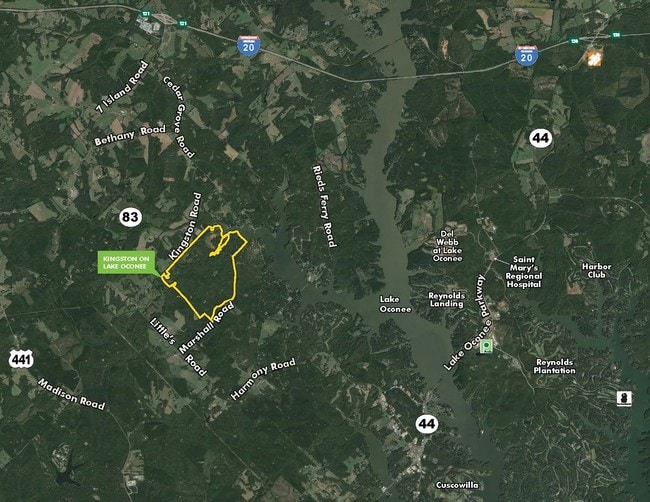
Kingston Rd, Buckhead, GA 30625


Property Detail
Kingston Rd
066002000
812.68 AC TAXED IN MORGAN COUNTY LANDDIST: 4
Agriculturalland
MORGAN
LTCO
Georgia
B and X Area of moderate flood hazard, usually the area between the limits of the 100-year and 500-year floods.
240
2025
799.46 AC
2025
Morgan County
010400
Other Market Areas
1,200 SF
Atlanta-Sandy Springs-Roswell, GA
NEARBY LISTINGS FOR SALE OR LEASE
DEMOGRAPHICS near Kingston Rd
1 mile
3 mile
5 mile
2025 Total Population
33
2,259
4,920
2030 Population
36
2,443
5,328
Pop Growth 2025-2030
+ 9.09%
+ 8.15%
+ 8.29%
Average Age
45
47
48
2025 Total Households
13
937
2,075
HH Growth 2025-2030
+ 7.69%
+ 8.43%
+ 8.43%
Median Household Inc
$99,999
$90,754
$93,081
Avg Household Size
2.50
2.40
2.30
2025 Avg HH Vehicles
3.00
2.00
2.00
Median Home Value
$383,333
$371,559
$408,364
Median Year Built
2003
2000
2002
Nearby Places
Map Layers
Map Styles
 Street
 Aerial
Transit
 Traffic
 Biking
Places
Listings with unknown addresses are not visible on the map
- Restaurants
- Banks
- Shops
- Fitness
- Groceries
SALE & LEASE HISTORY
LISTING DATE
SALE/LEASE

Sep 28, 2016
For Sale
Nearby Properties
Address
Land Use
TOTAL SIZE
Lot Size
Zoning
Address
Land Use
TOTAL SIZE
Lot Size
Zoning
291.86 AC
LR1
Address
Land Use
TOTAL SIZE
Lot Size
Zoning
330 SF
126.06 AC
LR1
Address
Land Use
TOTAL SIZE
Lot Size
Zoning
749.45 AC
AG
Address
Land Use
TOTAL SIZE
Lot Size
Zoning
161.33 AC
AG
Address
Land Use
TOTAL SIZE
Lot Size
Zoning
124.48 AC
AG
Address
Land Use
TOTAL SIZE
Lot Size
Zoning
323.85 AC
AG
Address
Land Use
TOTAL SIZE
Lot Size
Zoning
96.74 AC
AG
Address
Land Use
TOTAL SIZE
Lot Size
Zoning
832 SF
107.37 AC
AG
Address
Land Use
TOTAL SIZE
Lot Size
Zoning
3,906 SF
24 AC
AG
Address
Land Use
TOTAL SIZE
Lot Size
Zoning
249.12 AC
AG
Address
Land Use
TOTAL SIZE
Lot Size
Zoning
84.30 AC
AG
Address
Land Use
TOTAL SIZE
Lot Size
Zoning
68.12 AC
AG
Address
Land Use
TOTAL SIZE
Lot Size
Zoning
75.95 AC
AG
Address
Land Use
TOTAL SIZE
Lot Size
Zoning
3,500 SF
75.74 AC
AG
Address
Land Use
TOTAL SIZE
Lot Size
Zoning
5,495 SF
151.50 AC
AG
Address
Land Use
TOTAL SIZE
Lot Size
Zoning
3,836 SF
196.83 AC
AG
Address
Land Use
TOTAL SIZE
Lot Size
Zoning
13.80 AC
LR1
Address
Land Use
TOTAL SIZE
Lot Size
Zoning
116 AC
AG
Address
Land Use
TOTAL SIZE
Lot Size
Zoning
56.31 AC
AG
Address
Land Use
TOTAL SIZE
Lot Size
Zoning
107.52 AC
AG
Address
Land Use
TOTAL SIZE
Lot Size
Zoning
168.47 AC
RM-3
Address
Land Use
TOTAL SIZE
Lot Size
Zoning
104.55 AC
AG
Address
Land Use
TOTAL SIZE
Lot Size
Zoning
4,272 SF
4.30 AC
LR1
Address
Land Use
TOTAL SIZE
Lot Size
Zoning
265.81 AC
AG
Address
Land Use
TOTAL SIZE
Lot Size
Zoning
90 AC
AG
Address
Land Use
TOTAL SIZE
Lot Size
Zoning
3,600 SF
10.99 AC
LR1
Address
Land Use
TOTAL SIZE
Lot Size
Zoning
212.23 AC
AG
Address
Land Use
TOTAL SIZE
Lot Size
Zoning
0.27 AC
LR1
Address
Land Use
TOTAL SIZE
Lot Size
Zoning
3,024 SF
5.57 AC
LR1
The World's #1 Commercial Real Estate Marketplace
Connect with us
© 2026 CoStar Group
The information above has been obtained from sources believed reliable. While we do not doubt its accuracy we have not verified it and make no guarantee, warranty or representation about it. It is your responsibility to independently confirm its accuracy and completeness. Any projections, opinions, assumptions, or estimates used are for example only and do not represent the current or future performance of the property. The value of this transaction to you depends on tax and other factors which should be evaluated by your tax, financial, and legal advisors. You and your advisors should conduct a careful, independent investigation of the property to determine to your satisfaction the suitability of the property for your needs.