Property Record
Kiowa Rd, Apple Valley, CA 92308


NEARBY LISTINGS FOR SALE OR LEASE
-
-
-
-
-
-
Yucca Loma Rd rd @ Apple Valley Rd
Apple Valley, CA 92307
$1,475,000 - $8,950,000
4.39 - 17.06 AC Lot
Land
-
-
View all Apple Valley listings for sale on LoopNet.com
Property Detail
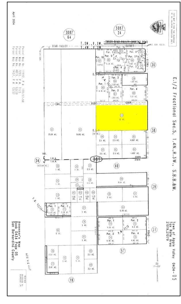
Kiowa Rd
0434-051-29
N 1/2 SE 1/4 NE 1/4 SEC 5 TP 4N R 3W
Vacantlandnec
San Bernardino
D
California
06071C6505J
20 AC
2024
Mojave River Valley
2025
Inland Empire (California)
009709
Riverside-San Bernardino-Ontario, CA
DEMOGRAPHICS near Kiowa Rd
1 Mile
3 Mile
5 Mile
2024 Total Population
6,933
41,481
99,745
2029 Population
7,077
42,138
101,983
Pop Growth 2024-2029
+ 2.08%
+ 1.58%
+ 2.24%
Average Age
37
41
39
2024 Total Households
2,221
14,596
33,564
HH Growth 2024-2029
+ 2.12%
+ 1.54%
+ 2.28%
Median Household Inc
$57,512
$62,124
$69,376
Avg Household Size
3.10
2.80
2.90
2024 Avg HH Vehicles
2.00
2.00
2.00
Median Home Value
$369,831
$357,187
$366,669
Median Year Built
1986
1987
1986
Nearby Places
Map Layers
Map Styles
 Street
 Aerial
- Restaurants
- Banks
- Shops
- Fitness
- Groceries
PUBLIC TRANSPORTATION
COMMUTER RAIL
Victorville Amtrak (Southwest Chief - Amtrak)
DRIVE
WALK
Distance
Victorville Amtrak (Southwest Chief - Amtrak)
16 min
9.5 mi
Freight Ports
Port of Long Beach
DRIVE
WALK
Distance
Port of Long Beach
122 min
100.6 mi
Nearby Properties
Address
Land Use
TOTAL SIZE
Lot Size
Zoning
Address
Land Use
TOTAL SIZE
Lot Size
Zoning
116,365 SF
8.93 AC
Address
Land Use
TOTAL SIZE
Lot Size
Zoning
97,008 SF
10.25 AC
Address
Land Use
TOTAL SIZE
Lot Size
Zoning
84,623 SF
7.18 AC
Address
Land Use
TOTAL SIZE
Lot Size
Zoning
137,104 SF
12 AC
Address
Land Use
TOTAL SIZE
Lot Size
Zoning
39,443 SF
7.21 AC
Address
Land Use
TOTAL SIZE
Lot Size
Zoning
102,120 SF
11.82 AC
Address
Land Use
TOTAL SIZE
Lot Size
Zoning
123,947 SF
8.80 AC
Address
Land Use
TOTAL SIZE
Lot Size
Zoning
42,082 SF
8.10 AC
Address
Land Use
TOTAL SIZE
Lot Size
Zoning
36,151 SF
2.85 AC
Address
Land Use
TOTAL SIZE
Lot Size
Zoning
71,920 SF
2.78 AC
Address
Land Use
TOTAL SIZE
Lot Size
Zoning
74.39 AC
Address
Land Use
TOTAL SIZE
Lot Size
Zoning
18,800 SF
2.60 AC
Address
Land Use
TOTAL SIZE
Lot Size
Zoning
75,280 SF
4.07 AC
Address
Land Use
TOTAL SIZE
Lot Size
Zoning
127,429 SF
4.62 AC
Address
Land Use
TOTAL SIZE
Lot Size
Zoning
30,860 SF
2.57 AC
Address
Land Use
TOTAL SIZE
Lot Size
Zoning
20,309 SF
2.35 AC
Address
Land Use
TOTAL SIZE
Lot Size
Zoning
33,298 SF
1.99 AC
Address
Land Use
TOTAL SIZE
Lot Size
Zoning
21,726 SF
1.95 AC
Address
Land Use
TOTAL SIZE
Lot Size
Zoning
14,739 SF
1.38 AC
Address
Land Use
TOTAL SIZE
Lot Size
Zoning
16,804 SF
1.80 AC
Address
Land Use
TOTAL SIZE
Lot Size
Zoning
23,846 SF
1.62 AC
Address
Land Use
TOTAL SIZE
Lot Size
Zoning
20,012 SF
1.82 AC
Address
Land Use
TOTAL SIZE
Lot Size
Zoning
35,178 SF
3.44 AC
Address
Land Use
TOTAL SIZE
Lot Size
Zoning
59,340 SF
14.75 AC
Address
Land Use
TOTAL SIZE
Lot Size
Zoning
22,488 SF
3.05 AC
Address
Land Use
TOTAL SIZE
Lot Size
Zoning
24,684 SF
1.98 AC
Address
Land Use
TOTAL SIZE
Lot Size
Zoning
86,148 SF
5.38 AC
Address
Land Use
TOTAL SIZE
Lot Size
Zoning
17,255 SF
1.55 AC
Address
Land Use
TOTAL SIZE
Lot Size
Zoning
4,998 SF
2.76 AC
Address
Land Use
TOTAL SIZE
Lot Size
Zoning
42,394 SF
4.15 AC
The World's #1 Commercial Real Estate Marketplace
Connect with us
© 2025 CoStar Group
The information above has been obtained from sources believed reliable. While we do not doubt its accuracy we have not verified it and make no guarantee, warranty or representation about it. It is your responsibility to independently confirm its accuracy and completeness. Any projections, opinions, assumptions, or estimates used are for example only and do not represent the current or future performance of the property. The value of this transaction to you depends on tax and other factors which should be evaluated by your tax, financial, and legal advisors. You and your advisors should conduct a careful, independent investigation of the property to determine to your satisfaction the suitability of the property for your needs.