Property Record
Knotty Pine Ln, Ashland, VA 23005
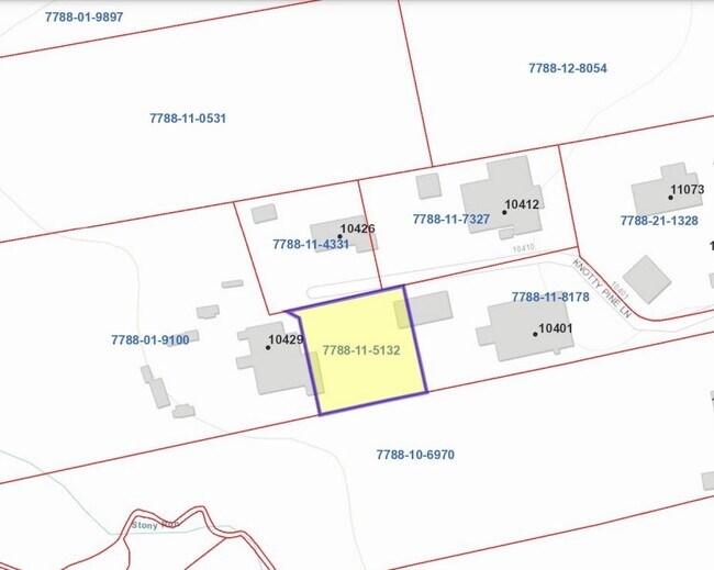

Property Detail
Knotty Pine Ln
7788-11-5132
KNOTTY PINE LANE
Commercialnec
HANOVER
M-2
Virginia
B and X Area of moderate flood hazard, usually the area between the limits of the 100-year and 500-year floods.
1 AC
2026
I-95 North/Ashland
2026
Richmond VA
320602
Richmond, VA
NEARBY LISTINGS FOR SALE OR LEASE
DEMOGRAPHICS near Knotty Pine Ln
1 mile
3 mile
5 mile
2025 Total Population
2,042
21,081
77,063
2030 Population
2,184
21,814
79,300
Pop Growth 2025-2030
+ 6.95%
+ 3.48%
+ 2.90%
Average Age
41
41
41
2025 Total Households
826
7,997
29,407
HH Growth 2025-2030
+ 7.14%
+ 3.69%
+ 2.93%
Median Household Inc
$105,107
$114,446
$105,715
Avg Household Size
2.40
2.60
2.50
2025 Avg HH Vehicles
2.00
2.00
2.00
Median Home Value
$376,020
$406,994
$386,942
Median Year Built
2003
1996
1993
Nearby Places
Map Layers
Map Styles
 Street
 Aerial
Layers
 Traffic
 Biking
Places
Listings with unknown addresses are not visible on the map
- Restaurants
- Banks
- Shops
- Fitness
- Groceries
PUBLIC TRANSPORTATION
COMMUTER RAIL
Drive
Walk
Distance
10 min
4.7 mi
Drive
Walk
Distance
17 min
8.5 mi
AIRPORT
Richmond International
Drive
Walk
Distance
Richmond International
30 min
20.9 mi
Freight Ports
Virginia Port Authority - Richmond
Drive
Walk
Distance
Virginia Port Authority - Richmond
31 min
20.5 mi
Nearby Properties
Address
Land Use
TOTAL SIZE
Lot Size
Zoning
Address
Land Use
TOTAL SIZE
Lot Size
Zoning
210.61 AC
M-2
Address
Land Use
TOTAL SIZE
Lot Size
Zoning
347,648 SF
24.75 AC
R-5
Address
Land Use
TOTAL SIZE
Lot Size
Zoning
186,034 SF
1 AC
B-3C
Address
Land Use
TOTAL SIZE
Lot Size
Zoning
43.49 AC
M-2
Address
Land Use
TOTAL SIZE
Lot Size
Zoning
162,972 SF
1 AC
R-6C
Address
Land Use
TOTAL SIZE
Lot Size
Zoning
59.30 AC
M-2
Address
Land Use
TOTAL SIZE
Lot Size
Zoning
135,874 SF
31.99 AC
MIXED
Address
Land Use
TOTAL SIZE
Lot Size
Zoning
21.38 AC
R-5C
Address
Land Use
TOTAL SIZE
Lot Size
Zoning
1,138 SF
10.30 AC
A-1
Address
Land Use
TOTAL SIZE
Lot Size
Zoning
50.20 AC
M-2
Address
Land Use
TOTAL SIZE
Lot Size
Zoning
30.94 AC
M-2
Address
Land Use
TOTAL SIZE
Lot Size
Zoning
320,540 SF
18.50 AC
M-2
Address
Land Use
TOTAL SIZE
Lot Size
Zoning
2,952 SF
20.87 AC
RM
Address
Land Use
TOTAL SIZE
Lot Size
Zoning
159,432 SF
14 AC
R-5
Address
Land Use
TOTAL SIZE
Lot Size
Zoning
142,140 SF
10.01 AC
R-5
Address
Land Use
TOTAL SIZE
Lot Size
Zoning
25.94 AC
M-1
Address
Land Use
TOTAL SIZE
Lot Size
Zoning
216,900 SF
13.41 AC
R-6
Address
Land Use
TOTAL SIZE
Lot Size
Zoning
22.80 AC
A-1
Address
Land Use
TOTAL SIZE
Lot Size
Zoning
21 AC
M-2
Address
Land Use
TOTAL SIZE
Lot Size
Zoning
293,114 SF
15.56 AC
M-2
Address
Land Use
TOTAL SIZE
Lot Size
Zoning
25.93 AC
M-2
Address
Land Use
TOTAL SIZE
Lot Size
Zoning
24.80 AC
M-2
Address
Land Use
TOTAL SIZE
Lot Size
Zoning
24.17 AC
M-2
Address
Land Use
TOTAL SIZE
Lot Size
Zoning
76,749 SF
22.25 AC
A-1
Address
Land Use
TOTAL SIZE
Lot Size
Zoning
12.49 AC
M-2
Address
Land Use
TOTAL SIZE
Lot Size
Zoning
31.70 AC
M-2
Address
Land Use
TOTAL SIZE
Lot Size
Zoning
128,005 SF
16.91 AC
M-1
Address
Land Use
TOTAL SIZE
Lot Size
Zoning
215,072 SF
16.32 AC
M-2
Address
Land Use
TOTAL SIZE
Lot Size
Zoning
196,298 SF
12.60 AC
MIXED
Address
Land Use
TOTAL SIZE
Lot Size
Zoning
17.80 AC
B-3
The World's #1 Commercial Real Estate Marketplace
Connect with us
© 2026 CoStar Group
The information above has been obtained from sources believed reliable. While we do not doubt its accuracy we have not verified it and make no guarantee, warranty or representation about it. It is your responsibility to independently confirm its accuracy and completeness. Any projections, opinions, assumptions, or estimates used are for example only and do not represent the current or future performance of the property. The value of this transaction to you depends on tax and other factors which should be evaluated by your tax, financial, and legal advisors. You and your advisors should conduct a careful, independent investigation of the property to determine to your satisfaction the suitability of the property for your needs.