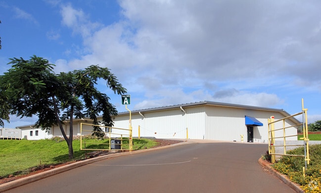
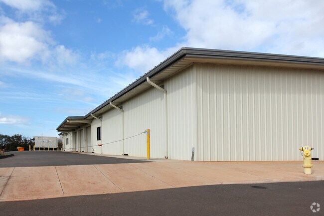
Property Record
Kunia Rd, Ewa Beach, HI 96706
NEARBY LISTINGS FOR SALE OR LEASE
Property Detail
Kunia Rd
Urban Honolulu, HI
LOT 5613 17,057 SF MAP 523 LCAPP 1069 TOG/ESMT SUBJ/ESMT
1-9-2-002-004-0000
Honolulu
Agriculturalland
Hawaii
D
5613
15003C0328G
7 AC
2024
West Oahu
2025
Hawaii
008415
DEMOGRAPHICS near Kunia Rd
1 mile
3 mile
5 mile
2024 Total Population
3,507
46,788
156,469
2029 Population
3,251
44,445
149,384
Pop Growth 2024-2029
(7.30%)
(5.01%)
(4.53%)
Average Age
38
39
39
2024 Total Households
876
12,453
45,246
HH Growth 2024-2029
(8.56%)
(5.95%)
(5.22%)
Median Household Inc
$121,999
$101,297
$102,253
Avg Household Size
3.60
3.50
3.20
2024 Avg HH Vehicles
2.00
2.00
2.00
Median Home Value
$701,923
$713,090
$701,570
Median Year Built
1996
1990
1988
Nearby Places
Map Layers
Map Styles
 Street
 Aerial
Transit
 Traffic
 Biking
Places
Listings with unknown addresses are not visible on the map
- Restaurants
- Banks
- Shops
- Fitness
- Groceries
PUBLIC TRANSPORTATION
AIRPORT
Daniel K Inouye International
Drive
Walk
Distance
Daniel K Inouye International
30 min
15.7 mi
Freight Ports
Honolulu Harbor, Oahu
Drive
Walk
Distance
Honolulu Harbor, Oahu
39 min
19.8 mi
Nearby Properties
Address
Land Use
TOTAL SIZE
Lot Size
Zoning
Address
Land Use
TOTAL SIZE
Lot Size
Zoning
310,432 SF
192.56 AC
BMX-3
Address
Land Use
TOTAL SIZE
Lot Size
Zoning
367,348 SF
18.25 AC
A-2
Address
Land Use
TOTAL SIZE
Lot Size
Zoning
82,948 SF
16.06 AC
AG-1
Address
Land Use
TOTAL SIZE
Lot Size
Zoning
229,396 SF
11.31 AC
BMX-3
Address
Land Use
TOTAL SIZE
Lot Size
Zoning
2,225 SF
19.72 AC
AG-1
Address
Land Use
TOTAL SIZE
Lot Size
Zoning
1,714 SF
200.33 AC
AG-1
Address
Land Use
TOTAL SIZE
Lot Size
Zoning
23.72 AC
A-1
Address
Land Use
TOTAL SIZE
Lot Size
Zoning
138,018 SF
10.65 AC
A-1
Address
Land Use
TOTAL SIZE
Lot Size
Zoning
15.12 AC
A-2
Address
Land Use
TOTAL SIZE
Lot Size
Zoning
25.97 AC
R-5
Address
Land Use
TOTAL SIZE
Lot Size
Zoning
13.47 AC
AMX-2
Address
Land Use
TOTAL SIZE
Lot Size
Zoning
38,400 SF
19.30 AC
AG-1
Address
Land Use
TOTAL SIZE
Lot Size
Zoning
99,015 SF
15 AC
A-2
Address
Land Use
TOTAL SIZE
Lot Size
Zoning
121,970 SF
9.83 AC
R-5
Address
Land Use
TOTAL SIZE
Lot Size
Zoning
24,012 SF
7.80 AC
A-2
Address
Land Use
TOTAL SIZE
Lot Size
Zoning
32,564 SF
7.13 AC
A-2
Address
Land Use
TOTAL SIZE
Lot Size
Zoning
13.21 AC
A-1
Address
Land Use
TOTAL SIZE
Lot Size
Zoning
424,593 SF
8.73 AC
B-2
Address
Land Use
TOTAL SIZE
Lot Size
Zoning
10.82 AC
A-1
Address
Land Use
TOTAL SIZE
Lot Size
Zoning
157,460 SF
9.51 AC
BMX-3
Address
Land Use
TOTAL SIZE
Lot Size
Zoning
9.57 AC
AG-1
Address
Land Use
TOTAL SIZE
Lot Size
Zoning
9.48 AC
AMX-2
Address
Land Use
TOTAL SIZE
Lot Size
Zoning
9.50 AC
AMX-2
Address
Land Use
TOTAL SIZE
Lot Size
Zoning
9.51 AC
R-5
Address
Land Use
TOTAL SIZE
Lot Size
Zoning
9.38 AC
A-1
Address
Land Use
TOTAL SIZE
Lot Size
Zoning
9.89 AC
AMX-2
Address
Land Use
TOTAL SIZE
Lot Size
Zoning
97,080 SF
6.48 AC
A-1
Address
Land Use
TOTAL SIZE
Lot Size
Zoning
16.08 AC
R-5
Address
Land Use
TOTAL SIZE
Lot Size
Zoning
8.37 AC
A-2
Address
Land Use
TOTAL SIZE
Lot Size
Zoning
9.27 AC
R-5
The World's #1 Commercial Real Estate Marketplace
Connect with us
© 2026 CoStar Group
The information above has been obtained from sources believed reliable. While we do not doubt its accuracy we have not verified it and make no guarantee, warranty or representation about it. It is your responsibility to independently confirm its accuracy and completeness. Any projections, opinions, assumptions, or estimates used are for example only and do not represent the current or future performance of the property. The value of this transaction to you depends on tax and other factors which should be evaluated by your tax, financial, and legal advisors. You and your advisors should conduct a careful, independent investigation of the property to determine to your satisfaction the suitability of the property for your needs.