Property Record
L12 Vac Ave, Lancaster, CA 93536
Property Detail
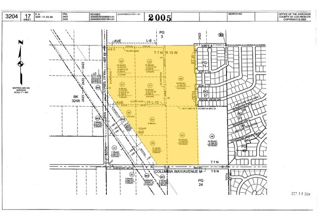
L12 Vac Ave
3204-017-066
THAT POR LYING NE OF SCE CO EASE OF SW 1/4 OF NW 1/4 OF SW 1/4 SEC 33 T7N R13W
Residentialacreage
LOS ANGELES
LCA210*
California
B and X Area of moderate flood hazard, usually the area between the limits of the 100-year and 500-year floods.
2.78 AC
2024
Antelope Valley
2025
Los Angeles
901214
Los Angeles-Long Beach-Glendale, CA
NEARBY LISTINGS FOR SALE OR LEASE
DEMOGRAPHICS near L12 Vac Ave
1 mile
3 mile
5 mile
2025 Total Population
3,215
26,099
65,659
2030 Population
3,286
26,198
65,621
Pop Growth 2025-2030
+ 2.21%
+ 0.38%
(0.06%)
Average Age
41
41
40
2025 Total Households
1,031
8,701
21,110
HH Growth 2025-2030
+ 2.13%
+ 0.29%
(0.25%)
Median Household Inc
$117,079
$111,074
$111,888
Avg Household Size
3.10
2.90
3.00
2025 Avg HH Vehicles
3.00
2.00
2.00
Median Home Value
$687,984
$638,122
$610,672
Median Year Built
2001
1992
1993
Nearby Places
Map Layers
Map Styles
 Street
 Aerial
Transit
 Traffic
 Biking
Places
Listings with unknown addresses are not visible on the map
- Restaurants
- Banks
- Shops
- Fitness
- Groceries
Nearby Properties
Address
Land Use
TOTAL SIZE
Lot Size
Zoning
Address
Land Use
TOTAL SIZE
Lot Size
Zoning
67,985 SF
3.34 AC
LCRA10000*
Address
Land Use
TOTAL SIZE
Lot Size
Zoning
36,115 SF
13.25 AC
LCA210
Address
Land Use
TOTAL SIZE
Lot Size
Zoning
105,077 SF
13.27 AC
LCC1-LCR3*
Address
Land Use
TOTAL SIZE
Lot Size
Zoning
27,821 SF
1.09 AC
LCR3P*
Address
Land Use
TOTAL SIZE
Lot Size
Zoning
138,009 SF
12.01 AC
LCR3*
Address
Land Use
TOTAL SIZE
Lot Size
Zoning
44,160 SF
5.51 AC
LCR3-2DU-D
Address
Land Use
TOTAL SIZE
Lot Size
Zoning
21,873 SF
3.38 AC
LCA22*
Address
Land Use
TOTAL SIZE
Lot Size
Zoning
7,396 SF
1.34 AC
LCMX-DRU
Address
Land Use
TOTAL SIZE
Lot Size
Zoning
77,586 SF
9.49 AC
LCR3*
Address
Land Use
TOTAL SIZE
Lot Size
Zoning
12.44 AC
PDC1*
Address
Land Use
TOTAL SIZE
Lot Size
Zoning
1,862 SF
9.24 AC
LRCP
Address
Land Use
TOTAL SIZE
Lot Size
Zoning
79.26 AC
LCA25*
Address
Land Use
TOTAL SIZE
Lot Size
Zoning
18,821 SF
6.72 AC
LCR3*
Address
Land Use
TOTAL SIZE
Lot Size
Zoning
12,572 SF
4.83 AC
LCA11*
Address
Land Use
TOTAL SIZE
Lot Size
Zoning
13,392 SF
0.60 AC
LCR3
Address
Land Use
TOTAL SIZE
Lot Size
Zoning
3,280 SF
0.37 AC
LCC3*
Address
Land Use
TOTAL SIZE
Lot Size
Zoning
Address
Land Use
TOTAL SIZE
Lot Size
Zoning
11,200 SF
1.94 AC
LRCPD*
Address
Land Use
TOTAL SIZE
Lot Size
Zoning
30,535 SF
2.44 AC
LCM1*
Address
Land Use
TOTAL SIZE
Lot Size
Zoning
4,478 SF
0.69 AC
LCC3*
Address
Land Use
TOTAL SIZE
Lot Size
Zoning
40.30 AC
LRR1-2.5
Address
Land Use
TOTAL SIZE
Lot Size
Zoning
9,717 SF
0.49 AC
LCC3
Address
Land Use
TOTAL SIZE
Lot Size
Zoning
39.08 AC
LRR1-2.5
Address
Land Use
TOTAL SIZE
Lot Size
Zoning
16,380 SF
0.59 AC
LCR3*
Address
Land Use
TOTAL SIZE
Lot Size
Zoning
167.45 AC
LCA221/2-A
Address
Land Use
TOTAL SIZE
Lot Size
Zoning
12,523 SF
0.74 AC
LCC3
Address
Land Use
TOTAL SIZE
Lot Size
Zoning
18,392 SF
2.69 AC
LCA11*
Address
Land Use
TOTAL SIZE
Lot Size
Zoning
18,300 SF
4.84 AC
LCM1*
Address
Land Use
TOTAL SIZE
Lot Size
Zoning
Address
Land Use
TOTAL SIZE
Lot Size
Zoning
30,464 SF
1.17 AC
LCR3*
The World's #1 Commercial Real Estate Marketplace
Connect with us
© 2026 CoStar Group
The information above has been obtained from sources believed reliable. While we do not doubt its accuracy we have not verified it and make no guarantee, warranty or representation about it. It is your responsibility to independently confirm its accuracy and completeness. Any projections, opinions, assumptions, or estimates used are for example only and do not represent the current or future performance of the property. The value of this transaction to you depends on tax and other factors which should be evaluated by your tax, financial, and legal advisors. You and your advisors should conduct a careful, independent investigation of the property to determine to your satisfaction the suitability of the property for your needs.