Property Record
La Mancha Dr, Sparks, NV 89441

Property Detail
La Mancha Dr
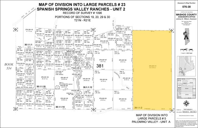
076-381-01
DLM 5 PAR 29-1-1-2
Residentialacreage
WASHOE
GR
Nevada
B and X Area of moderate flood hazard, usually the area between the limits of the 100-year and 500-year floods.
322.43 AC
0
N Outlying Washoe County
2026
Reno/Sparks
003519
Reno, NV
NEARBY LISTINGS FOR SALE OR LEASE
-
-
View all Sparks listings for sale on LoopNet.com
DEMOGRAPHICS near La Mancha Dr
1 mile
3 mile
5 mile
2025 Total Population
36
10,461
43,457
2030 Population
39
10,733
45,523
Pop Growth 2025-2030
+ 8.33%
+ 2.60%
+ 4.75%
Average Age
47
44
42
2025 Total Households
13
3,765
15,604
HH Growth 2025-2030
+ 15.38%
+ 2.66%
+ 4.77%
Median Household Inc
$158,333
$128,617
$119,401
Avg Household Size
2.50
2.80
2.80
2025 Avg HH Vehicles
3.00
3.00
2.00
Median Home Value
$770,833
$744,767
$687,564
Median Year Built
2011
2005
2006
Nearby Places
Map Layers
Map Styles
 Street
 Aerial
Transit
 Traffic
 Biking
Places
Listings with unknown addresses are not visible on the map
- Restaurants
- Banks
- Shops
- Fitness
- Groceries
PUBLIC TRANSPORTATION
AIRPORT
Reno/Tahoe International
Drive
Walk
Distance
Reno/Tahoe International
52 min
21.5 mi
Freight Ports
Port of Stockton
Drive
Walk
Distance
Port of Stockton
237 min
195.8 mi
Nearby Properties
Address
Land Use
TOTAL SIZE
Lot Size
Zoning
Address
Land Use
TOTAL SIZE
Lot Size
Zoning
55,889 SF
9.87 AC
PSP
Address
Land Use
TOTAL SIZE
Lot Size
Zoning
39.12 AC
I
Address
Land Use
TOTAL SIZE
Lot Size
Zoning
10.19 AC
I
Address
Land Use
TOTAL SIZE
Lot Size
Zoning
2.78 AC
LDS
Address
Land Use
TOTAL SIZE
Lot Size
Zoning
1.01 AC
NUD
Address
Land Use
TOTAL SIZE
Lot Size
Zoning
7.92 AC
LDS
Address
Land Use
TOTAL SIZE
Lot Size
Zoning
49.49 AC
LDS
Address
Land Use
TOTAL SIZE
Lot Size
Zoning
596.80 AC
OS
Address
Land Use
TOTAL SIZE
Lot Size
Zoning
45.34 AC
LDS
Address
Land Use
TOTAL SIZE
Lot Size
Zoning
3.99 AC
PD
Address
Land Use
TOTAL SIZE
Lot Size
Zoning
0.93 AC
GR
Address
Land Use
TOTAL SIZE
Lot Size
Zoning
122.97 AC
GR
Address
Land Use
TOTAL SIZE
Lot Size
Zoning
9.95 AC
MDS
Address
Land Use
TOTAL SIZE
Lot Size
Zoning
3.21 AC
LDS
Address
Land Use
TOTAL SIZE
Lot Size
Zoning
2,500 SF
10.08 AC
GR
Address
Land Use
TOTAL SIZE
Lot Size
Zoning
39.80 AC
GR
Address
Land Use
TOTAL SIZE
Lot Size
Zoning
39.91 AC
GR
Address
Land Use
TOTAL SIZE
Lot Size
Zoning
40.49 AC
GR
Address
Land Use
TOTAL SIZE
Lot Size
Zoning
37.99 AC
GR
Address
Land Use
TOTAL SIZE
Lot Size
Zoning
39.94 AC
GR
Address
Land Use
TOTAL SIZE
Lot Size
Zoning
41.71 AC
GR
Address
Land Use
TOTAL SIZE
Lot Size
Zoning
45.33 AC
GR
Address
Land Use
TOTAL SIZE
Lot Size
Zoning
40.02 AC
GR
Address
Land Use
TOTAL SIZE
Lot Size
Zoning
39.04 AC
GR
Address
Land Use
TOTAL SIZE
Lot Size
Zoning
54.70 AC
GR
Address
Land Use
TOTAL SIZE
Lot Size
Zoning
36.58 AC
GR
Address
Land Use
TOTAL SIZE
Lot Size
Zoning
512 SF
9.69 AC
GR
Address
Land Use
TOTAL SIZE
Lot Size
Zoning
4,000 SF
9.23 AC
GR
Address
Land Use
TOTAL SIZE
Lot Size
Zoning
19.85 AC
GR
Address
Land Use
TOTAL SIZE
Lot Size
Zoning
2,400 SF
10 AC
GR
The World's #1 Commercial Real Estate Marketplace
Connect with us
© 2026 CoStar Group
The information above has been obtained from sources believed reliable. While we do not doubt its accuracy we have not verified it and make no guarantee, warranty or representation about it. It is your responsibility to independently confirm its accuracy and completeness. Any projections, opinions, assumptions, or estimates used are for example only and do not represent the current or future performance of the property. The value of this transaction to you depends on tax and other factors which should be evaluated by your tax, financial, and legal advisors. You and your advisors should conduct a careful, independent investigation of the property to determine to your satisfaction the suitability of the property for your needs.