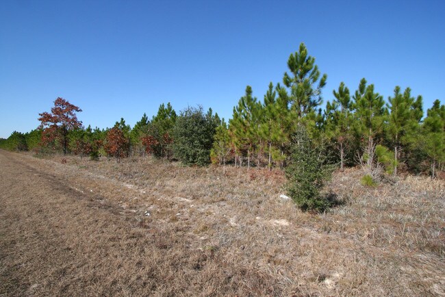
Property Record
Lake Hampton Rd, Hilliard, FL 32046


NEARBY LISTINGS FOR SALE OR LEASE
Property Detail
Lake Hampton Rd
Jacksonville, FL
PT SW1/4 OF SW1/4, PT E1/2 OF SW1/4 & PT W1/2 OF E1/2 SEC 8-4N-24E IN OR 2808/1765
08-4N-24-0000-0002-0000
Nassau
Timberlandforesttreesagricultural
Florida
X
2
13039C0345G
134.37 AC
2025
Nassau County
2025
Jacksonville (Florida)
050403
DEMOGRAPHICS near Lake Hampton Rd
1 mile
3 mile
5 mile
2024 Total Population
141
775
4,919
2029 Population
166
907
5,352
Pop Growth 2024-2029
+ 17.73%
+ 17.03%
+ 8.80%
Average Age
42
42
41
2024 Total Households
51
285
1,539
HH Growth 2024-2029
+ 19.61%
+ 18.25%
+ 10.40%
Median Household Inc
$87,500
$81,009
$56,838
Avg Household Size
2.80
2.70
2.60
2024 Avg HH Vehicles
2.00
2.00
2.00
Median Home Value
$294,736
$290,340
$185,265
Median Year Built
1994
1992
1985
Nearby Places
Map Layers
Map Styles
 Street
 Aerial
Transit
 Traffic
 Biking
Places
Listings with unknown addresses are not visible on the map
- Restaurants
- Banks
- Shops
- Fitness
- Groceries
PUBLIC TRANSPORTATION
AIRPORT
Jacksonville International
Drive
Walk
Distance
Jacksonville International
55 min
34.9 mi
Freight Ports
Georgia Ports - Brunswick
Drive
Walk
Distance
Georgia Ports - Brunswick
80 min
49.8 mi
Nearby Properties
Address
Land Use
TOTAL SIZE
Lot Size
Zoning
Address
Land Use
TOTAL SIZE
Lot Size
Zoning
33,143 SF
6.53 AC
OR
Address
Land Use
TOTAL SIZE
Lot Size
Zoning
23,621 SF
35.49 AC
OR
Address
Land Use
TOTAL SIZE
Lot Size
Zoning
675 AC
OR
Address
Land Use
TOTAL SIZE
Lot Size
Zoning
600 AC
OR
Address
Land Use
TOTAL SIZE
Lot Size
Zoning
16,004 SF
192.15 AC
OR
Address
Land Use
TOTAL SIZE
Lot Size
Zoning
Address
Land Use
TOTAL SIZE
Lot Size
Zoning
404.35 AC
OR
Address
Land Use
TOTAL SIZE
Lot Size
Zoning
14,189 SF
92.20 AC
OR
Address
Land Use
TOTAL SIZE
Lot Size
Zoning
4,139 SF
4.42 AC
CI
Address
Land Use
TOTAL SIZE
Lot Size
Zoning
Address
Land Use
TOTAL SIZE
Lot Size
Zoning
267 AC
OR
Address
Land Use
TOTAL SIZE
Lot Size
Zoning
181 AC
OR
Address
Land Use
TOTAL SIZE
Lot Size
Zoning
129 AC
OR
Address
Land Use
TOTAL SIZE
Lot Size
Zoning
24,255 SF
14 AC
OR
Address
Land Use
TOTAL SIZE
Lot Size
Zoning
120 AC
OR
Address
Land Use
TOTAL SIZE
Lot Size
Zoning
216 AC
OR
Address
Land Use
TOTAL SIZE
Lot Size
Zoning
4,957 SF
76.44 AC
OR
Address
Land Use
TOTAL SIZE
Lot Size
Zoning
3,824 SF
2.30 AC
OR
Address
Land Use
TOTAL SIZE
Lot Size
Zoning
4,754 SF
18.91 AC
OR
Address
Land Use
TOTAL SIZE
Lot Size
Zoning
1,578 SF
10 AC
OR
Address
Land Use
TOTAL SIZE
Lot Size
Zoning
6,211 SF
13.20 AC
OR
Address
Land Use
TOTAL SIZE
Lot Size
Zoning
4,932 SF
14.20 AC
OR
Address
Land Use
TOTAL SIZE
Lot Size
Zoning
4,990 SF
3.50 AC
OR
Address
Land Use
TOTAL SIZE
Lot Size
Zoning
176.22 AC
OR
Address
Land Use
TOTAL SIZE
Lot Size
Zoning
2,434 SF
7.67 AC
OR
Address
Land Use
TOTAL SIZE
Lot Size
Zoning
3,648 SF
0.52 AC
OR
Address
Land Use
TOTAL SIZE
Lot Size
Zoning
2,650 SF
0.28 AC
OR
Address
Land Use
TOTAL SIZE
Lot Size
Zoning
2,296 SF
7.39 AC
OR
Address
Land Use
TOTAL SIZE
Lot Size
Zoning
5,490 SF
2.60 AC
OR
Address
Land Use
TOTAL SIZE
Lot Size
Zoning
2,848 SF
3 AC
OR
The World's #1 Commercial Real Estate Marketplace
Connect with us
© 2026 CoStar Group
The information above has been obtained from sources believed reliable. While we do not doubt its accuracy we have not verified it and make no guarantee, warranty or representation about it. It is your responsibility to independently confirm its accuracy and completeness. Any projections, opinions, assumptions, or estimates used are for example only and do not represent the current or future performance of the property. The value of this transaction to you depends on tax and other factors which should be evaluated by your tax, financial, and legal advisors. You and your advisors should conduct a careful, independent investigation of the property to determine to your satisfaction the suitability of the property for your needs.