Property Record
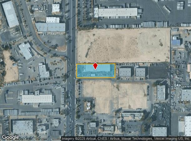
4522 N Lamb Blvd, Las Vegas, NV 89115
NEARBY LISTINGS FOR SALE OR LEASE
Property Detail
4522 N Lamb Blvd
Las Vegas-Henderson-Paradise, NV
Craig Lamb Coml
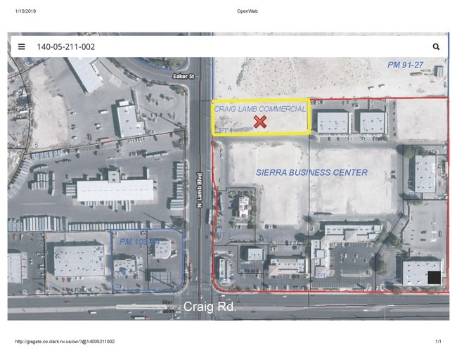
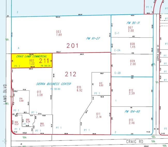
140-05-211-002
CRAIG LAMB COML PLAT BOOK 106 PAGE 29 PT LOT 1
Autorepair
Clark
X
Nevada
32003C2177F
1
2026
1.22 AC
2025
North Las Vegas
006001
Las Vegas
17,304 SF
DEMOGRAPHICS near 4522 N Lamb Blvd
1 Mile
3 Mile
5 Mile
2024 Total Population
16,277
99,297
311,365
2029 Population
17,334
106,219
334,342
Pop Growth 2024-2029
+ 6.49%
+ 6.97%
+ 7.38%
Average Age
31
33
34
2024 Total Households
4,883
30,465
94,812
HH Growth 2024-2029
+ 6.59%
+ 6.92%
+ 7.41%
Median Household Inc
$44,999
$51,643
$51,496
Avg Household Size
3.30
3.10
3.10
2024 Avg HH Vehicles
2.00
2.00
2.00
Median Home Value
$248,755
$285,315
$275,904
Median Year Built
1995
1997
1995
Nearby Places
Map Layers
Map Styles
 Street
 Aerial
- Restaurants
- Banks
- Shops
- Fitness
- Groceries
PUBLIC TRANSPORTATION
AIRPORT
Harry Reid International
DRIVE
WALK
Distance
Harry Reid International
24 min
15.4 mi
Boulder City Municipal
DRIVE
WALK
Distance
Boulder City Municipal
42 min
29.2 mi
SALE & LEASE HISTORY
LISTING DATE
SALE/LEASE

Mar 27, 2019
For Sale
Nearby Properties
Address
Land Use
TOTAL SIZE
Lot Size
Zoning
Address
Land Use
TOTAL SIZE
Lot Size
Zoning
1,767,948 SF
142.04 AC
Address
Land Use
TOTAL SIZE
Lot Size
Zoning
252,005 SF
27.94 AC
C3
Address
Land Use
TOTAL SIZE
Lot Size
Zoning
668,480 SF
63.10 AC
M1
Address
Land Use
TOTAL SIZE
Lot Size
Zoning
1,102,891 SF
84.43 AC
Address
Land Use
TOTAL SIZE
Lot Size
Zoning
798,660 SF
37.86 AC
M2
Address
Land Use
TOTAL SIZE
Lot Size
Zoning
813,120 SF
38.20 AC
Address
Land Use
TOTAL SIZE
Lot Size
Zoning
656,250 SF
29.11 AC
Address
Land Use
TOTAL SIZE
Lot Size
Zoning
588,286 SF
33.26 AC
Address
Land Use
TOTAL SIZE
Lot Size
Zoning
747,196 SF
40.03 AC
Address
Land Use
TOTAL SIZE
Lot Size
Zoning
632,224 SF
31.23 AC
Address
Land Use
TOTAL SIZE
Lot Size
Zoning
681,792 SF
29.65 AC
Address
Land Use
TOTAL SIZE
Lot Size
Zoning
621,824 SF
32.27 AC
Address
Land Use
TOTAL SIZE
Lot Size
Zoning
677,768 SF
31.52 AC
Address
Land Use
TOTAL SIZE
Lot Size
Zoning
696,064 SF
29.08 AC
Address
Land Use
TOTAL SIZE
Lot Size
Zoning
15,566 SF
48.39 AC
R4
Address
Land Use
TOTAL SIZE
Lot Size
Zoning
602,609 SF
27.33 AC
M2
Address
Land Use
TOTAL SIZE
Lot Size
Zoning
570,810 SF
29.73 AC
Address
Land Use
TOTAL SIZE
Lot Size
Zoning
625,804 SF
27.23 AC
Address
Land Use
TOTAL SIZE
Lot Size
Zoning
617,670 SF
27.90 AC
M2
Address
Land Use
TOTAL SIZE
Lot Size
Zoning
720,000 SF
25.07 AC
Address
Land Use
TOTAL SIZE
Lot Size
Zoning
3,735 SF
17.69 AC
R3
Address
Land Use
TOTAL SIZE
Lot Size
Zoning
509,586 SF
23.97 AC
Address
Land Use
TOTAL SIZE
Lot Size
Zoning
546,249 SF
28.58 AC
Address
Land Use
TOTAL SIZE
Lot Size
Zoning
152,520 SF
42.31 AC
M2
The World's #1 Commercial Real Estate Marketplace
Connect with us
© 2025 CoStar Group
The information above has been obtained from sources believed reliable. While we do not doubt its accuracy we have not verified it and make no guarantee, warranty or representation about it. It is your responsibility to independently confirm its accuracy and completeness. Any projections, opinions, assumptions, or estimates used are for example only and do not represent the current or future performance of the property. The value of this transaction to you depends on tax and other factors which should be evaluated by your tax, financial, and legal advisors. You and your advisors should conduct a careful, independent investigation of the property to determine to your satisfaction the suitability of the property for your needs.