Property Record
Lanier Rd, Madison, AL 35758
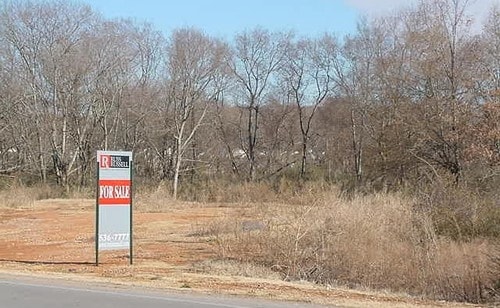


Property Detail
Lanier Rd
Huntsville, AL
LOT 2A FIRST COMMERCIAL PARK PHASE 2 PB 2021 PG 82339
16-05-21-0-000-001.001
MADISON
Commercialacreage
Alabama
AE The base floodplain where base flood elevations are provided. AE Zones are now used on new format FIRMs instead of A1-A30 Zones.
2
2025
5.30 AC
2025
Jetplex/Madison
011013
Huntsville
NEARBY LISTINGS FOR SALE OR LEASE
DEMOGRAPHICS near Lanier Rd
1 mile
3 mile
5 mile
2025 Total Population
4,090
38,017
80,458
2030 Population
4,525
40,742
86,649
Pop Growth 2025-2030
+ 10.64%
+ 7.17%
+ 7.69%
Average Age
40
39
39
2025 Total Households
1,867
16,412
32,485
HH Growth 2025-2030
+ 10.44%
+ 7.43%
+ 7.86%
Median Household Inc
$87,102
$96,460
$111,345
Avg Household Size
2.10
2.30
2.40
2025 Avg HH Vehicles
2.00
2.00
2.00
Median Home Value
$421,111
$405,922
$410,468
Median Year Built
1995
1997
2000
Nearby Places
Map Layers
Map Styles
 Street
 Aerial
Layers
 Traffic
 Biking
Places
Listings with unknown addresses are not visible on the map
- Restaurants
- Banks
- Shops
- Fitness
- Groceries
PUBLIC TRANSPORTATION
AIRPORT
Huntsville International-Carl T Jones Field
Drive
Walk
Distance
Huntsville International-Carl T Jones Field
11 min
5.0 mi
Freight Ports
Port of Mobile
Drive
Walk
Distance
Port of Mobile
378 min
346.2 mi
SALE & LEASE HISTORY
LISTING DATE
SALE/LEASE

Mar 31, 2017
For Sale
Nearby Properties
Address
Land Use
TOTAL SIZE
Lot Size
Zoning
Address
Land Use
TOTAL SIZE
Lot Size
Zoning
91,200 SF
Address
Land Use
TOTAL SIZE
Lot Size
Zoning
83,201 SF
Address
Land Use
TOTAL SIZE
Lot Size
Zoning
27,558 SF
12.41 AC
Address
Land Use
TOTAL SIZE
Lot Size
Zoning
337,050 SF
66 AC
Address
Land Use
TOTAL SIZE
Lot Size
Zoning
5,487 SF
30 AC
Address
Land Use
TOTAL SIZE
Lot Size
Zoning
547,730 SF
26 AC
Address
Land Use
TOTAL SIZE
Lot Size
Zoning
29,400 SF
80 AC
Address
Land Use
TOTAL SIZE
Lot Size
Zoning
3,772 SF
31 AC
Address
Land Use
TOTAL SIZE
Lot Size
Zoning
4,699 SF
24 AC
Address
Land Use
TOTAL SIZE
Lot Size
Zoning
108,800 SF
Address
Land Use
TOTAL SIZE
Lot Size
Zoning
3,663 SF
32.72 AC
Address
Land Use
TOTAL SIZE
Lot Size
Zoning
4,431 SF
23.55 AC
Address
Land Use
TOTAL SIZE
Lot Size
Zoning
4,631 SF
17 AC
Address
Land Use
TOTAL SIZE
Lot Size
Zoning
4,631 SF
41.41 AC
Address
Land Use
TOTAL SIZE
Lot Size
Zoning
13,720 SF
40 AC
Address
Land Use
TOTAL SIZE
Lot Size
Zoning
1,974 SF
22.35 AC
Address
Land Use
TOTAL SIZE
Lot Size
Zoning
4,644 SF
20.70 AC
Address
Land Use
TOTAL SIZE
Lot Size
Zoning
18,244 SF
35 AC
Address
Land Use
TOTAL SIZE
Lot Size
Zoning
3,589 SF
13.60 AC
Address
Land Use
TOTAL SIZE
Lot Size
Zoning
2,964 SF
22.28 AC
Address
Land Use
TOTAL SIZE
Lot Size
Zoning
7,920 SF
49 AC
Address
Land Use
TOTAL SIZE
Lot Size
Zoning
2,009 SF
20.06 AC
Address
Land Use
TOTAL SIZE
Lot Size
Zoning
3,073 SF
16.80 AC
Address
Land Use
TOTAL SIZE
Lot Size
Zoning
4,800 SF
49 AC
Address
Land Use
TOTAL SIZE
Lot Size
Zoning
11,255 SF
37 AC
Address
Land Use
TOTAL SIZE
Lot Size
Zoning
299,200 SF
33 AC
Address
Land Use
TOTAL SIZE
Lot Size
Zoning
2,687 SF
14 AC
Address
Land Use
TOTAL SIZE
Lot Size
Zoning
4,254 SF
19.25 AC
Address
Land Use
TOTAL SIZE
Lot Size
Zoning
38,047 SF
7 AC
Address
Land Use
TOTAL SIZE
Lot Size
Zoning
2,471 SF
14.08 AC
The World's #1 Commercial Real Estate Marketplace
Connect with us
© 2026 CoStar Group
The information above has been obtained from sources believed reliable. While we do not doubt its accuracy we have not verified it and make no guarantee, warranty or representation about it. It is your responsibility to independently confirm its accuracy and completeness. Any projections, opinions, assumptions, or estimates used are for example only and do not represent the current or future performance of the property. The value of this transaction to you depends on tax and other factors which should be evaluated by your tax, financial, and legal advisors. You and your advisors should conduct a careful, independent investigation of the property to determine to your satisfaction the suitability of the property for your needs.