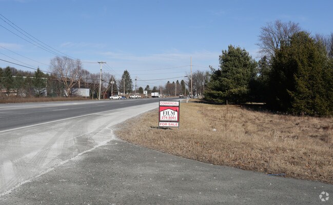
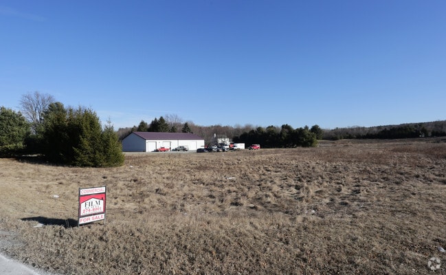
Property Record
Lape Rd, , NY

Property Detail
Lape Rd
Albany-Schenectady-Troy, NY
RENSSELAER
4489-210-7-60
New York
Commercialacreage
60.000
HC
8.60 AC
2025
Outer Rensselaer County
2024
Albany/Schenectady/Troy
052502
NEARBY LISTINGS FOR SALE OR LEASE
DEMOGRAPHICS near Lape Rd
1 mile
3 mile
5 mile
2025 Total Population
768
4,386
15,799
2030 Population
767
4,364
15,616
Pop Growth 2025-2030
(0.13%)
(0.50%)
(1.16%)
Average Age
44
44
44
2025 Total Households
313
1,797
6,527
HH Growth 2025-2030
(0.32%)
(0.61%)
(1.26%)
Median Household Inc
$118,518
$110,849
$94,783
Avg Household Size
2.40
2.40
2.40
2025 Avg HH Vehicles
2.00
2.00
2.00
Median Home Value
$290,593
$284,793
$283,183
Median Year Built
1973
1971
1968
Nearby Places
Map Layers
Map Styles
 Street
 Aerial
Transit
 Traffic
 Biking
Places
Listings with unknown addresses are not visible on the map
- Restaurants
- Banks
- Shops
- Fitness
- Groceries
PUBLIC TRANSPORTATION
AIRPORT
Albany International
Drive
Walk
Distance
Albany International
33 min
21.6 mi
Freight Ports
Albany, NY Port
Drive
Walk
Distance
Albany, NY Port
23 min
15.7 mi
SALE & LEASE HISTORY
LISTING DATE
SALE/LEASE

Sep 24, 2016
For Sale
Sep 03, 2021
For Lease
Mar 27, 2017
For Sale
Mar 14, 2017
For Sale
Nearby Properties
Address
Land Use
TOTAL SIZE
Lot Size
Zoning
Address
Land Use
TOTAL SIZE
Lot Size
Zoning
1,015,740 SF
115.47 AC
HC
Address
Land Use
TOTAL SIZE
Lot Size
Zoning
278,670 SF
55.98 AC
PD-3
Address
Land Use
TOTAL SIZE
Lot Size
Zoning
488,000 SF
101.90 AC
HC
Address
Land Use
TOTAL SIZE
Lot Size
Zoning
108,473 SF
62.61 AC
R-40
Address
Land Use
TOTAL SIZE
Lot Size
Zoning
23,200 SF
16.71 AC
HC
Address
Land Use
TOTAL SIZE
Lot Size
Zoning
7,384 SF
4.13 AC
HC
Address
Land Use
TOTAL SIZE
Lot Size
Zoning
Address
Land Use
TOTAL SIZE
Lot Size
Zoning
78,000 SF
8.76 AC
HC
Address
Land Use
TOTAL SIZE
Lot Size
Zoning
3,975 SF
2.60 AC
HC
Address
Land Use
TOTAL SIZE
Lot Size
Zoning
648 SF
46.65 AC
RA
Address
Land Use
TOTAL SIZE
Lot Size
Zoning
30,192 SF
9.06 AC
HC
Address
Land Use
TOTAL SIZE
Lot Size
Zoning
6,440 SF
7.54 AC
PD-1
Address
Land Use
TOTAL SIZE
Lot Size
Zoning
Address
Land Use
TOTAL SIZE
Lot Size
Zoning
18,831 SF
25 AC
PD-4
Address
Land Use
TOTAL SIZE
Lot Size
Zoning
11,710 SF
1.28 AC
PD-3
Address
Land Use
TOTAL SIZE
Lot Size
Zoning
31,920 SF
7.68 AC
HC
Address
Land Use
TOTAL SIZE
Lot Size
Zoning
3,872 SF
17.81 AC
HC
Address
Land Use
TOTAL SIZE
Lot Size
Zoning
25,810 SF
4.75 AC
HC
Address
Land Use
TOTAL SIZE
Lot Size
Zoning
3,675 SF
2.49 AC
HC
Address
Land Use
TOTAL SIZE
Lot Size
Zoning
3,300 SF
2.20 AC
HC
Address
Land Use
TOTAL SIZE
Lot Size
Zoning
8,732 SF
6.75 AC
HC
Address
Land Use
TOTAL SIZE
Lot Size
Zoning
5,840 SF
15.70 AC
RA
Address
Land Use
TOTAL SIZE
Lot Size
Zoning
Address
Land Use
TOTAL SIZE
Lot Size
Zoning
15,200 SF
3.35 AC
RA
Address
Land Use
TOTAL SIZE
Lot Size
Zoning
10,849 SF
7.25 AC
R-40
Address
Land Use
TOTAL SIZE
Lot Size
Zoning
11,710 SF
2.87 AC
PD-3
Address
Land Use
TOTAL SIZE
Lot Size
Zoning
16,800 SF
8.57 AC
HC
Address
Land Use
TOTAL SIZE
Lot Size
Zoning
1,856 SF
104.22 AC
RA
Address
Land Use
TOTAL SIZE
Lot Size
Zoning
105.74 AC
RA
Address
Land Use
TOTAL SIZE
Lot Size
Zoning
5,152 SF
26.16 AC
PD-1
The World's #1 Commercial Real Estate Marketplace
Connect with us
© 2026 CoStar Group
The information above has been obtained from sources believed reliable. While we do not doubt its accuracy we have not verified it and make no guarantee, warranty or representation about it. It is your responsibility to independently confirm its accuracy and completeness. Any projections, opinions, assumptions, or estimates used are for example only and do not represent the current or future performance of the property. The value of this transaction to you depends on tax and other factors which should be evaluated by your tax, financial, and legal advisors. You and your advisors should conduct a careful, independent investigation of the property to determine to your satisfaction the suitability of the property for your needs.