Property Record
Laurel Rd, Nokomis, FL 34275
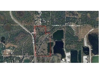

Property Detail
Laurel Rd
North Port-Bradenton-Sarasota, FL
TRACT OF LAND BEING PORTION OF LANDS DESC IN ORI 2022196447 LYING IN SEC 22-38-19 DESC AS FOLLOWS COM AT NW COR OS SAID SEC 22 TH ALONG NLY LINE OF SAID SEC 22, S 89-42-34 W 936.73 FT TH LEAVING
0365-00-2000
SARASOTA
Miscellaneous
Florida
KT
41.71 AC
2024
Sarasota Outlying
2025
Tampa/St Petersburg
002714
NEARBY LISTINGS FOR SALE OR LEASE
DEMOGRAPHICS near Laurel Rd
1 mile
3 mile
5 mile
2025 Total Population
719
11,697
50,035
2030 Population
803
12,960
54,346
Pop Growth 2025-2030
+ 11.68%
+ 10.80%
+ 8.62%
Average Age
58
59
59
2025 Total Households
351
5,742
25,238
HH Growth 2025-2030
+ 11.97%
+ 10.87%
+ 8.59%
Median Household Inc
$98,706
$93,168
$77,751
Avg Household Size
2.00
2.00
1.90
2025 Avg HH Vehicles
2.00
2.00
2.00
Median Home Value
$632,596
$580,975
$493,224
Median Year Built
2010
2008
1995
Nearby Places
Map Layers
Map Styles
 Street
 Aerial
Layers
 Traffic
 Biking
Places
Listings with unknown addresses are not visible on the map
- Restaurants
- Banks
- Shops
- Fitness
- Groceries
PUBLIC TRANSPORTATION
AIRPORT
Sarasota/Bradenton International
Drive
Walk
Distance
Sarasota/Bradenton International
40 min
28.3 mi
Freight Ports
Port Manatee
Drive
Walk
Distance
Port Manatee
52 min
40.8 mi
Nearby Properties
Address
Land Use
TOTAL SIZE
Lot Size
Zoning
Address
Land Use
TOTAL SIZE
Lot Size
Zoning
738,835 SF
65.43 AC
LW
Address
Land Use
TOTAL SIZE
Lot Size
Zoning
308,834 SF
16 AC
PUD
Address
Land Use
TOTAL SIZE
Lot Size
Zoning
273,036 SF
28.76 AC
RMF3
Address
Land Use
TOTAL SIZE
Lot Size
Zoning
238,850 SF
18.24 AC
LE
Address
Land Use
TOTAL SIZE
Lot Size
Zoning
263,056 SF
25.54 AC
LW
Address
Land Use
TOTAL SIZE
Lot Size
Zoning
181,657 SF
56.90 AC
GU
Address
Land Use
TOTAL SIZE
Lot Size
Zoning
48,681 SF
5 AC
OPI
Address
Land Use
TOTAL SIZE
Lot Size
Zoning
177,646 SF
5.23 AC
LE
Address
Land Use
TOTAL SIZE
Lot Size
Zoning
362,000 SF
41.51 AC
PID
Address
Land Use
TOTAL SIZE
Lot Size
Zoning
1,184 SF
90 AC
PUD
Address
Land Use
TOTAL SIZE
Lot Size
Zoning
252,213 SF
13.49 AC
LE
Address
Land Use
TOTAL SIZE
Lot Size
Zoning
110,209 SF
12.55 AC
PID
Address
Land Use
TOTAL SIZE
Lot Size
Zoning
70,220 SF
9.31 AC
LW
Address
Land Use
TOTAL SIZE
Lot Size
Zoning
115,474 SF
12.08 AC
PID
Address
Land Use
TOTAL SIZE
Lot Size
Zoning
49,400 SF
4.51 AC
OPI
Address
Land Use
TOTAL SIZE
Lot Size
Zoning
120,522 SF
5.25 AC
PID
Address
Land Use
TOTAL SIZE
Lot Size
Zoning
54.33 AC
CG
Address
Land Use
TOTAL SIZE
Lot Size
Zoning
49,388 SF
3.71 AC
OPI
Address
Land Use
TOTAL SIZE
Lot Size
Zoning
68,029 SF
51.98 AC
GU
Address
Land Use
TOTAL SIZE
Lot Size
Zoning
41.87 AC
PUD
Address
Land Use
TOTAL SIZE
Lot Size
Zoning
405,742 SF
14.39 AC
PUD
Address
Land Use
TOTAL SIZE
Lot Size
Zoning
8,105 SF
650.83 AC
GU
Address
Land Use
TOTAL SIZE
Lot Size
Zoning
193,409 SF
13.26 AC
PUD
Address
Land Use
TOTAL SIZE
Lot Size
Zoning
6,740 SF
648.99 AC
GU
Address
Land Use
TOTAL SIZE
Lot Size
Zoning
10,804 SF
492.33 AC
GU
Address
Land Use
TOTAL SIZE
Lot Size
Zoning
40,987 SF
11.89 AC
OPI
Address
Land Use
TOTAL SIZE
Lot Size
Zoning
61,400 SF
3.22 AC
LE
Address
Land Use
TOTAL SIZE
Lot Size
Zoning
18,008 SF
648.77 AC
GU
Address
Land Use
TOTAL SIZE
Lot Size
Zoning
645.20 AC
GU
The World's #1 Commercial Real Estate Marketplace
Connect with us
© 2026 CoStar Group
The information above has been obtained from sources believed reliable. While we do not doubt its accuracy we have not verified it and make no guarantee, warranty or representation about it. It is your responsibility to independently confirm its accuracy and completeness. Any projections, opinions, assumptions, or estimates used are for example only and do not represent the current or future performance of the property. The value of this transaction to you depends on tax and other factors which should be evaluated by your tax, financial, and legal advisors. You and your advisors should conduct a careful, independent investigation of the property to determine to your satisfaction the suitability of the property for your needs.