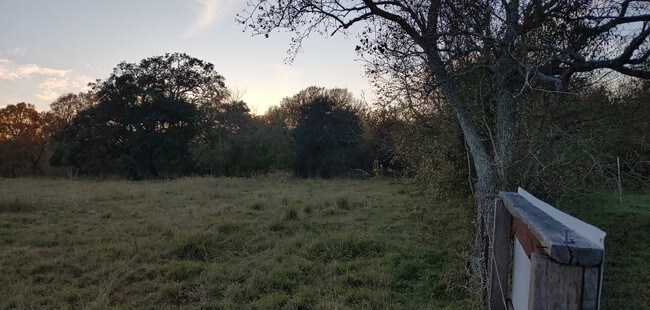
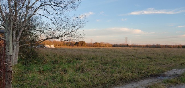
Property Record
Lawson Rd, Rosharon, TX 77583

Property Detail
Lawson Rd
0025-00-000-4700-907
0025 D FITZGERALD, ACRES 116.49, (94% IN R52)
Ranch
FORT BEND
YMQ
Texas
A Areas with a 1% annual chance of flooding and a 26% chance of flooding over the life of a 30-year mortgage.
116.49 AC
2024
Southwest Outlier
2025
Houston
661902
Houston-Pasadena-The Woodlands, TX
NEARBY LISTINGS FOR SALE OR LEASE
DEMOGRAPHICS near Lawson Rd
1 mile
3 mile
5 mile
2025 Total Population
4,561
55,633
124,497
2030 Population
5,185
64,348
142,422
Pop Growth 2025-2030
+ 13.68%
+ 15.67%
+ 14.40%
Average Age
35
36
36
2025 Total Households
1,358
16,899
38,300
HH Growth 2025-2030
+ 14.06%
+ 16.06%
+ 14.76%
Median Household Inc
$172,583
$112,884
$112,804
Avg Household Size
3.30
3.30
3.20
2025 Avg HH Vehicles
2.00
2.00
2.00
Median Home Value
$456,290
$372,059
$365,790
Median Year Built
2007
2009
2010
Nearby Places
Map Layers
Map Styles
 Street
 Aerial
Layers
 Traffic
 Biking
Places
Listings with unknown addresses are not visible on the map
- Restaurants
- Banks
- Shops
- Fitness
- Groceries
PUBLIC TRANSPORTATION
AIRPORT
William P Hobby
Drive
Walk
Distance
William P Hobby
43 min
21.9 mi
Freight Ports
Port of Houston
Drive
Walk
Distance
Port of Houston
48 min
26.4 mi
SALE & LEASE HISTORY
LISTING DATE
SALE/LEASE

Oct 23, 2019
For Sale
Nearby Properties
Address
Land Use
TOTAL SIZE
Lot Size
Zoning
Address
Land Use
TOTAL SIZE
Lot Size
Zoning
Address
Land Use
TOTAL SIZE
Lot Size
Zoning
344,620 SF
78.14 AC
SY
Address
Land Use
TOTAL SIZE
Lot Size
Zoning
359,733 SF
62.50 AC
Address
Land Use
TOTAL SIZE
Lot Size
Zoning
0.08 AC
Address
Land Use
TOTAL SIZE
Lot Size
Zoning
228,566 SF
31.85 AC
Address
Land Use
TOTAL SIZE
Lot Size
Zoning
1,764 SF
39.64 AC
ST
Address
Land Use
TOTAL SIZE
Lot Size
Zoning
16.28 AC
Address
Land Use
TOTAL SIZE
Lot Size
Zoning
123,079 SF
14.99 AC
Address
Land Use
TOTAL SIZE
Lot Size
Zoning
215,000 SF
26.95 AC
I
Address
Land Use
TOTAL SIZE
Lot Size
Zoning
22,240 SF
3.98 AC
Address
Land Use
TOTAL SIZE
Lot Size
Zoning
95,041 SF
7.77 AC
I
Address
Land Use
TOTAL SIZE
Lot Size
Zoning
95,479 SF
10.17 AC
Address
Land Use
TOTAL SIZE
Lot Size
Zoning
82,400 SF
10.85 AC
I
Address
Land Use
TOTAL SIZE
Lot Size
Zoning
96,295 SF
12.04 AC
I
Address
Land Use
TOTAL SIZE
Lot Size
Zoning
537.89 AC
Address
Land Use
TOTAL SIZE
Lot Size
Zoning
127,500 SF
7.60 AC
Address
Land Use
TOTAL SIZE
Lot Size
Zoning
105,790 SF
12.82 AC
X
Address
Land Use
TOTAL SIZE
Lot Size
Zoning
70,000 SF
64.91 AC
Address
Land Use
TOTAL SIZE
Lot Size
Zoning
21,410 SF
16 AC
Address
Land Use
TOTAL SIZE
Lot Size
Zoning
2,000 SF
24.85 AC
Address
Land Use
TOTAL SIZE
Lot Size
Zoning
28,633 SF
9.36 AC
Address
Land Use
TOTAL SIZE
Lot Size
Zoning
224.26 AC
Address
Land Use
TOTAL SIZE
Lot Size
Zoning
4.30 AC
Address
Land Use
TOTAL SIZE
Lot Size
Zoning
Address
Land Use
TOTAL SIZE
Lot Size
Zoning
Address
Land Use
TOTAL SIZE
Lot Size
Zoning
Address
Land Use
TOTAL SIZE
Lot Size
Zoning
17,091 SF
6.57 AC
Address
Land Use
TOTAL SIZE
Lot Size
Zoning
274.73 AC
Address
Land Use
TOTAL SIZE
Lot Size
Zoning
Address
Land Use
TOTAL SIZE
Lot Size
Zoning
22,331 SF
3 AC
X
The World's #1 Commercial Real Estate Marketplace
Connect with us
© 2026 CoStar Group
The information above has been obtained from sources believed reliable. While we do not doubt its accuracy we have not verified it and make no guarantee, warranty or representation about it. It is your responsibility to independently confirm its accuracy and completeness. Any projections, opinions, assumptions, or estimates used are for example only and do not represent the current or future performance of the property. The value of this transaction to you depends on tax and other factors which should be evaluated by your tax, financial, and legal advisors. You and your advisors should conduct a careful, independent investigation of the property to determine to your satisfaction the suitability of the property for your needs.