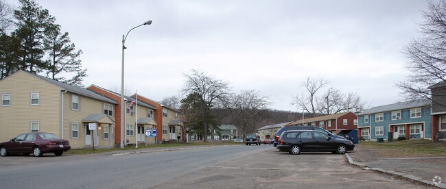
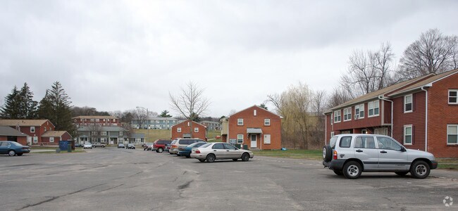
Property Record
Leary Dr, Holyoke, MA 01040

Property Detail
Leary Dr
HOLY-000148-000000-000038
HAMPDEN
Governmentalpublicusegeneral
Massachusetts
RM20
38
B and X Area of moderate flood hazard, usually the area between the limits of the 100-year and 500-year floods.
21.45 AC
0
Holyoke
2025
Hartford
812002
Springfield, MA
196,705 SF
NEARBY LISTINGS FOR SALE OR LEASE
DEMOGRAPHICS near Leary Dr
1 mile
3 mile
5 mile
2025 Total Population
7,184
56,515
124,888
2030 Population
7,145
56,402
124,976
Pop Growth 2025-2030
(0.54%)
(0.20%)
+ 0.07%
Average Age
42
41
42
2025 Total Households
2,956
23,184
53,551
HH Growth 2025-2030
(0.58%)
(0.20%)
+ 0.12%
Median Household Inc
$63,702
$56,937
$63,515
Avg Household Size
2.30
2.30
2.30
2025 Avg HH Vehicles
2.00
1.00
2.00
Median Home Value
$298,434
$289,429
$298,544
Median Year Built
1949
1953
1959
Nearby Places
Map Layers
Map Styles
 Street
 Aerial
Layers
 Traffic
 Biking
Places
Listings with unknown addresses are not visible on the map
- Restaurants
- Banks
- Shops
- Fitness
- Groceries
PUBLIC TRANSPORTATION
COMMUTER RAIL
Holyoke Amtrak (Valley Flyer - Amtrak, Vermonter - Amtrak)
Drive
Walk
Distance
Holyoke Amtrak (Valley Flyer - Amtrak, Vermonter - Amtrak)
6 min
3.0 mi
Springfield (Hartford Line - CONN DOT)
Drive
Walk
Distance
Springfield (Hartford Line - CONN DOT)
13 min
9.4 mi
AIRPORT
Bradley International
Drive
Walk
Distance
Bradley International
42 min
21.0 mi
Freight Ports
Albany, NY Port
Drive
Walk
Distance
Albany, NY Port
102 min
83.0 mi
Nearby Properties
Address
Land Use
TOTAL SIZE
Lot Size
Zoning
Address
Land Use
TOTAL SIZE
Lot Size
Zoning
50.97 AC
BH
Address
Land Use
TOTAL SIZE
Lot Size
Zoning
22.15 AC
R-1A
Address
Land Use
TOTAL SIZE
Lot Size
Zoning
29.88 AC
105
Address
Land Use
TOTAL SIZE
Lot Size
Zoning
189,022 SF
10.62 AC
RA
Address
Land Use
TOTAL SIZE
Lot Size
Zoning
138,504 SF
13.18 AC
RO
Address
Land Use
TOTAL SIZE
Lot Size
Zoning
17.72 AC
R-2
Address
Land Use
TOTAL SIZE
Lot Size
Zoning
12.90 AC
IP
Address
Land Use
TOTAL SIZE
Lot Size
Zoning
2.41 AC
DR
Address
Land Use
TOTAL SIZE
Lot Size
Zoning
17.64 AC
105
Address
Land Use
TOTAL SIZE
Lot Size
Zoning
136,654 SF
11.71 AC
BG
Address
Land Use
TOTAL SIZE
Lot Size
Zoning
8.16 AC
RM40
Address
Land Use
TOTAL SIZE
Lot Size
Zoning
16.38 AC
RA
Address
Land Use
TOTAL SIZE
Lot Size
Zoning
72,239 SF
13.87 AC
R-1A
Address
Land Use
TOTAL SIZE
Lot Size
Zoning
908.80 AC
RA
Address
Land Use
TOTAL SIZE
Lot Size
Zoning
161,029 SF
9.97 AC
RA
Address
Land Use
TOTAL SIZE
Lot Size
Zoning
23,111 SF
1.43 AC
IA
Address
Land Use
TOTAL SIZE
Lot Size
Zoning
138,289 SF
22.79 AC
IG
Address
Land Use
TOTAL SIZE
Lot Size
Zoning
207,672 SF
18.62 AC
IP
Address
Land Use
TOTAL SIZE
Lot Size
Zoning
4.66 AC
105
Address
Land Use
TOTAL SIZE
Lot Size
Zoning
201,410 SF
13.16 AC
RM20
Address
Land Use
TOTAL SIZE
Lot Size
Zoning
191,133 SF
12.28 AC
RM-2
Address
Land Use
TOTAL SIZE
Lot Size
Zoning
62,808 SF
7.60 AC
R-1
Address
Land Use
TOTAL SIZE
Lot Size
Zoning
201,953 SF
5.64 AC
BH
Address
Land Use
TOTAL SIZE
Lot Size
Zoning
26.98 AC
BG
Address
Land Use
TOTAL SIZE
Lot Size
Zoning
194,875 SF
2.75 AC
IG
Address
Land Use
TOTAL SIZE
Lot Size
Zoning
19.80 AC
105
Address
Land Use
TOTAL SIZE
Lot Size
Zoning
5.88 AC
IG
Address
Land Use
TOTAL SIZE
Lot Size
Zoning
64,216 SF
27.50 AC
Address
Land Use
TOTAL SIZE
Lot Size
Zoning
161,190 SF
17.15 AC
RM20
The World's #1 Commercial Real Estate Marketplace
Connect with us
© 2026 CoStar Group
The information above has been obtained from sources believed reliable. While we do not doubt its accuracy we have not verified it and make no guarantee, warranty or representation about it. It is your responsibility to independently confirm its accuracy and completeness. Any projections, opinions, assumptions, or estimates used are for example only and do not represent the current or future performance of the property. The value of this transaction to you depends on tax and other factors which should be evaluated by your tax, financial, and legal advisors. You and your advisors should conduct a careful, independent investigation of the property to determine to your satisfaction the suitability of the property for your needs.