Property Record
Loop 79 S, Del Rio, TX 78840

Save to a Folder
{{folder.Name}}
{{folder.ListingIds.length}} Properties
{{folder.ListingIds.length}} Property
Create a New Folder
Property Detail
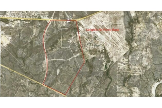
Loop 79 S
Del Rio, TX
ABST 1026 SUR 20 SW PT I & G N RR CO, ACRES 513.9404
14398
VAL VERDE
Ruralimprovednonresidential
Texas
A Areas with a 1% annual chance of flooding and a 26% chance of flooding over the life of a 30-year mortgage.
513.94 AC
2025
Texas West Area
2025
Other Market Areas
950301
NEARBY LISTINGS FOR SALE OR LEASE
-
-
View all Del Rio listings for sale on LoopNet.com
DEMOGRAPHICS near Loop 79 S
1 mile
3 mile
5 mile
2025 Total Population
6
7,070
17,077
2030 Population
6
7,199
17,281
Pop Growth 2025-2030
0.00%
+ 1.82%
+ 1.19%
Average Age
15
33
36
2025 Total Households
2
1,837
5,186
HH Growth 2025-2030
0.00%
+ 2.18%
+ 1.29%
Median Household Inc
$137,500
$59,682
$52,034
Avg Household Size
.00
2.80
2.90
2025 Avg HH Vehicles
3.00
2.00
2.00
Median Home Value
$150,000
$99,120
$102,114
Median Year Built
1989
1989
1982
Nearby Places
Map Layers
Map Styles
 Street
 Aerial
Layers
 Traffic
 Biking
Places
Listings with unknown addresses are not visible on the map
- Restaurants
- Banks
- Shops
- Fitness
- Groceries
PUBLIC TRANSPORTATION
COMMUTER RAIL
Del Rio Amtrak Station (Sunset Limited - Amtrak, Texas Eagle - Amtrak)
Drive
Walk
Distance
Del Rio Amtrak Station (Sunset Limited - Amtrak, Texas Eagle - Amtrak)
9 min
7.0 mi
Freight Ports
Port of Corpus Christi
Drive
Walk
Distance
Port of Corpus Christi
316 min
290.4 mi
Nearby Properties
Address
Land Use
TOTAL SIZE
Lot Size
Zoning
Address
Land Use
TOTAL SIZE
Lot Size
Zoning
205,157 SF
3 AC
Address
Land Use
TOTAL SIZE
Lot Size
Zoning
51,183 SF
13.88 AC
Address
Land Use
TOTAL SIZE
Lot Size
Zoning
111,404 SF
8.05 AC
Address
Land Use
TOTAL SIZE
Lot Size
Zoning
68,888 SF
10 AC
Address
Land Use
TOTAL SIZE
Lot Size
Zoning
58,330 SF
1.49 AC
Address
Land Use
TOTAL SIZE
Lot Size
Zoning
29,693 SF
4.01 AC
Address
Land Use
TOTAL SIZE
Lot Size
Zoning
65,199 SF
4.68 AC
Address
Land Use
TOTAL SIZE
Lot Size
Zoning
42,521 SF
1.03 AC
Address
Land Use
TOTAL SIZE
Lot Size
Zoning
27,241 SF
0.92 AC
Address
Land Use
TOTAL SIZE
Lot Size
Zoning
100,006 SF
2.15 AC
Address
Land Use
TOTAL SIZE
Lot Size
Zoning
8,925 SF
10.25 AC
Address
Land Use
TOTAL SIZE
Lot Size
Zoning
57,809 SF
0.52 AC
Address
Land Use
TOTAL SIZE
Lot Size
Zoning
65,300 SF
6.42 AC
Address
Land Use
TOTAL SIZE
Lot Size
Zoning
28,700 SF
2.04 AC
Address
Land Use
TOTAL SIZE
Lot Size
Zoning
4,880 SF
0.44 AC
Address
Land Use
TOTAL SIZE
Lot Size
Zoning
71,994 SF
1.23 AC
Address
Land Use
TOTAL SIZE
Lot Size
Zoning
806.42 AC
Address
Land Use
TOTAL SIZE
Lot Size
Zoning
3.07 AC
Address
Land Use
TOTAL SIZE
Lot Size
Zoning
7,118 SF
5.19 AC
Address
Land Use
TOTAL SIZE
Lot Size
Zoning
83,684 SF
3 AC
Address
Land Use
TOTAL SIZE
Lot Size
Zoning
4,774 SF
0.30 AC
Address
Land Use
TOTAL SIZE
Lot Size
Zoning
3,792 SF
0.33 AC
Address
Land Use
TOTAL SIZE
Lot Size
Zoning
63,969 SF
3.23 AC
Address
Land Use
TOTAL SIZE
Lot Size
Zoning
4,332 SF
20 AC
Address
Land Use
TOTAL SIZE
Lot Size
Zoning
19,692 SF
2.64 AC
Address
Land Use
TOTAL SIZE
Lot Size
Zoning
3,462 SF
0.33 AC
Address
Land Use
TOTAL SIZE
Lot Size
Zoning
6,820 SF
1.57 AC
Address
Land Use
TOTAL SIZE
Lot Size
Zoning
26,000 SF
7 AC
Address
Land Use
TOTAL SIZE
Lot Size
Zoning
24,392 SF
1.07 AC
The World's #1 Commercial Real Estate Marketplace
Connect with us
© 2026 CoStar Group
The information above has been obtained from sources believed reliable. While we do not doubt its accuracy we have not verified it and make no guarantee, warranty or representation about it. It is your responsibility to independently confirm its accuracy and completeness. Any projections, opinions, assumptions, or estimates used are for example only and do not represent the current or future performance of the property. The value of this transaction to you depends on tax and other factors which should be evaluated by your tax, financial, and legal advisors. You and your advisors should conduct a careful, independent investigation of the property to determine to your satisfaction the suitability of the property for your needs.