Property Record
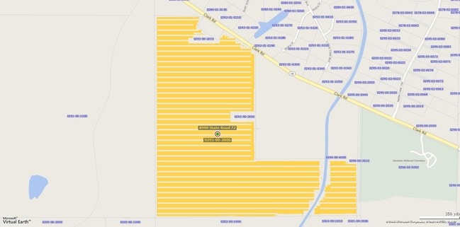
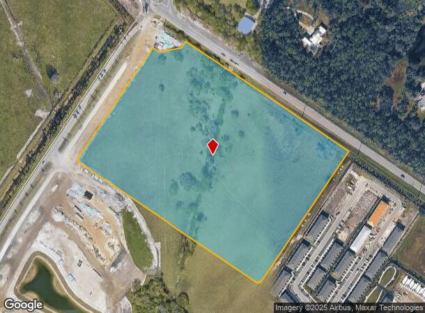
8990 State Road 72, Sarasota, FL 34241
NEARBY LISTINGS FOR SALE OR LEASE
-
-
View all Sarasota listings for sale on LoopNet.com
Property Detail
8990 State Road 72
0293-00-2000
Not Part Of A Subdivision
Pasture
TRACT OF LAND LYING IN SECS 15, 16, 21 & 22-37-19 BEING BOUNDED ON NE BY SWLY R/W LINE OF SR 72, BOUNDED ON THE SE BY PLAT OF LT RANCH NEIGHBORHOOD 1, BOUNDED ON SW BY PLAT OF LT RANCH
AE
Sarasota
12115C0235G
Florida
2024
20 AC
2025
Sarasota
002727
Tampa/St Petersburg
1,187 SF
North Port-Sarasota-Bradenton, FL
DEMOGRAPHICS near 8990 State Road 72
1 Mile
3 Mile
5 Mile
2024 Total Population
672
5,857
40,242
2029 Population
763
6,719
46,413
Pop Growth 2024-2029
+ 13.54%
+ 14.72%
+ 15.33%
Average Age
48
51
50
2024 Total Households
250
2,400
17,609
HH Growth 2024-2029
+ 13.60%
+ 14.75%
+ 15.49%
Median Household Inc
$98,749
$97,761
$91,833
Avg Household Size
2.70
2.40
2.20
2024 Avg HH Vehicles
2.00
2.00
2.00
Median Home Value
$489,682
$512,489
$441,236
Median Year Built
1992
1996
2000
Nearby Places
Map Layers
Map Styles
 Street
 Aerial
- Restaurants
- Banks
- Shops
- Fitness
- Groceries
PUBLIC TRANSPORTATION
AIRPORT
Sarasota/Bradenton International
DRIVE
WALK
Distance
Sarasota/Bradenton International
29 min
19.5 mi
Freight Ports
Port Manatee
DRIVE
WALK
Distance
Port Manatee
42 min
32.1 mi
Nearby Properties
Address
Land Use
TOTAL SIZE
Lot Size
Zoning
Address
Land Use
TOTAL SIZE
Lot Size
Zoning
15,614 SF
104.95 AC
RMH
Address
Land Use
TOTAL SIZE
Lot Size
Zoning
196,331 SF
55.82 AC
GU
Address
Land Use
TOTAL SIZE
Lot Size
Zoning
67,564 SF
121.85 AC
GU
Address
Land Use
TOTAL SIZE
Lot Size
Zoning
91,157 SF
23.27 AC
OUE1
Address
Land Use
TOTAL SIZE
Lot Size
Zoning
94,436 SF
21.15 AC
OUE1
Address
Land Use
TOTAL SIZE
Lot Size
Zoning
126.94 AC
VPD
Address
Land Use
TOTAL SIZE
Lot Size
Zoning
58,646 SF
58.50 AC
OUE1
Address
Land Use
TOTAL SIZE
Lot Size
Zoning
45,554 SF
10.75 AC
CN
Address
Land Use
TOTAL SIZE
Lot Size
Zoning
15,459 SF
293.03 AC
OUE
Address
Land Use
TOTAL SIZE
Lot Size
Zoning
11,898 SF
279.55 AC
OUE
Address
Land Use
TOTAL SIZE
Lot Size
Zoning
36,133 SF
32.43 AC
RSF1
Address
Land Use
TOTAL SIZE
Lot Size
Zoning
41,484 SF
31.35 AC
OUE1
Address
Land Use
TOTAL SIZE
Lot Size
Zoning
9.64 AC
VPD
Address
Land Use
TOTAL SIZE
Lot Size
Zoning
43,600 SF
41.22 AC
OUE
Address
Land Use
TOTAL SIZE
Lot Size
Zoning
65.12 AC
GU
Address
Land Use
TOTAL SIZE
Lot Size
Zoning
13,185 SF
352.55 AC
GU
Address
Land Use
TOTAL SIZE
Lot Size
Zoning
493.81 AC
OUR
Address
Land Use
TOTAL SIZE
Lot Size
Zoning
1,680 SF
40.30 AC
RE1
Address
Land Use
TOTAL SIZE
Lot Size
Zoning
18,400 SF
99 AC
OUE
Address
Land Use
TOTAL SIZE
Lot Size
Zoning
40,615 SF
128.52 AC
RSF1
Address
Land Use
TOTAL SIZE
Lot Size
Zoning
39.86 AC
RE1
Address
Land Use
TOTAL SIZE
Lot Size
Zoning
26,979 SF
226.05 AC
OUE
Address
Land Use
TOTAL SIZE
Lot Size
Zoning
17,094 SF
228.92 AC
OUE2
Address
Land Use
TOTAL SIZE
Lot Size
Zoning
19,832 SF
337.87 AC
OUE
Address
Land Use
TOTAL SIZE
Lot Size
Zoning
15,497 SF
9.53 AC
OUE
Address
Land Use
TOTAL SIZE
Lot Size
Zoning
15,554 SF
11.44 AC
OUE
Address
Land Use
TOTAL SIZE
Lot Size
Zoning
3,376 SF
1.14 AC
CN
Address
Land Use
TOTAL SIZE
Lot Size
Zoning
178.20 AC
OUE
Address
Land Use
TOTAL SIZE
Lot Size
Zoning
5,671 SF
17.19 AC
OUE1
Address
Land Use
TOTAL SIZE
Lot Size
Zoning
9,627 SF
75.20 AC
OUR
The World's #1 Commercial Real Estate Marketplace
Connect with us
© 2025 CoStar Group
The information above has been obtained from sources believed reliable. While we do not doubt its accuracy we have not verified it and make no guarantee, warranty or representation about it. It is your responsibility to independently confirm its accuracy and completeness. Any projections, opinions, assumptions, or estimates used are for example only and do not represent the current or future performance of the property. The value of this transaction to you depends on tax and other factors which should be evaluated by your tax, financial, and legal advisors. You and your advisors should conduct a careful, independent investigation of the property to determine to your satisfaction the suitability of the property for your needs.