Property Record
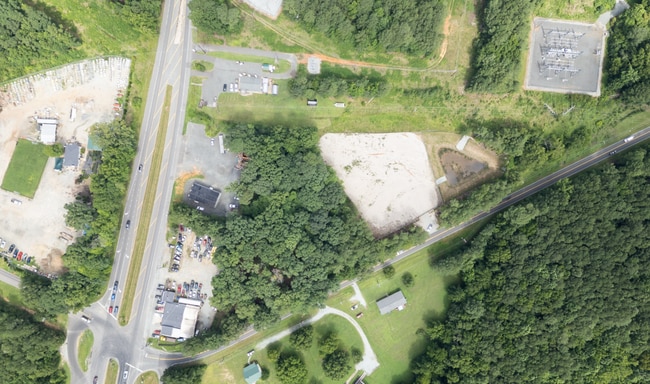
5001 Pleasant Green Rd, Durham, NC 27705


Current Lease Availabilities
NEARBY LISTINGS FOR SALE OR LEASE
Property Detail
5001 Pleasant Green Rd
9893547502
W/S 1567
Residentialacreage
Orange
X
North Carolina
3710989300K
3 AC
2025
Orange County
2025
Raleigh/Durham
001706
Durham-Chapel Hill, NC
DEMOGRAPHICS near 5001 Pleasant Green Rd
1 Mile
3 Mile
5 Mile
2024 Total Population
1,133
10,785
53,077
2029 Population
1,051
10,532
52,932
Pop Growth 2024-2029
(7.24%)
(2.35%)
(0.27%)
Average Age
40
42
41
2024 Total Households
417
4,309
22,859
HH Growth 2024-2029
(7.43%)
(2.14%)
+ 0.33%
Median Household Inc
$49,374
$101,360
$78,904
Avg Household Size
2.60
2.40
2.20
2024 Avg HH Vehicles
2.00
2.00
2.00
Median Home Value
$201,923
$339,561
$365,415
Median Year Built
1988
1988
1989
Nearby Places
Map Layers
Map Styles
 Street
 Aerial
- Restaurants
- Banks
- Shops
- Fitness
- Groceries
PUBLIC TRANSPORTATION
COMMUTER RAIL
Durham Amtrak Station (Carolinian - Amtrak, Piedmont - Amtrak)
DRIVE
WALK
Distance
Durham Amtrak Station (Carolinian - Amtrak, Piedmont - Amtrak)
11 min
7.8 mi
AIRPORT
Raleigh-Durham International
DRIVE
WALK
Distance
Raleigh-Durham International
30 min
21.9 mi
Freight Ports
Virginia Port Authority - Richmond
DRIVE
WALK
Distance
Virginia Port Authority - Richmond
173 min
152.3 mi
Nearby Properties
Address
Land Use
TOTAL SIZE
Lot Size
Zoning
Address
Land Use
TOTAL SIZE
Lot Size
Zoning
1,050.17 AC
ARR1
Address
Land Use
TOTAL SIZE
Lot Size
Zoning
119,180 SF
14.95 AC
IL
Address
Land Use
TOTAL SIZE
Lot Size
Zoning
14,883 SF
53.71 AC
Address
Land Use
TOTAL SIZE
Lot Size
Zoning
82,175 SF
10.13 AC
IP
Address
Land Use
TOTAL SIZE
Lot Size
Zoning
91,650 SF
4.99 AC
IL
Address
Land Use
TOTAL SIZE
Lot Size
Zoning
28.88 AC
IL
Address
Land Use
TOTAL SIZE
Lot Size
Zoning
1,663 SF
6.29 AC
PDR 4.540
Address
Land Use
TOTAL SIZE
Lot Size
Zoning
46,605 SF
4.96 AC
CG
Address
Land Use
TOTAL SIZE
Lot Size
Zoning
54,102 SF
5.65 AC
CC(D)
Address
Land Use
TOTAL SIZE
Lot Size
Zoning
28,040 SF
50.56 AC
R1
Address
Land Use
TOTAL SIZE
Lot Size
Zoning
82.01 AC
RS-20
Address
Land Use
TOTAL SIZE
Lot Size
Zoning
44,800 SF
4.98 AC
IL(D)
Address
Land Use
TOTAL SIZE
Lot Size
Zoning
30,000 SF
8.90 AC
Address
Land Use
TOTAL SIZE
Lot Size
Zoning
71,640 SF
6.51 AC
IL,IP
Address
Land Use
TOTAL SIZE
Lot Size
Zoning
30,406 SF
8.27 AC
IP
Address
Land Use
TOTAL SIZE
Lot Size
Zoning
67,400 SF
3.82 AC
IL(D)
Address
Land Use
TOTAL SIZE
Lot Size
Zoning
85,248 SF
7.90 AC
IP
Address
Land Use
TOTAL SIZE
Lot Size
Zoning
2,112 SF
158.61 AC
Address
Land Use
TOTAL SIZE
Lot Size
Zoning
101.99 AC
ARPID
Address
Land Use
TOTAL SIZE
Lot Size
Zoning
22,775 SF
5.52 AC
IP
Address
Land Use
TOTAL SIZE
Lot Size
Zoning
153.96 AC
AREDDR1
Address
Land Use
TOTAL SIZE
Lot Size
Zoning
1,106 SF
82.36 AC
RB
Address
Land Use
TOTAL SIZE
Lot Size
Zoning
40,012 SF
3.82 AC
EDDR1
Address
Land Use
TOTAL SIZE
Lot Size
Zoning
32.82 AC
RR
Address
Land Use
TOTAL SIZE
Lot Size
Zoning
2,604 SF
5.08 AC
CG(D)
Address
Land Use
TOTAL SIZE
Lot Size
Zoning
23,430 SF
2.55 AC
IL
Address
Land Use
TOTAL SIZE
Lot Size
Zoning
13,675 SF
1.93 AC
IL
Address
Land Use
TOTAL SIZE
Lot Size
Zoning
15,900 SF
1.85 AC
IL
Address
Land Use
TOTAL SIZE
Lot Size
Zoning
6,156 SF
16.70 AC
Address
Land Use
TOTAL SIZE
Lot Size
Zoning
32,920 SF
3.54 AC
IL
The World's #1 Commercial Real Estate Marketplace
Connect with us
© 2026 CoStar Group
The information above has been obtained from sources believed reliable. While we do not doubt its accuracy we have not verified it and make no guarantee, warranty or representation about it. It is your responsibility to independently confirm its accuracy and completeness. Any projections, opinions, assumptions, or estimates used are for example only and do not represent the current or future performance of the property. The value of this transaction to you depends on tax and other factors which should be evaluated by your tax, financial, and legal advisors. You and your advisors should conduct a careful, independent investigation of the property to determine to your satisfaction the suitability of the property for your needs.