Property Record
144 Bell Dr, Cary, IL 60013

This Property Is For Sale
Property Detail
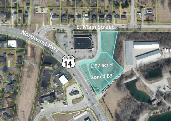
144 Bell Dr
Chicago-Naperville-Elgin, IL-IN
DOC 2013R0048328 (PLAT) LT 3 MILLERS HILL
20-18-177-027
MCHENRY
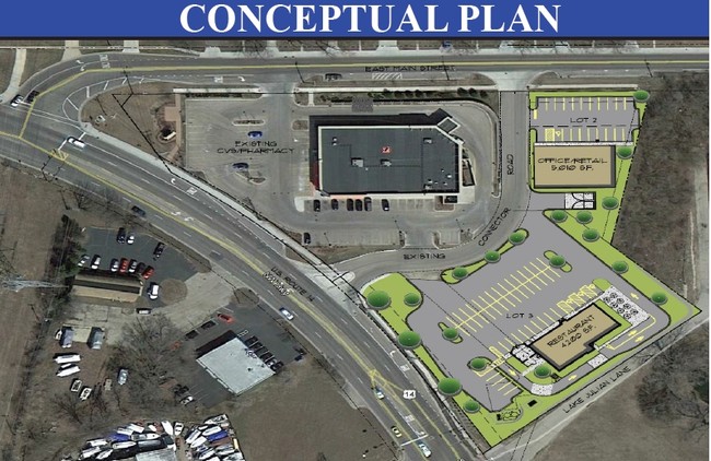
Commercialnec
Illinois
B and X Area of moderate flood hazard, usually the area between the limits of the 100-year and 500-year floods.
3
2024
0.77 AC
2024
Far Northwest
871307
Chicago
NEARBY LISTINGS FOR SALE OR LEASE
DEMOGRAPHICS near 144 Bell Dr
1 mile
3 mile
5 mile
2025 Total Population
8,277
36,716
88,301
2030 Population
8,386
37,111
89,378
Pop Growth 2025-2030
+ 1.32%
+ 1.08%
+ 1.22%
Average Age
41
42
42
2025 Total Households
3,083
13,310
32,922
HH Growth 2025-2030
+ 1.36%
+ 1.18%
+ 1.26%
Median Household Inc
$107,414
$117,003
$110,862
Avg Household Size
2.70
2.70
2.60
2025 Avg HH Vehicles
2.00
2.00
2.00
Median Home Value
$287,319
$342,279
$324,702
Median Year Built
1973
1981
1984
Nearby Places
Map Layers
Map Styles
 Street
 Aerial
Layers
 Traffic
 Biking
Places
Listings with unknown addresses are not visible on the map
- Restaurants
- Banks
- Shops
- Fitness
- Groceries
PUBLIC TRANSPORTATION
COMMUTER RAIL
Cary Station (Union Pacific Northwest Line - Northeast Illinois Regional Commuter Railroad (Metra))
Drive
Walk
Distance
Cary Station (Union Pacific Northwest Line - Northeast Illinois Regional Commuter Railroad (Metra))
1 min
11 min
0.6 mi
Fox River Grove Station (Union Pacific Northwest Line - Northeast Illinois Regional Commuter Railroad (Metra))
Drive
Walk
Distance
Fox River Grove Station (Union Pacific Northwest Line - Northeast Illinois Regional Commuter Railroad (Metra))
2 min
19 min
1.0 mi
AIRPORT
Chicago O'Hare International
Drive
Walk
Distance
Chicago O'Hare International
43 min
29.5 mi
Freight Ports
Port Milwaukee
Drive
Walk
Distance
Port Milwaukee
94 min
70.5 mi
Nearby Properties
Address
Land Use
TOTAL SIZE
Lot Size
Zoning
Address
Land Use
TOTAL SIZE
Lot Size
Zoning
Address
Land Use
TOTAL SIZE
Lot Size
Zoning
28.48 AC
Address
Land Use
TOTAL SIZE
Lot Size
Zoning
Address
Land Use
TOTAL SIZE
Lot Size
Zoning
20.81 AC
Address
Land Use
TOTAL SIZE
Lot Size
Zoning
217,182 SF
22.43 AC
Address
Land Use
TOTAL SIZE
Lot Size
Zoning
47,164 SF
0.70 AC
Address
Land Use
TOTAL SIZE
Lot Size
Zoning
504,206 SF
11.06 AC
Address
Land Use
TOTAL SIZE
Lot Size
Zoning
55,547 SF
0.60 AC
Address
Land Use
TOTAL SIZE
Lot Size
Zoning
72,173 SF
5.23 AC
Address
Land Use
TOTAL SIZE
Lot Size
Zoning
Address
Land Use
TOTAL SIZE
Lot Size
Zoning
35,452 SF
105.76 AC
Address
Land Use
TOTAL SIZE
Lot Size
Zoning
30.77 AC
Address
Land Use
TOTAL SIZE
Lot Size
Zoning
Address
Land Use
TOTAL SIZE
Lot Size
Zoning
4.74 AC
Address
Land Use
TOTAL SIZE
Lot Size
Zoning
75,205 SF
22.94 AC
Address
Land Use
TOTAL SIZE
Lot Size
Zoning
4.34 AC
Address
Land Use
TOTAL SIZE
Lot Size
Zoning
152,670 SF
13 AC
Address
Land Use
TOTAL SIZE
Lot Size
Zoning
59,003 SF
5 AC
Address
Land Use
TOTAL SIZE
Lot Size
Zoning
64,872 SF
6.91 AC
Address
Land Use
TOTAL SIZE
Lot Size
Zoning
Address
Land Use
TOTAL SIZE
Lot Size
Zoning
76,702 SF
7.03 AC
Address
Land Use
TOTAL SIZE
Lot Size
Zoning
112,744 SF
10.93 AC
Address
Land Use
TOTAL SIZE
Lot Size
Zoning
Address
Land Use
TOTAL SIZE
Lot Size
Zoning
75,000 SF
4.64 AC
Address
Land Use
TOTAL SIZE
Lot Size
Zoning
26,015 SF
3.45 AC
Address
Land Use
TOTAL SIZE
Lot Size
Zoning
Address
Land Use
TOTAL SIZE
Lot Size
Zoning
84,342 SF
1.70 AC
Address
Land Use
TOTAL SIZE
Lot Size
Zoning
The World's #1 Commercial Real Estate Marketplace
Connect with us
© 2026 CoStar Group
The information above has been obtained from sources believed reliable. While we do not doubt its accuracy we have not verified it and make no guarantee, warranty or representation about it. It is your responsibility to independently confirm its accuracy and completeness. Any projections, opinions, assumptions, or estimates used are for example only and do not represent the current or future performance of the property. The value of this transaction to you depends on tax and other factors which should be evaluated by your tax, financial, and legal advisors. You and your advisors should conduct a careful, independent investigation of the property to determine to your satisfaction the suitability of the property for your needs.