Property Record
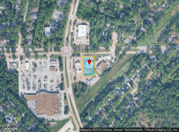
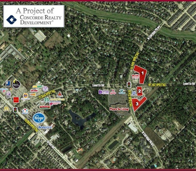
12549 Louetta Rd, Cypress, TX 77429

NEARBY LISTINGS FOR SALE OR LEASE
Property Detail
12549 Louetta Rd
1123570000020
Lakewood Forest Sec 10
Officebuilding
RES F4 BLK 17 LAKEWOOD FOREST SEC 10
X
Harris
48201C0430M
Texas
2024
0.72 AC
2025
FM 1960/Hwy 249
554702
Houston
8,816 SF
Houston-Pasadena-The Woodlands, TX
DEMOGRAPHICS near 12549 Louetta Rd
1 mile
3 mile
5 mile
2024 Total Population
11,270
86,732
230,506
2029 Population
11,312
87,891
233,791
Pop Growth 2024-2029
+ 0.37%
+ 1.34%
+ 1.43%
Average Age
42
38
38
2024 Total Households
3,999
30,494
80,694
HH Growth 2024-2029
+ 0.28%
+ 1.24%
+ 1.41%
Median Household Inc
$130,361
$112,262
$94,627
Avg Household Size
2.80
2.80
2.80
2024 Avg HH Vehicles
2.00
2.00
2.00
Median Home Value
$292,795
$292,595
$277,365
Median Year Built
1987
2001
2000
Nearby Places
Map Layers
Map Styles
 Street
 Aerial
Transit
 Traffic
 Biking
Places
Listings with unknown addresses are not visible on the map
- Restaurants
- Banks
- Shops
- Fitness
- Groceries
PUBLIC TRANSPORTATION
AIRPORT
George Bush Intcntl/Houston
Drive
Walk
Distance
George Bush Intcntl/Houston
30 min
21.9 mi
William P Hobby
Drive
Walk
Distance
William P Hobby
58 min
37.0 mi
Freight Ports
Port of Houston
Drive
Walk
Distance
Port of Houston
50 min
32.6 mi
SALE & LEASE HISTORY
LISTING DATE
SALE/LEASE

Sep 24, 2016
For Sale
Nearby Properties
Address
Land Use
TOTAL SIZE
Lot Size
Zoning
Address
Land Use
TOTAL SIZE
Lot Size
Zoning
1,648,539 SF
28.70 AC
Address
Land Use
TOTAL SIZE
Lot Size
Zoning
339,067 SF
34.40 AC
Address
Land Use
TOTAL SIZE
Lot Size
Zoning
1,073,104 SF
4.74 AC
Address
Land Use
TOTAL SIZE
Lot Size
Zoning
227,400 SF
2.77 AC
Address
Land Use
TOTAL SIZE
Lot Size
Zoning
386,754 SF
17.99 AC
Address
Land Use
TOTAL SIZE
Lot Size
Zoning
543,414 SF
22.58 AC
Address
Land Use
TOTAL SIZE
Lot Size
Zoning
263,640 SF
36.62 AC
Address
Land Use
TOTAL SIZE
Lot Size
Zoning
535,370 SF
28.74 AC
Address
Land Use
TOTAL SIZE
Lot Size
Zoning
426,203 SF
23.88 AC
Address
Land Use
TOTAL SIZE
Lot Size
Zoning
551,524 SF
10.06 AC
Address
Land Use
TOTAL SIZE
Lot Size
Zoning
333,337 SF
21.66 AC
Address
Land Use
TOTAL SIZE
Lot Size
Zoning
351,343 SF
12.82 AC
Address
Land Use
TOTAL SIZE
Lot Size
Zoning
267,094 SF
14.76 AC
Address
Land Use
TOTAL SIZE
Lot Size
Zoning
405,225 SF
18.34 AC
Address
Land Use
TOTAL SIZE
Lot Size
Zoning
387,938 SF
16.05 AC
Address
Land Use
TOTAL SIZE
Lot Size
Zoning
368,361 SF
23.95 AC
Address
Land Use
TOTAL SIZE
Lot Size
Zoning
260,253 SF
7.46 AC
Address
Land Use
TOTAL SIZE
Lot Size
Zoning
371,761 SF
12.71 AC
Address
Land Use
TOTAL SIZE
Lot Size
Zoning
231,734 SF
8.48 AC
Address
Land Use
TOTAL SIZE
Lot Size
Zoning
300,080 SF
13.86 AC
Address
Land Use
TOTAL SIZE
Lot Size
Zoning
245,453 SF
10.11 AC
Address
Land Use
TOTAL SIZE
Lot Size
Zoning
314,385 SF
13.78 AC
Address
Land Use
TOTAL SIZE
Lot Size
Zoning
127,408 SF
3.08 AC
Address
Land Use
TOTAL SIZE
Lot Size
Zoning
267,258 SF
11.99 AC
Address
Land Use
TOTAL SIZE
Lot Size
Zoning
334,495 SF
13.38 AC
Address
Land Use
TOTAL SIZE
Lot Size
Zoning
177,104 SF
14.30 AC
Address
Land Use
TOTAL SIZE
Lot Size
Zoning
127,570 SF
33.51 AC
Address
Land Use
TOTAL SIZE
Lot Size
Zoning
64,284 SF
4.06 AC
Address
Land Use
TOTAL SIZE
Lot Size
Zoning
129,174 SF
13.65 AC
Address
Land Use
TOTAL SIZE
Lot Size
Zoning
223,873 SF
16.55 AC
The World's #1 Commercial Real Estate Marketplace
Connect with us
© 2026 CoStar Group
The information above has been obtained from sources believed reliable. While we do not doubt its accuracy we have not verified it and make no guarantee, warranty or representation about it. It is your responsibility to independently confirm its accuracy and completeness. Any projections, opinions, assumptions, or estimates used are for example only and do not represent the current or future performance of the property. The value of this transaction to you depends on tax and other factors which should be evaluated by your tax, financial, and legal advisors. You and your advisors should conduct a careful, independent investigation of the property to determine to your satisfaction the suitability of the property for your needs.