Property Record
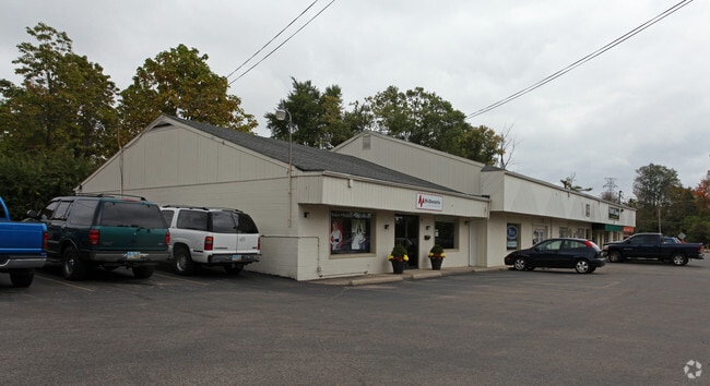
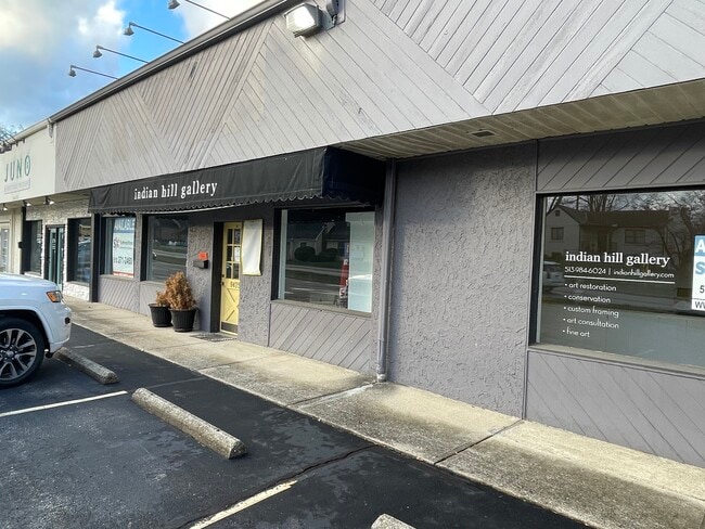
Loveland Madeira Rd, Cincinnati, OH 45242
NEARBY LISTINGS FOR SALE OR LEASE
Property Detail
Loveland Madeira Rd
620-0241-0093
LOVELAND-MADEIRA RD 150 X 125.99 IRR R1- T5- S33 NE
Storebuilding
Hamilton
X
Ohio
39061C0252F
0.46 AC
2024
Kenwood
2024
Cincinnati/Dayton
023902
Cincinnati, OH-KY-IN
DEMOGRAPHICS near Loveland Madeira Rd
1 Mile
3 Mile
5 Mile
2024 Total Population
1,518
34,797
131,508
2029 Population
1,488
34,427
131,251
Pop Growth 2024-2029
(1.98%)
(1.06%)
(0.20%)
Average Age
42
42
42
2024 Total Households
521
13,025
52,231
HH Growth 2024-2029
(1.92%)
(1.14%)
(0.26%)
Median Household Inc
$197,499
$121,218
$99,407
Avg Household Size
2.90
2.60
2.40
2024 Avg HH Vehicles
2.00
2.00
2.00
Median Home Value
$490,131
$418,860
$312,772
Median Year Built
1978
1976
1975
Nearby Places
Map Layers
Map Styles
 Street
 Aerial
- Restaurants
- Banks
- Shops
- Fitness
- Groceries
PUBLIC TRANSPORTATION
AIRPORT
Cincinnati/Northern Kentucky International
DRIVE
WALK
Distance
Cincinnati/Northern Kentucky International
50 min
30.1 mi
SALE & LEASE HISTORY
LISTING DATE
SALE/LEASE

Nov 20, 2024
For Lease
Nearby Properties
Address
Land Use
TOTAL SIZE
Lot Size
Zoning
Address
Land Use
TOTAL SIZE
Lot Size
Zoning
74.81 AC
Address
Land Use
TOTAL SIZE
Lot Size
Zoning
280,900 SF
11.14 AC
D2
Address
Land Use
TOTAL SIZE
Lot Size
Zoning
5.78 AC
Address
Land Use
TOTAL SIZE
Lot Size
Zoning
11,393 SF
56.95 AC
Address
Land Use
TOTAL SIZE
Lot Size
Zoning
35.74 AC
Address
Land Use
TOTAL SIZE
Lot Size
Zoning
6.10 AC
H
Address
Land Use
TOTAL SIZE
Lot Size
Zoning
2.08 AC
Address
Land Use
TOTAL SIZE
Lot Size
Zoning
17,055 SF
6.51 AC
D1
Address
Land Use
TOTAL SIZE
Lot Size
Zoning
138,040 SF
176.17 AC
Address
Land Use
TOTAL SIZE
Lot Size
Zoning
14.15 AC
DD
Address
Land Use
TOTAL SIZE
Lot Size
Zoning
19.25 AC
E
Address
Land Use
TOTAL SIZE
Lot Size
Zoning
Address
Land Use
TOTAL SIZE
Lot Size
Zoning
16.76 AC
EE
Address
Land Use
TOTAL SIZE
Lot Size
Zoning
11,880 SF
23.07 AC
DD
Address
Land Use
TOTAL SIZE
Lot Size
Zoning
8.77 AC
O
Address
Land Use
TOTAL SIZE
Lot Size
Zoning
37,707 SF
8.66 AC
A
Address
Land Use
TOTAL SIZE
Lot Size
Zoning
3.33 AC
H
Address
Land Use
TOTAL SIZE
Lot Size
Zoning
2,654 SF
9.67 AC
O
Address
Land Use
TOTAL SIZE
Lot Size
Zoning
27.35 AC
A
Address
Land Use
TOTAL SIZE
Lot Size
Zoning
12.48 AC
R1
Address
Land Use
TOTAL SIZE
Lot Size
Zoning
24,862 SF
123.41 AC
Address
Land Use
TOTAL SIZE
Lot Size
Zoning
10.91 AC
E
Address
Land Use
TOTAL SIZE
Lot Size
Zoning
58,316 SF
3.09 AC
E
Address
Land Use
TOTAL SIZE
Lot Size
Zoning
12.24 AC
E
Address
Land Use
TOTAL SIZE
Lot Size
Zoning
12.17 AC
E
Address
Land Use
TOTAL SIZE
Lot Size
Zoning
6,797 SF
11.02 AC
D2
Address
Land Use
TOTAL SIZE
Lot Size
Zoning
13.30 AC
R1
Address
Land Use
TOTAL SIZE
Lot Size
Zoning
20.11 AC
DD
Address
Land Use
TOTAL SIZE
Lot Size
Zoning
6.42 AC
A
Address
Land Use
TOTAL SIZE
Lot Size
Zoning
96,046 SF
12.88 AC
B
The World's #1 Commercial Real Estate Marketplace
Connect with us
© 2025 CoStar Group
The information above has been obtained from sources believed reliable. While we do not doubt its accuracy we have not verified it and make no guarantee, warranty or representation about it. It is your responsibility to independently confirm its accuracy and completeness. Any projections, opinions, assumptions, or estimates used are for example only and do not represent the current or future performance of the property. The value of this transaction to you depends on tax and other factors which should be evaluated by your tax, financial, and legal advisors. You and your advisors should conduct a careful, independent investigation of the property to determine to your satisfaction the suitability of the property for your needs.