Property Record
Loveland Madeira Rd, Loveland, OH 45140
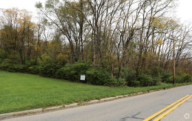
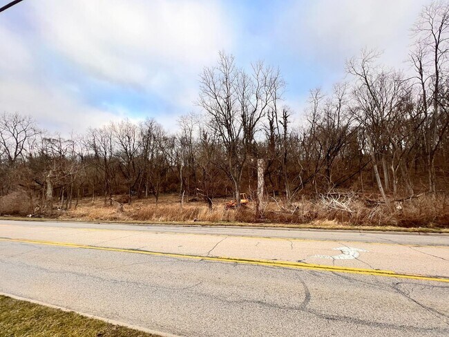
This Property Is For Sale
NEARBY LISTINGS FOR SALE OR LEASE
Property Detail
Loveland Madeira Rd
620-0091-0012
NS LOVELAND RD 150 X 534 IR R1-T5-S23
Recreationalacreage
Hamilton
X
Ohio
39165C0220F
1.57 AC
2023
Mason/Montgomery
2023
Cincinnati/Dayton
040301
Cincinnati, OH-KY-IN
DEMOGRAPHICS near Loveland Madeira Rd
1 Mile
3 Mile
5 Mile
2024 Total Population
6,070
45,420
111,836
2029 Population
6,014
45,736
114,702
Pop Growth 2024-2029
(0.92%)
+ 0.70%
+ 2.56%
Average Age
39
41
41
2024 Total Households
2,280
17,052
42,512
HH Growth 2024-2029
(1.01%)
+ 0.74%
+ 2.59%
Median Household Inc
$94,030
$113,189
$106,205
Avg Household Size
2.60
2.60
2.60
2024 Avg HH Vehicles
2.00
2.00
2.00
Median Home Value
$283,577
$357,292
$323,012
Median Year Built
1981
1986
1986
Nearby Places
Map Layers
Map Styles
 Street
 Aerial
- Restaurants
- Banks
- Shops
- Fitness
- Groceries
PUBLIC TRANSPORTATION
AIRPORT
Cincinnati/Northern Kentucky International
DRIVE
WALK
Distance
Cincinnati/Northern Kentucky International
54 min
38.4 mi
Freight Ports
Port of Toledo
DRIVE
WALK
Distance
Port of Toledo
232 min
200.1 mi
Nearby Properties
Address
Land Use
TOTAL SIZE
Lot Size
Zoning
Address
Land Use
TOTAL SIZE
Lot Size
Zoning
29.31 AC
DD
Address
Land Use
TOTAL SIZE
Lot Size
Zoning
47,424 SF
32.35 AC
Address
Land Use
TOTAL SIZE
Lot Size
Zoning
140,876 SF
64.04 AC
Address
Land Use
TOTAL SIZE
Lot Size
Zoning
26.04 AC
DD
Address
Land Use
TOTAL SIZE
Lot Size
Zoning
19.25 AC
E
Address
Land Use
TOTAL SIZE
Lot Size
Zoning
116,775 SF
12.37 AC
Address
Land Use
TOTAL SIZE
Lot Size
Zoning
16.76 AC
EE
Address
Land Use
TOTAL SIZE
Lot Size
Zoning
3.33 AC
H
Address
Land Use
TOTAL SIZE
Lot Size
Zoning
27.35 AC
A
Address
Land Use
TOTAL SIZE
Lot Size
Zoning
89,708 SF
16.98 AC
Address
Land Use
TOTAL SIZE
Lot Size
Zoning
36,098 SF
25.17 AC
Address
Land Use
TOTAL SIZE
Lot Size
Zoning
209,019 SF
24.19 AC
Address
Land Use
TOTAL SIZE
Lot Size
Zoning
12.55 AC
EE
Address
Land Use
TOTAL SIZE
Lot Size
Zoning
10.91 AC
E
Address
Land Use
TOTAL SIZE
Lot Size
Zoning
12.24 AC
E
Address
Land Use
TOTAL SIZE
Lot Size
Zoning
14.99 AC
OO
Address
Land Use
TOTAL SIZE
Lot Size
Zoning
12.17 AC
E
Address
Land Use
TOTAL SIZE
Lot Size
Zoning
7,273 SF
4.98 AC
OO
Address
Land Use
TOTAL SIZE
Lot Size
Zoning
192,207 SF
9.03 AC
E
Address
Land Use
TOTAL SIZE
Lot Size
Zoning
16.10 AC
Address
Land Use
TOTAL SIZE
Lot Size
Zoning
37,328 SF
9.35 AC
Address
Land Use
TOTAL SIZE
Lot Size
Zoning
Address
Land Use
TOTAL SIZE
Lot Size
Zoning
24.20 AC
Address
Land Use
TOTAL SIZE
Lot Size
Zoning
58,972 SF
24.87 AC
A
Address
Land Use
TOTAL SIZE
Lot Size
Zoning
Address
Land Use
TOTAL SIZE
Lot Size
Zoning
1,932 SF
11.36 AC
EE
Address
Land Use
TOTAL SIZE
Lot Size
Zoning
12,594 SF
10.33 AC
Address
Land Use
TOTAL SIZE
Lot Size
Zoning
3,425 SF
13.77 AC
A
Address
Land Use
TOTAL SIZE
Lot Size
Zoning
148,282 SF
12.97 AC
Address
Land Use
TOTAL SIZE
Lot Size
Zoning
127,273 SF
10.70 AC
The World's #1 Commercial Real Estate Marketplace
Connect with us
© 2025 CoStar Group
The information above has been obtained from sources believed reliable. While we do not doubt its accuracy we have not verified it and make no guarantee, warranty or representation about it. It is your responsibility to independently confirm its accuracy and completeness. Any projections, opinions, assumptions, or estimates used are for example only and do not represent the current or future performance of the property. The value of this transaction to you depends on tax and other factors which should be evaluated by your tax, financial, and legal advisors. You and your advisors should conduct a careful, independent investigation of the property to determine to your satisfaction the suitability of the property for your needs.