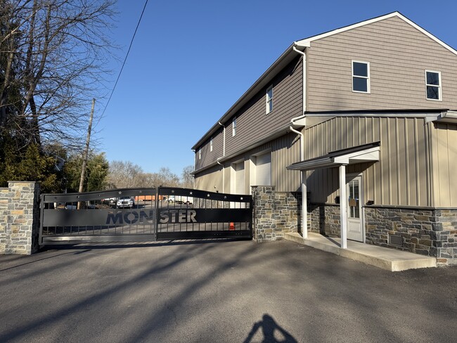
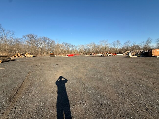
Property Record
Lower State Rd, Doylestown, PA 18901

Property Detail
Lower State Rd
09-007-122-001
6.22AC E S LR09041 113 FT N LR09046 355 FT LR09041
Commercialnec
BUCKS
R1
Pennsylvania
AE The base floodplain where base flood elevations are provided. AE Zones are now used on new format FIRMs instead of A1-A30 Zones.
6.22 AC
2024
Bucks
2025
Philadelphia
104701
Philadelphia-Camden-Wilmington, PA-NJ-DE-MD
NEARBY LISTINGS FOR SALE OR LEASE
DEMOGRAPHICS near Lower State Rd
1 mile
3 mile
5 mile
2025 Total Population
2,413
47,021
119,424
2030 Population
2,455
48,047
120,996
Pop Growth 2025-2030
+ 1.74%
+ 2.18%
+ 1.32%
Average Age
41
44
43
2025 Total Households
744
17,709
43,982
HH Growth 2025-2030
+ 1.88%
+ 2.63%
+ 1.50%
Median Household Inc
$169,687
$119,875
$129,372
Avg Household Size
2.90
2.50
2.60
2025 Avg HH Vehicles
2.00
2.00
2.00
Median Home Value
$672,574
$591,011
$573,884
Median Year Built
1990
1982
1986
Nearby Places
Map Layers
Map Styles
 Street
 Aerial
Transit
 Traffic
 Biking
Places
Listings with unknown addresses are not visible on the map
- Restaurants
- Banks
- Shops
- Fitness
- Groceries
PUBLIC TRANSPORTATION
COMMUTER RAIL
New Britain (R5 - Southeastern Pennsylvania Transportation Authority Regional Rail (SEPTA Regional Rail))
Drive
Walk
Distance
New Britain (R5 - Southeastern Pennsylvania Transportation Authority Regional Rail (SEPTA Regional Rail))
4 min
1.5 mi
Delaware Valley College (R5 - Southeastern Pennsylvania Transportation Authority Regional Rail (SEPTA Regional Rail))
Drive
Walk
Distance
Delaware Valley College (R5 - Southeastern Pennsylvania Transportation Authority Regional Rail (SEPTA Regional Rail))
6 min
1.6 mi
AIRPORT
Trenton Mercer
Drive
Walk
Distance
Trenton Mercer
42 min
24.6 mi
Lehigh Valley International
Drive
Walk
Distance
Lehigh Valley International
64 min
36.8 mi
Philadelphia International
Drive
Walk
Distance
Philadelphia International
66 min
38.1 mi
Freight Ports
Port of Philadelphia
Drive
Walk
Distance
Port of Philadelphia
45 min
26.6 mi
SALE & LEASE HISTORY
LISTING DATE
SALE/LEASE

Jun 06, 2023
For Sale
Nearby Properties
Address
Land Use
TOTAL SIZE
Lot Size
Zoning
Address
Land Use
TOTAL SIZE
Lot Size
Zoning
72,937 SF
42.19 AC
CR
Address
Land Use
TOTAL SIZE
Lot Size
Zoning
254,699 SF
22.06 AC
RC
Address
Land Use
TOTAL SIZE
Lot Size
Zoning
8,120 SF
56.80 AC
C3
Address
Land Use
TOTAL SIZE
Lot Size
Zoning
30,939 SF
28.69 AC
I
Address
Land Use
TOTAL SIZE
Lot Size
Zoning
254,330 SF
25.38 AC
C2
Address
Land Use
TOTAL SIZE
Lot Size
Zoning
344,604 SF
6.95 AC
LI
Address
Land Use
TOTAL SIZE
Lot Size
Zoning
146,924 SF
17.47 AC
C2
Address
Land Use
TOTAL SIZE
Lot Size
Zoning
90,000 SF
7.25 AC
R2
Address
Land Use
TOTAL SIZE
Lot Size
Zoning
77,630 SF
28.53 AC
R2B
Address
Land Use
TOTAL SIZE
Lot Size
Zoning
97,496 SF
12.67 AC
R3
Address
Land Use
TOTAL SIZE
Lot Size
Zoning
230,150 SF
12.10 AC
CR-H
Address
Land Use
TOTAL SIZE
Lot Size
Zoning
77,964 SF
9.79 AC
R3
Address
Land Use
TOTAL SIZE
Lot Size
Zoning
54,090 SF
7.25 AC
R4
Address
Land Use
TOTAL SIZE
Lot Size
Zoning
114,588 SF
0.82 AC
FC
Address
Land Use
TOTAL SIZE
Lot Size
Zoning
16,828 SF
3.28 AC
R2
Address
Land Use
TOTAL SIZE
Lot Size
Zoning
11,159 SF
304.23 AC
Q
Address
Land Use
TOTAL SIZE
Lot Size
Zoning
63,612 SF
0.47 AC
CI
Address
Land Use
TOTAL SIZE
Lot Size
Zoning
33,658 SF
0.52 AC
Address
Land Use
TOTAL SIZE
Lot Size
Zoning
63,612 SF
0.50 AC
CI
Address
Land Use
TOTAL SIZE
Lot Size
Zoning
24,195 SF
1.50 AC
R2
Address
Land Use
TOTAL SIZE
Lot Size
Zoning
61,558 SF
7.48 AC
C2
Address
Land Use
TOTAL SIZE
Lot Size
Zoning
26,134 SF
8.37 AC
C2
Address
Land Use
TOTAL SIZE
Lot Size
Zoning
31,122 SF
9.86 AC
C2
Address
Land Use
TOTAL SIZE
Lot Size
Zoning
42,587 SF
12.09 AC
R1
Address
Land Use
TOTAL SIZE
Lot Size
Zoning
24,300 SF
3.36 AC
C1
Address
Land Use
TOTAL SIZE
Lot Size
Zoning
21,285 SF
118.88 AC
R1
Address
Land Use
TOTAL SIZE
Lot Size
Zoning
63,612 SF
0.52 AC
CI
Address
Land Use
TOTAL SIZE
Lot Size
Zoning
32,298 SF
3.97 AC
R3
Address
Land Use
TOTAL SIZE
Lot Size
Zoning
52,976 SF
5.80 AC
C-2
Address
Land Use
TOTAL SIZE
Lot Size
Zoning
36,635 SF
2.97 AC
CR-H
The World's #1 Commercial Real Estate Marketplace
Connect with us
© 2026 CoStar Group
The information above has been obtained from sources believed reliable. While we do not doubt its accuracy we have not verified it and make no guarantee, warranty or representation about it. It is your responsibility to independently confirm its accuracy and completeness. Any projections, opinions, assumptions, or estimates used are for example only and do not represent the current or future performance of the property. The value of this transaction to you depends on tax and other factors which should be evaluated by your tax, financial, and legal advisors. You and your advisors should conduct a careful, independent investigation of the property to determine to your satisfaction the suitability of the property for your needs.