Property Record
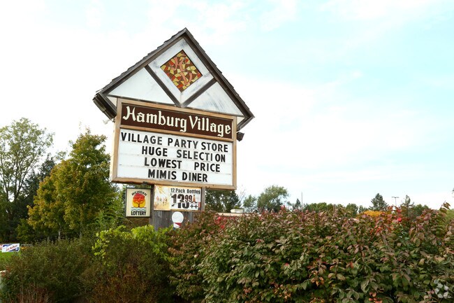
M-36 E M-36 E, Hamburg, MI 48139


Property Detail
M-36 E M-36 E
15-22-200-044
COMM E ? CRNR OF SEC 22, T1N, R5E; TH S88?26?18? W 2,100.15 FT ALG E & W ? LN SEC 22, & THE CNTRLN OF M-36 POB; TH CONT
Commercialnec
LIVINGSTON
CS
Michigan
AE The base floodplain where base flood elevations are provided. AE Zones are now used on new format FIRMs instead of A1-A30 Zones.
1.83 AC
2025
Livingston County
2025
Detroit
743700
Detroit-Warren-Dearborn, MI
10,806 SF
NEARBY LISTINGS FOR SALE OR LEASE
-
-
View all Hamburg listings for sale on LoopNet.com
DEMOGRAPHICS near M-36 E M-36 E
1 mile
3 mile
5 mile
2025 Total Population
1,903
16,558
42,620
2030 Population
1,896
16,662
42,934
Pop Growth 2025-2030
(0.37%)
+ 0.63%
+ 0.74%
Average Age
46
45
45
2025 Total Households
775
6,459
16,514
HH Growth 2025-2030
(0.39%)
+ 0.59%
+ 0.71%
Median Household Inc
$110,239
$116,952
$121,924
Avg Household Size
2.40
2.50
2.50
2025 Avg HH Vehicles
2.00
2.00
2.00
Median Home Value
$407,222
$376,492
$385,031
Median Year Built
1977
1987
1987
Nearby Places
Map Layers
Map Styles
 Street
 Aerial
Transit
 Traffic
 Biking
Places
Listings with unknown addresses are not visible on the map
- Restaurants
- Banks
- Shops
- Fitness
- Groceries
PUBLIC TRANSPORTATION
AIRPORT
Bishop International
Drive
Walk
Distance
Bishop International
59 min
42.7 mi
Detroit Metro Wayne County
Drive
Walk
Distance
Detroit Metro Wayne County
59 min
44.7 mi
Nearby Properties
Address
Land Use
TOTAL SIZE
Lot Size
Zoning
Address
Land Use
TOTAL SIZE
Lot Size
Zoning
92,039 SF
5.34 AC
WFR
Address
Land Use
TOTAL SIZE
Lot Size
Zoning
55,885 SF
6.51 AC
VC
Address
Land Use
TOTAL SIZE
Lot Size
Zoning
1,970 SF
37.72 AC
MHP
Address
Land Use
TOTAL SIZE
Lot Size
Zoning
41,961 SF
4.88 AC
RA
Address
Land Use
TOTAL SIZE
Lot Size
Zoning
50 AC
MHP
Address
Land Use
TOTAL SIZE
Lot Size
Zoning
520.30 AC
PPRF
Address
Land Use
TOTAL SIZE
Lot Size
Zoning
19,390 SF
2.44 AC
VC
Address
Land Use
TOTAL SIZE
Lot Size
Zoning
640 AC
PPRF
Address
Land Use
TOTAL SIZE
Lot Size
Zoning
195 AC
RAA
Address
Land Use
TOTAL SIZE
Lot Size
Zoning
27,000 SF
2 AC
WFR
Address
Land Use
TOTAL SIZE
Lot Size
Zoning
52,800 SF
8.10 AC
LB
Address
Land Use
TOTAL SIZE
Lot Size
Zoning
105,868 SF
37.75 AC
GI
Address
Land Use
TOTAL SIZE
Lot Size
Zoning
52,100 SF
10.36 AC
GI
Address
Land Use
TOTAL SIZE
Lot Size
Zoning
1,706 SF
32 AC
RAA
Address
Land Use
TOTAL SIZE
Lot Size
Zoning
29,928 SF
7 AC
VC
Address
Land Use
TOTAL SIZE
Lot Size
Zoning
15,273 SF
3.72 AC
WFR
Address
Land Use
TOTAL SIZE
Lot Size
Zoning
37,508 SF
1.10 AC
RA
Address
Land Use
TOTAL SIZE
Lot Size
Zoning
8,045 SF
13.03 AC
CS
Address
Land Use
TOTAL SIZE
Lot Size
Zoning
402.30 AC
PPRF
Address
Land Use
TOTAL SIZE
Lot Size
Zoning
10,420 SF
3.56 AC
GI
Address
Land Use
TOTAL SIZE
Lot Size
Zoning
16,340 SF
4.10 AC
CS
Address
Land Use
TOTAL SIZE
Lot Size
Zoning
11,785 SF
6.78 AC
NS
Address
Land Use
TOTAL SIZE
Lot Size
Zoning
11,483 SF
1.66 AC
VC
Address
Land Use
TOTAL SIZE
Lot Size
Zoning
11,457 SF
2 AC
WFR
Address
Land Use
TOTAL SIZE
Lot Size
Zoning
10,262 SF
249 AC
RA
Address
Land Use
TOTAL SIZE
Lot Size
Zoning
3,411 SF
10.09 AC
VC
Address
Land Use
TOTAL SIZE
Lot Size
Zoning
Address
Land Use
TOTAL SIZE
Lot Size
Zoning
4,876 SF
0.14 AC
VC
Address
Land Use
TOTAL SIZE
Lot Size
Zoning
15.48 AC
VC
Address
Land Use
TOTAL SIZE
Lot Size
Zoning
1,593 SF
0.49 AC
WFR
The World's #1 Commercial Real Estate Marketplace
Connect with us
© 2026 CoStar Group
The information above has been obtained from sources believed reliable. While we do not doubt its accuracy we have not verified it and make no guarantee, warranty or representation about it. It is your responsibility to independently confirm its accuracy and completeness. Any projections, opinions, assumptions, or estimates used are for example only and do not represent the current or future performance of the property. The value of this transaction to you depends on tax and other factors which should be evaluated by your tax, financial, and legal advisors. You and your advisors should conduct a careful, independent investigation of the property to determine to your satisfaction the suitability of the property for your needs.