Property Record
M-50 Rd, Montpelier, OH 43543

Save to a Folder
{{folder.Name}}
{{folder.ListingIds.length}} Properties
{{folder.ListingIds.length}} Property
Create a New Folder
Property Detail
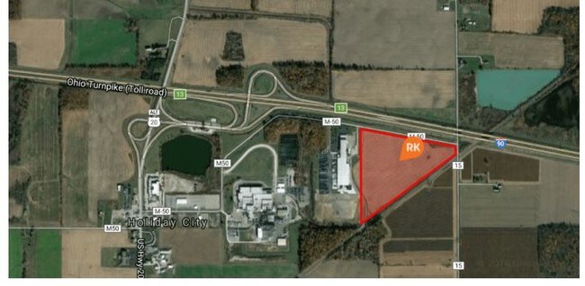
M-50 Rd
Other Market Areas
REAL ESTATE - NON OPERATE R.3 T.8 S.32 TR12 NE 1/4 EX SW PT 31.75A 066-99060-040
083-320-00-009.000
WILLIAMS
Industrialacreage
Ohio
2025
31.75 AC
2025
Ohio North Area
950300
NEARBY LISTINGS FOR SALE OR LEASE
-
-
View all Montpelier listings for sale on LoopNet.com
DEMOGRAPHICS near M-50 Rd
1 mile
3 mile
5 mile
2025 Total Population
62
1,062
7,802
2030 Population
62
1,051
7,768
Pop Growth 2025-2030
0.00%
(1.04%)
(0.44%)
Average Age
44
44
42
2025 Total Households
26
445
3,245
HH Growth 2025-2030
0.00%
(1.12%)
(0.46%)
Median Household Inc
$61,500
$60,682
$53,482
Avg Household Size
2.50
2.40
2.30
2025 Avg HH Vehicles
2.00
2.00
2.00
Median Home Value
$207,143
$201,639
$140,084
Median Year Built
1970
1970
1958
Nearby Places
Map Layers
Map Styles
 Street
 Aerial
Layers
 Traffic
 Biking
Places
Listings with unknown addresses are not visible on the map
- Restaurants
- Banks
- Shops
- Fitness
- Groceries
SALE & LEASE HISTORY
LISTING DATE
SALE/LEASE

Jul 27, 2018
For Sale
Nearby Properties
Address
Land Use
TOTAL SIZE
Lot Size
Zoning
Address
Land Use
TOTAL SIZE
Lot Size
Zoning
2,540 SF
645.48 AC
Address
Land Use
TOTAL SIZE
Lot Size
Zoning
34,300 SF
43.99 AC
Address
Land Use
TOTAL SIZE
Lot Size
Zoning
129,906 SF
54.48 AC
Address
Land Use
TOTAL SIZE
Lot Size
Zoning
168,613 SF
3.24 AC
Address
Land Use
TOTAL SIZE
Lot Size
Zoning
66,690 SF
6.75 AC
Address
Land Use
TOTAL SIZE
Lot Size
Zoning
105,705 SF
28.42 AC
Address
Land Use
TOTAL SIZE
Lot Size
Zoning
49,812 SF
5 AC
Address
Land Use
TOTAL SIZE
Lot Size
Zoning
60,000 SF
2.39 AC
Address
Land Use
TOTAL SIZE
Lot Size
Zoning
100,000 SF
1.96 AC
Address
Land Use
TOTAL SIZE
Lot Size
Zoning
44.50 AC
Address
Land Use
TOTAL SIZE
Lot Size
Zoning
9,120 SF
13.35 AC
Address
Land Use
TOTAL SIZE
Lot Size
Zoning
10,000 SF
19.87 AC
Address
Land Use
TOTAL SIZE
Lot Size
Zoning
1,704 SF
160 AC
Address
Land Use
TOTAL SIZE
Lot Size
Zoning
17,840 SF
7.51 AC
Address
Land Use
TOTAL SIZE
Lot Size
Zoning
25,960 SF
5.49 AC
Address
Land Use
TOTAL SIZE
Lot Size
Zoning
4,800 SF
1.52 AC
Address
Land Use
TOTAL SIZE
Lot Size
Zoning
38,200 SF
9.85 AC
Address
Land Use
TOTAL SIZE
Lot Size
Zoning
2,085 SF
160 AC
Address
Land Use
TOTAL SIZE
Lot Size
Zoning
23,828 SF
41.09 AC
Address
Land Use
TOTAL SIZE
Lot Size
Zoning
25,300 SF
3.97 AC
Address
Land Use
TOTAL SIZE
Lot Size
Zoning
2,256 SF
154.71 AC
Address
Land Use
TOTAL SIZE
Lot Size
Zoning
150.37 AC
Address
Land Use
TOTAL SIZE
Lot Size
Zoning
72,168 SF
4.09 AC
Address
Land Use
TOTAL SIZE
Lot Size
Zoning
12,154 SF
5.52 AC
Address
Land Use
TOTAL SIZE
Lot Size
Zoning
2,854 SF
1.33 AC
Address
Land Use
TOTAL SIZE
Lot Size
Zoning
150.66 AC
Address
Land Use
TOTAL SIZE
Lot Size
Zoning
151.05 AC
Address
Land Use
TOTAL SIZE
Lot Size
Zoning
3,908 SF
80 AC
Address
Land Use
TOTAL SIZE
Lot Size
Zoning
2,325 SF
80 AC
The World's #1 Commercial Real Estate Marketplace
Connect with us
© 2026 CoStar Group
The information above has been obtained from sources believed reliable. While we do not doubt its accuracy we have not verified it and make no guarantee, warranty or representation about it. It is your responsibility to independently confirm its accuracy and completeness. Any projections, opinions, assumptions, or estimates used are for example only and do not represent the current or future performance of the property. The value of this transaction to you depends on tax and other factors which should be evaluated by your tax, financial, and legal advisors. You and your advisors should conduct a careful, independent investigation of the property to determine to your satisfaction the suitability of the property for your needs.