Property Record
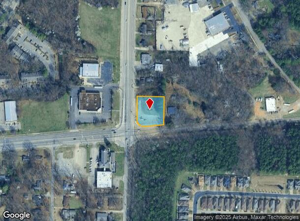
Macon Rd, Memphis, TN 38134
NEARBY LISTINGS FOR SALE OR LEASE
Property Detail
Macon Rd
Memphis, TN-MS-AR
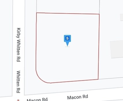
NS MACON RD COR KIRBY-WHITTEN (NE) SEE MAP D2-7B
D0-207-0-0097
Shelby
Vacantlandnec
Tennessee
X
6
47157C0312G
0.80 AC
2024
Cordova
2025
Memphis
020622
DEMOGRAPHICS near Macon Rd
1 Mile
3 Mile
5 Mile
2024 Total Population
10,036
58,322
174,218
2029 Population
9,773
56,918
169,627
Pop Growth 2024-2029
(2.62%)
(2.41%)
(2.64%)
Average Age
34
37
39
2024 Total Households
4,301
24,046
69,458
HH Growth 2024-2029
(2.72%)
(2.45%)
(2.70%)
Median Household Inc
$52,738
$55,845
$69,563
Avg Household Size
2.30
2.40
2.40
2024 Avg HH Vehicles
2.00
2.00
2.00
Median Home Value
$155,978
$175,240
$227,669
Median Year Built
1989
1987
1984
Nearby Places
Map Layers
Map Styles
 Street
 Aerial
- Restaurants
- Banks
- Shops
- Fitness
- Groceries
PUBLIC TRANSPORTATION
AIRPORT
Memphis International
DRIVE
WALK
Distance
Memphis International
25 min
17.1 mi
Freight Ports
Port of Shreveport
DRIVE
WALK
Distance
Port of Shreveport
417 min
384.4 mi
SALE & LEASE HISTORY
LISTING DATE
SALE/LEASE

Mar 01, 2022
For Sale
Nearby Properties
Address
Land Use
TOTAL SIZE
Lot Size
Zoning
Address
Land Use
TOTAL SIZE
Lot Size
Zoning
253,002 SF
2.82 AC
CA
Address
Land Use
TOTAL SIZE
Lot Size
Zoning
270,045 SF
28.34 AC
CA
Address
Land Use
TOTAL SIZE
Lot Size
Zoning
85,062 SF
8.43 AC
CA
Address
Land Use
TOTAL SIZE
Lot Size
Zoning
231,038 SF
24.97 AC
RU-2
Address
Land Use
TOTAL SIZE
Lot Size
Zoning
134,272 SF
28.85 AC
CMP-1
Address
Land Use
TOTAL SIZE
Lot Size
Zoning
99,768 SF
100.86 AC
EMP
Address
Land Use
TOTAL SIZE
Lot Size
Zoning
325,370 SF
64.04 AC
CA
Address
Land Use
TOTAL SIZE
Lot Size
Zoning
94,003 SF
7.20 AC
CMU-2
Address
Land Use
TOTAL SIZE
Lot Size
Zoning
63,114 SF
7.13 AC
CA
Address
Land Use
TOTAL SIZE
Lot Size
Zoning
175,984 SF
22.75 AC
RU-4
Address
Land Use
TOTAL SIZE
Lot Size
Zoning
75,099 SF
12.22 AC
EMP
Address
Land Use
TOTAL SIZE
Lot Size
Zoning
171,906 SF
7.52 AC
RU-3
Address
Land Use
TOTAL SIZE
Lot Size
Zoning
64,002 SF
67.10 AC
RU-2
Address
Land Use
TOTAL SIZE
Lot Size
Zoning
260,599 SF
28.13 AC
CA
Address
Land Use
TOTAL SIZE
Lot Size
Zoning
108,678 SF
8.99 AC
R-E
Address
Land Use
TOTAL SIZE
Lot Size
Zoning
192,560 SF
10.16 AC
CA
Address
Land Use
TOTAL SIZE
Lot Size
Zoning
133,020 SF
11.73 AC
SC-1
Address
Land Use
TOTAL SIZE
Lot Size
Zoning
91,232 SF
21.66 AC
IH
Address
Land Use
TOTAL SIZE
Lot Size
Zoning
116,745 SF
10.46 AC
CA
Address
Land Use
TOTAL SIZE
Lot Size
Zoning
198,103 SF
17.75 AC
CG-MS
Address
Land Use
TOTAL SIZE
Lot Size
Zoning
39,581 SF
7.69 AC
R-6
Address
Land Use
TOTAL SIZE
Lot Size
Zoning
449,267 SF
20.03 AC
RU-3
Address
Land Use
TOTAL SIZE
Lot Size
Zoning
80,836 SF
6.84 AC
RU-3
Address
Land Use
TOTAL SIZE
Lot Size
Zoning
191,316 SF
21.71 AC
CMU-3
Address
Land Use
TOTAL SIZE
Lot Size
Zoning
199,320 SF
9.05 AC
CA
Address
Land Use
TOTAL SIZE
Lot Size
Zoning
105,950 SF
21.19 AC
RU-3
Address
Land Use
TOTAL SIZE
Lot Size
Zoning
234,360 SF
22.12 AC
IH
Address
Land Use
TOTAL SIZE
Lot Size
Zoning
30,201 SF
44.30 AC
RU-2
Address
Land Use
TOTAL SIZE
Lot Size
Zoning
31.54 AC
CA
Address
Land Use
TOTAL SIZE
Lot Size
Zoning
253,831 SF
16.74 AC
EMP
The World's #1 Commercial Real Estate Marketplace
Connect with us
© 2025 CoStar Group
The information above has been obtained from sources believed reliable. While we do not doubt its accuracy we have not verified it and make no guarantee, warranty or representation about it. It is your responsibility to independently confirm its accuracy and completeness. Any projections, opinions, assumptions, or estimates used are for example only and do not represent the current or future performance of the property. The value of this transaction to you depends on tax and other factors which should be evaluated by your tax, financial, and legal advisors. You and your advisors should conduct a careful, independent investigation of the property to determine to your satisfaction the suitability of the property for your needs.